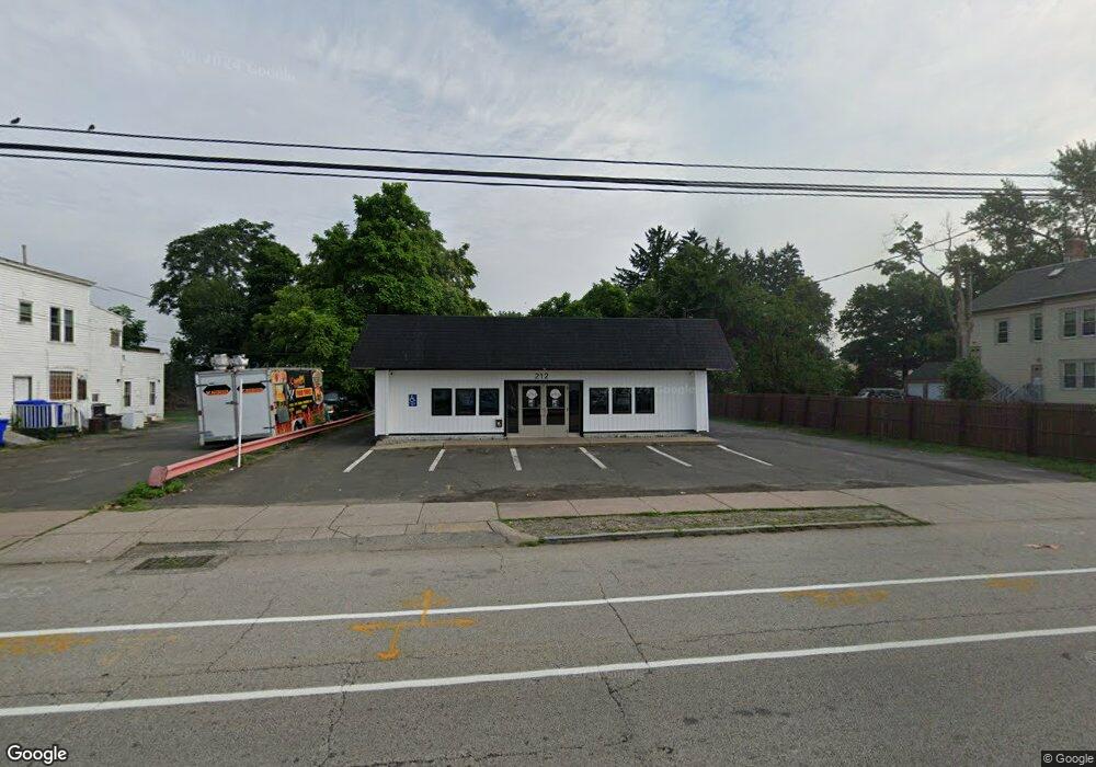
212 Burnside Ave Unit 212 East Hartford, CT 06108
Estimated Value: $174,031
--
Bed
--
Bath
2,040
Sq Ft
$85/Sq Ft
Est. Value
About This Home
This home is located at 212 Burnside Ave Unit 212, East Hartford, CT 06108 and is currently estimated at $174,031, approximately $85 per square foot. 212 Burnside Ave Unit 212 is a home located in Hartford County with nearby schools including Robert J. O'Brien School, East Hartford Middle School, and East Hartford High School.
Ownership History
Date
Name
Owned For
Owner Type
Purchase Details
Closed on
Aug 8, 2019
Sold by
Piolyn Jr Cafe Llc
Bought by
Ndj Property Llc
Current Estimated Value
Purchase Details
Closed on
Oct 26, 2009
Sold by
Doyle Street Cafe Llc
Bought by
Piolyn Jr Cafe Llc
Home Financials for this Owner
Home Financials are based on the most recent Mortgage that was taken out on this home.
Original Mortgage
$165,000
Interest Rate
5.09%
Mortgage Type
Commercial
Purchase Details
Closed on
Nov 1, 1999
Sold by
Roland Ridge Inc
Bought by
Doyle St Cafe Llc
Home Financials for this Owner
Home Financials are based on the most recent Mortgage that was taken out on this home.
Original Mortgage
$100,000
Interest Rate
18%
Mortgage Type
Commercial
Create a Home Valuation Report for This Property
The Home Valuation Report is an in-depth analysis detailing your home's value as well as a comparison with similar homes in the area
Home Values in the Area
Average Home Value in this Area
Purchase History
| Date | Buyer | Sale Price | Title Company |
|---|---|---|---|
| Ndj Property Llc | $102,000 | -- | |
| Piolyn Jr Cafe Llc | $185,000 | -- | |
| Doyle St Cafe Llc | $80,000 | -- |
Source: Public Records
Mortgage History
| Date | Status | Borrower | Loan Amount |
|---|---|---|---|
| Previous Owner | Doyle St Cafe Llc | $165,000 | |
| Previous Owner | Doyle St Cafe Llc | $170,000 | |
| Previous Owner | Doyle St Cafe Llc | $100,000 |
Source: Public Records
Tax History Compared to Growth
Tax History
| Year | Tax Paid | Tax Assessment Tax Assessment Total Assessment is a certain percentage of the fair market value that is determined by local assessors to be the total taxable value of land and additions on the property. | Land | Improvement |
|---|---|---|---|---|
| 2025 | $9,344 | $203,570 | $55,010 | $148,560 |
| 2024 | $8,147 | $185,150 | $55,010 | $130,140 |
| 2023 | $7,876 | $185,150 | $55,010 | $130,140 |
| 2022 | $7,591 | $185,150 | $55,010 | $130,140 |
| 2021 | $8,591 | $174,090 | $50,930 | $123,160 |
| 2020 | $8,691 | $174,090 | $50,930 | $123,160 |
| 2019 | $8,550 | $174,090 | $50,930 | $123,160 |
| 2018 | $8,297 | $174,090 | $50,930 | $123,160 |
| 2017 | $8,191 | $174,090 | $50,930 | $123,160 |
| 2016 | $7,975 | $173,900 | $50,930 | $122,970 |
| 2015 | $7,975 | $173,900 | $50,930 | $122,970 |
| 2014 | $7,895 | $173,900 | $50,930 | $122,970 |
Source: Public Records
Map
Nearby Homes
- 181 Burnside Ave
- 10 Kenyon Place
- 265 Burnside Ave
- 85R Olmsted St
- 98 Olmsted St
- 30 Oakwood St
- 52 Burnside Ave
- 47 Elm St
- 1589 Main St
- 453 Burnside Ave
- 41 Bissell St
- 67 Laurel St
- 51 Daniel St
- 506 Burnside Ave
- 509 Burnside Ave Unit A18
- 15 Michael Ave
- 61 Central Ave Unit 63
- 421 Tolland St
- 421 Tolland St Unit 209
- 279 Prospect St
- 212 Burnside Ave
- 229 Burnside Ave Unit 231
- 233 Burnside Ave Unit 235
- 217 Burnside Ave
- 91 Tolland St
- 228 Burnside Ave
- 224 Burnside Ave Unit 226
- 205 Burnside Ave
- 205 Burnside Ave
- 237 Burnside Ave Unit 239
- 232 Burnside Ave Unit 234
- 97 Tolland St
- 13 Kenyon Place Unit 15
- 11 Kenyon Place
- 190 Burnside Ave
- 99 Tolland St
- 63 Tolland St
- 186 Burnside Ave
- 244 Burnside Ave
- 82 Tolland St