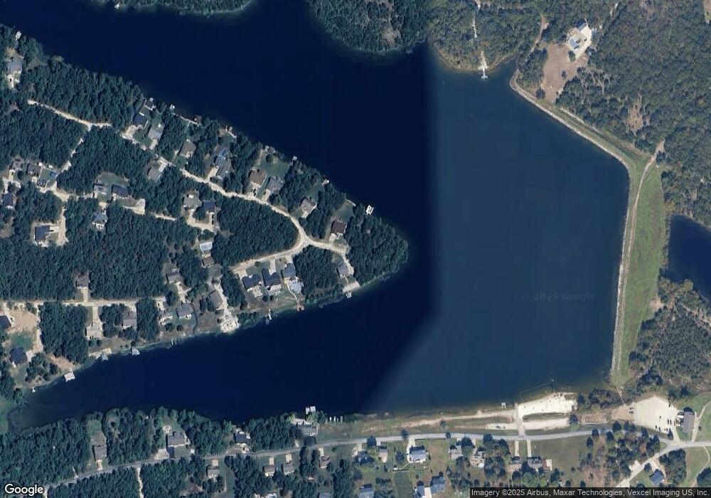
212 Cardiff Cir de Soto, MO 63020
Estimated Value: $36,000 - $212,000
--
Bed
--
Bath
--
Sq Ft
9,148
Sq Ft Lot
About This Home
This home is located at 212 Cardiff Cir, de Soto, MO 63020 and is currently estimated at $118,000. 212 Cardiff Cir is a home located in Jefferson County with nearby schools including Hillsboro Elementary School, Hillsboro Primary School, and Hillsboro Middle Elementary School.
Ownership History
Date
Name
Owned For
Owner Type
Purchase Details
Closed on
Jan 24, 2025
Sold by
Funke Robert and Funke Gina
Bought by
Neff Christopher G and Neff Carrie M
Current Estimated Value
Home Financials for this Owner
Home Financials are based on the most recent Mortgage that was taken out on this home.
Original Mortgage
$139,900
Outstanding Balance
$138,888
Interest Rate
6.6%
Mortgage Type
New Conventional
Estimated Equity
-$20,888
Purchase Details
Closed on
Feb 1, 2023
Sold by
Kost Sharon A
Bought by
Funke Robert and Funke Gina
Purchase Details
Closed on
Aug 24, 2015
Sold by
Schmitt Family Trust
Bought by
Harness Jody and Jefferson County
Purchase Details
Closed on
May 31, 2000
Sold by
Mckinnis Lyle C and Mckinnis Alice J
Bought by
Schmitt Clyde M and Schmitt Rena L
Create a Home Valuation Report for This Property
The Home Valuation Report is an in-depth analysis detailing your home's value as well as a comparison with similar homes in the area
Home Values in the Area
Average Home Value in this Area
Purchase History
| Date | Buyer | Sale Price | Title Company |
|---|---|---|---|
| Neff Christopher G | -- | None Listed On Document | |
| Funke Robert | $1,179 | -- | |
| Harness Jody | $1,011 | None Available | |
| Schmitt Clyde M | -- | -- |
Source: Public Records
Mortgage History
| Date | Status | Borrower | Loan Amount |
|---|---|---|---|
| Open | Neff Christopher G | $139,900 |
Source: Public Records
Tax History Compared to Growth
Tax History
| Year | Tax Paid | Tax Assessment Tax Assessment Total Assessment is a certain percentage of the fair market value that is determined by local assessors to be the total taxable value of land and additions on the property. | Land | Improvement |
|---|---|---|---|---|
| 2025 | $113 | $1,800 | $1,800 | -- |
| 2024 | $113 | $1,800 | $1,800 | -- |
| 2023 | $113 | -- | -- | -- |
| 2022 | -- | -- | -- | -- |
| 2021 | -- | $0 | $0 | $0 |
| 2020 | $0 | $0 | $0 | $0 |
| 2019 | $0 | $0 | $0 | $0 |
| 2018 | $0 | $0 | $0 | $0 |
| 2017 | $0 | $0 | $0 | $0 |
| 2016 | -- | $0 | $0 | $0 |
| 2015 | -- | $1,500 | $1,500 | $0 |
Source: Public Records
Map
Nearby Homes
- 1650 Brandywine Dr
- 1645 Brandywine Dr
- 609 Devonshire Ln
- 613 Devonshire Ln
- 109 Lakeshore Dr
- 176 Briarwood Terrace
- 121 Briarwood Terrace
- 1601 Hawkwood Trail
- 1600 Hawkwood Trail
- 12219 Peter Moore Ln
- 1561 Hickory Landing
- 1553 Hickory Landing
- 1551 Hickory Landing
- 1535 Hickory Landing
- 1533 Hickory Landing
- 358 N Thomas St
- 350 N Thomas St
- 1208 Boyd St
- 517 N 11th St
- 0 Missouri 21
- 212 Cardigan Cir
- 209 Cardigan Cir
- 1838 Wellington Dr
- 1830 Wellington Dr
- 0Lots 3&4 Surrey Cir
- 1613 Brandywine Dr
- 1637 Brandywine Dr
- 532 Picadilly Ct
- 1822 Wellington Dr
- 0 London Brandywine Unit 13008365
- 0 Brandywine Lot 34 Block B Unit 15005477
- 0 Brandywine Lot 7 Block B Unit 15005473
- 2100 London Bridge Row
- 1818 Wellington Dr
- 1829 Wellington Dr
- 0 Lot 25 Brandywine Ln Unit 12063423
- 0 Lot 25 Brandywine Ln Unit 14065992
- 0 Lot 25 Brandywine Ln Unit 16012380
- 0 Lot 25 Brandywine Ln Unit 17012499
- 16 Lot 16 Wellington Dr
