Estimated Value: $208,000 - $249,000
3
Beds
2
Baths
1,080
Sq Ft
$211/Sq Ft
Est. Value
About This Home
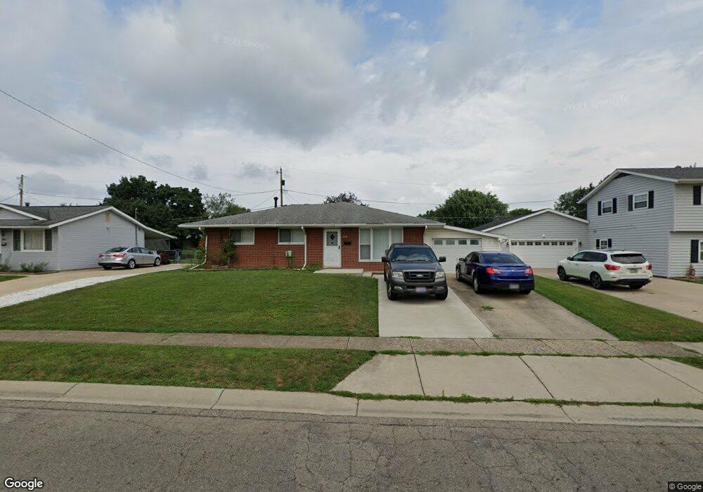
This home is located at 212 Custer Rd, Heath, OH 43056 and is currently estimated at $228,347, approximately $211 per square foot. 212 Custer Rd is a home located in Licking County with nearby schools including Garfield Elementary School, Stevenson Elementary School, and Heath Middle School.
Ownership History
Date
Name
Owned For
Owner Type
Purchase Details
Closed on
Jan 30, 2006
Sold by
Hupp Rita Anne and Hupp Charles W
Bought by
Hupp Richard A
Current Estimated Value
Home Financials for this Owner
Home Financials are based on the most recent Mortgage that was taken out on this home.
Original Mortgage
$114,207
Outstanding Balance
$64,940
Interest Rate
6.37%
Mortgage Type
FHA
Estimated Equity
$163,407
Purchase Details
Closed on
Apr 12, 2001
Sold by
Angle Feloa G
Bought by
Boucher Rita A
Home Financials for this Owner
Home Financials are based on the most recent Mortgage that was taken out on this home.
Original Mortgage
$91,350
Interest Rate
7.05%
Mortgage Type
FHA
Create a Home Valuation Report for This Property
The Home Valuation Report is an in-depth analysis detailing your home's value as well as a comparison with similar homes in the area
Home Values in the Area
Average Home Value in this Area
Purchase History
| Date | Buyer | Sale Price | Title Company |
|---|---|---|---|
| Hupp Richard A | $116,000 | None Available | |
| Boucher Rita A | $93,000 | -- |
Source: Public Records
Mortgage History
| Date | Status | Borrower | Loan Amount |
|---|---|---|---|
| Open | Hupp Richard A | $114,207 | |
| Previous Owner | Boucher Rita A | $91,350 |
Source: Public Records
Tax History
| Year | Tax Paid | Tax Assessment Tax Assessment Total Assessment is a certain percentage of the fair market value that is determined by local assessors to be the total taxable value of land and additions on the property. | Land | Improvement |
|---|---|---|---|---|
| 2024 | $2,788 | $64,790 | $16,700 | $48,090 |
| 2023 | $1,562 | $64,790 | $16,700 | $48,090 |
| 2022 | $2,806 | $51,770 | $8,610 | $43,160 |
| 2021 | $2,863 | $51,770 | $8,610 | $43,160 |
| 2020 | $2,881 | $51,770 | $8,610 | $43,160 |
| 2019 | $2,337 | $42,740 | $10,780 | $31,960 |
| 2018 | $2,362 | $0 | $0 | $0 |
| 2017 | $2,290 | $0 | $0 | $0 |
| 2016 | $2,182 | $0 | $0 | $0 |
| 2015 | $2,219 | $0 | $0 | $0 |
| 2014 | $3,120 | $0 | $0 | $0 |
| 2013 | $2,155 | $0 | $0 | $0 |
Source: Public Records
Map
Nearby Homes
- 231 Fieldpoint Rd
- 101 Fieldpoint Rd
- 224 Walden Rd
- 514 S 30th St
- 18 Swainford Dr
- 645 Kensington Dr Unit 645
- 233 Wildwood Ct Unit 233C
- 944 Fieldson Dr
- 164 Licking View Dr
- 616 Huron Dr
- 452 Saint James Gate
- 590 Seneca Dr
- 915 W Main St
- 1223 W Main St
- 172 S Williams St
- 132 Cambria St
- 1285 Bluejack Ln
- 67 N 31st St
- 105 Clark Ave
- 149 Maholm St
- 208 Custer Rd
- 216 Custer Rd
- 199 Fieldpoint Rd
- 204 Custer Rd
- 193 Fieldpoint Rd
- 222 Custer Rd
- 203 Fieldpoint Rd
- 189 Fieldpoint Rd
- 209 Fieldpoint Rd
- 198 Custer Rd
- 228 Custer Rd
- 215 Fieldpoint Rd
- 183 Fieldpoint Rd
- 205 Putnam Rd
- 190 Custer Rd
- 192 Fieldpoint Rd
- 196 Fieldpoint Rd
- 217 Fieldpoint Rd
- 186 Fieldpoint Rd
- 177 Fieldpoint Rd
Your Personal Tour Guide
Ask me questions while you tour the home.