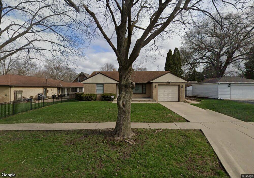
212 Dunning Ave West Dundee, IL 60118
Estimated Value: $279,278 - $334,000
3
Beds
--
Bath
1,180
Sq Ft
$260/Sq Ft
Est. Value
About This Home
This home is located at 212 Dunning Ave, West Dundee, IL 60118 and is currently estimated at $306,820, approximately $260 per square foot. 212 Dunning Ave is a home located in Kane County with nearby schools including Dundee Highlands Elementary School, Dundee Middle School, and Dundee-Crown High School.
Ownership History
Date
Name
Owned For
Owner Type
Purchase Details
Closed on
Aug 20, 2025
Sold by
Graff Abby L
Bought by
Abby L Graff Revocable Living Trust and Graff
Current Estimated Value
Purchase Details
Closed on
Aug 20, 2024
Sold by
Graff Pamela S and Drew Diane S
Bought by
Graff Abby L and Drew Sean V
Purchase Details
Closed on
Aug 31, 2013
Sold by
Brown Marilyn J
Bought by
Brown Marilyn J and Drew Diane S
Create a Home Valuation Report for This Property
The Home Valuation Report is an in-depth analysis detailing your home's value as well as a comparison with similar homes in the area
Home Values in the Area
Average Home Value in this Area
Purchase History
| Date | Buyer | Sale Price | Title Company |
|---|---|---|---|
| Abby L Graff Revocable Living Trust | -- | None Listed On Document | |
| Graff Abby L | -- | None Listed On Document | |
| Brown Marilyn J | -- | None Available |
Source: Public Records
Tax History
| Year | Tax Paid | Tax Assessment Tax Assessment Total Assessment is a certain percentage of the fair market value that is determined by local assessors to be the total taxable value of land and additions on the property. | Land | Improvement |
|---|---|---|---|---|
| 2024 | $6,331 | $93,669 | $21,919 | $71,750 |
| 2023 | $5,843 | $84,280 | $19,722 | $64,558 |
| 2022 | $5,572 | $74,252 | $19,722 | $54,530 |
| 2021 | $5,341 | $70,108 | $18,621 | $51,487 |
| 2020 | $5,227 | $68,531 | $18,202 | $50,329 |
| 2019 | $5,025 | $65,057 | $17,279 | $47,778 |
| 2018 | $5,135 | $64,840 | $16,937 | $47,903 |
| 2017 | $4,844 | $60,655 | $15,844 | $44,811 |
| 2016 | $4,399 | $53,729 | $15,341 | $38,388 |
| 2015 | -- | $44,205 | $17,713 | $26,492 |
| 2014 | -- | $42,984 | $17,224 | $25,760 |
| 2013 | -- | $44,300 | $17,751 | $26,549 |
Source: Public Records
Map
Nearby Homes
- 601 S 2nd St
- 505 Ryan Ln
- 601 Edwards Ave
- Lot 1 View St
- 315 Liberty St
- 305 Oregon Ave
- 1042 Chateau Bluff Ln
- 206 Water St
- 408 Jackson St
- 706 Geneva St
- 436 Barrington Ave
- 36 River Ridge Dr
- 10 Chateau Dr
- 605 Barrington Ave Unit 140
- 605 Barrington Ave Unit 208
- 123 Dundee Ave
- 804 Lindsay Ln
- 806 Lindsay Ln
- 820 Lindsay Ln
- 821 Lindsay Ln
Your Personal Tour Guide
Ask me questions while you tour the home.