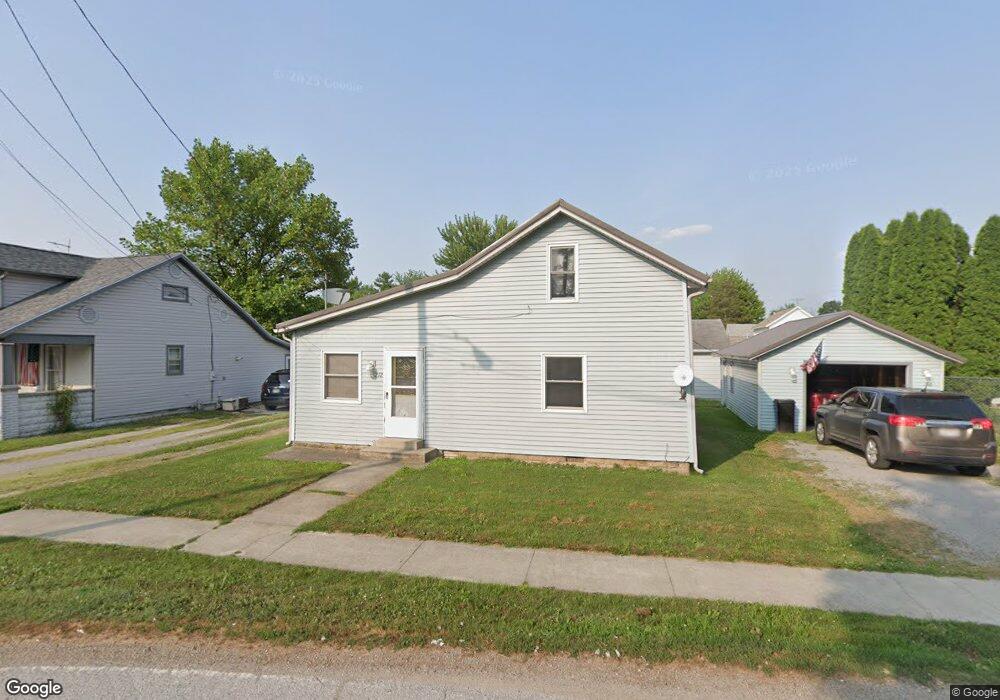
212 E Canal St S Antwerp, OH 45813
Estimated Value: $94,000 - $112,000
3
Beds
1
Bath
1,449
Sq Ft
$72/Sq Ft
Est. Value
About This Home
This home is located at 212 E Canal St S, Antwerp, OH 45813 and is currently estimated at $104,045, approximately $71 per square foot. 212 E Canal St S is a home located in Paulding County with nearby schools including Antwerp Local Elementary School and Antwerp Local High School.
Ownership History
Date
Name
Owned For
Owner Type
Purchase Details
Closed on
Apr 19, 2017
Sold by
Pier Roger D
Bought by
Mcguire Charles M
Current Estimated Value
Home Financials for this Owner
Home Financials are based on the most recent Mortgage that was taken out on this home.
Original Mortgage
$32,500
Outstanding Balance
$27,045
Interest Rate
4.21%
Mortgage Type
New Conventional
Estimated Equity
$77,000
Purchase Details
Closed on
Feb 19, 2009
Sold by
Pier Roger D and Pier Marlene J
Bought by
Lawhorn Shawn A and Lawhorn Diana
Home Financials for this Owner
Home Financials are based on the most recent Mortgage that was taken out on this home.
Original Mortgage
$57,600
Interest Rate
7%
Mortgage Type
Seller Take Back
Purchase Details
Closed on
May 17, 2006
Sold by
Cline Robin L and Cline Randall D
Bought by
Pier Roger D
Purchase Details
Closed on
Dec 4, 1997
Bought by
Pier Roger D
Create a Home Valuation Report for This Property
The Home Valuation Report is an in-depth analysis detailing your home's value as well as a comparison with similar homes in the area
Home Values in the Area
Average Home Value in this Area
Purchase History
| Date | Buyer | Sale Price | Title Company |
|---|---|---|---|
| Mcguire Charles M | $36,000 | None Available | |
| Lawhorn Shawn A | $59,900 | None Available | |
| Pier Roger D | $13,000 | None Available | |
| Pier Roger D | -- | -- |
Source: Public Records
Mortgage History
| Date | Status | Borrower | Loan Amount |
|---|---|---|---|
| Open | Mcguire Charles M | $32,500 | |
| Previous Owner | Lawhorn Shawn A | $57,600 |
Source: Public Records
Tax History Compared to Growth
Tax History
| Year | Tax Paid | Tax Assessment Tax Assessment Total Assessment is a certain percentage of the fair market value that is determined by local assessors to be the total taxable value of land and additions on the property. | Land | Improvement |
|---|---|---|---|---|
| 2024 | $848 | $19,080 | $3,290 | $15,790 |
| 2023 | $848 | $19,080 | $3,290 | $15,790 |
| 2022 | $768 | $19,080 | $3,290 | $15,790 |
| 2021 | $744 | $16,520 | $3,290 | $13,230 |
| 2020 | $761 | $16,520 | $3,290 | $13,230 |
| 2019 | $770 | $15,330 | $3,290 | $12,040 |
| 2018 | $718 | $15,330 | $3,290 | $12,040 |
| 2017 | $736 | $15,330 | $3,290 | $12,040 |
| 2016 | $736 | $15,330 | $3,290 | $12,040 |
| 2015 | $715 | $14,950 | $3,290 | $11,660 |
| 2014 | $671 | $14,950 | $3,290 | $11,660 |
| 2013 | $734 | $14,950 | $3,290 | $11,660 |
Source: Public Records
Map
Nearby Homes
- 208 W River St
- 309 N Madison St
- 5092 Road 176
- 136 Maumee Ln
- 13149 Road 27b
- 3190 Road 204
- 1258 Road 192
- 16453 Road 63
- 25812 Maumee Center Rd
- 24212 River Rd
- 26100 Worden Rd
- 4783 Legacy Cove
- TBD Allen Rd
- 11051 Road 93
- 4602 Indiana 101
- 5038 Chickadee Dr
- 100 Proxmire St
- 4974 Chickadee Dr
- 22428 Ash St Unit 25
- 22489 Ash St Unit 21
- 314 E Canal St
- 304 E Canal St
- 210 E Canal St
- 205 E Canal St
- 308 E Canal St
- 208 E Canal St
- 203 E Canal St
- 206 E Canal St S
- 301 E Canal St
- 201 E Canal St
- 204 E Canal St S
- 406 Erie St
- 202 E Canal St
- 101 1/2 E Canal St
- 310 E Canal St S
- 310 E Canal St S
- 316 E Canal St S
- 304 S Erie St
- 107 E Canal St
- 205 E Washington St