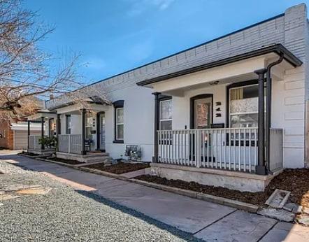

212 E Maple Ave Denver, CO 80209
Speer NeighborhoodAbout This Home
Property Id: 2257187
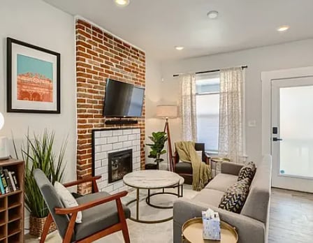
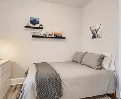
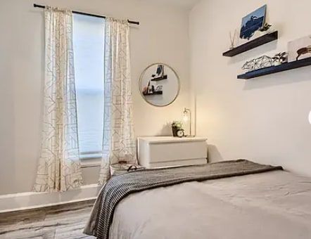
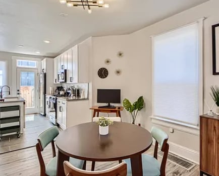
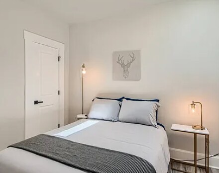
Beautifully updated unit in a historic Triplex building (built in the year 1900!) located in Denver's amazing Baker/Speer neighborhood. The unit features 2-bedrooms. 1-bathroom, has a full kitchen, beautifully redone bathroom, full kitchen with all new appliances, and small outdoor patio space to unwind. In the unit, we provide 1Gig-Fiber and wifi, with access to YoutubeTV streaming service on the TV (not Youtube) that includes HBO, Showtime, Starz, and you can log into any of the additional streaming services available on the smart TV. Laundry is available in-unit with a brand new AI-integrated wash tower.
The neighborhood is beautiful and one of the preserved historic zones of Denver. It's a quick 2 blocks to South Broadway Street, which is one of Denver's most lively and vibrant food and bar scenes. If you're wanting a more low-key night, you can stroll a few blocks into the neighborhood and find some amazing bites and sips, all of which are worth exploring the area to find! Washington Park, Cherry Creek district, Downtown/LoDo are all under a 10-minute drive, and the closest ski area is only 40 minutes away!

Map
Property History
| Date | Event | Price | List to Sale | Price per Sq Ft |
|---|---|---|---|---|
| 12/02/2025 12/02/25 | For Rent | $2,700 | -- | -- |
- 22 E Bayaud Ave
- 260 S Grant St
- 34 S Sherman St
- 39 S Grant St
- 20 1/2 S Sherman St
- 47 W Cedar Ave
- 35 W Byers Place
- 431 E Bayaud Ave Unit 314
- 431 E Bayaud Ave Unit 304
- 431 E Bayaud Ave Unit 305
- 232 S Pennsylvania St Unit 232
- 421 E Alameda Ave
- 354 S Lincoln St
- 21 S Pennsylvania St Unit 1
- 95 W Byers Place
- 61 W Alameda Ave
- 44 N Lincoln St
- 213 S Bannock St
- 110 W Bayaud Ave
- 120 W Bayaud Ave
- 124 S Sherman St Unit Upstairs
- 205 S Grant St
- 215 Bayaud Ave
- 227 S Logan St Unit 1
- 229 S Logan St Unit 2
- 210 S Logan St
- 210 S Logan St
- 210 S Logan St
- 137 S Pennsylvania St
- 123 S Pennsylvania St Unit 7
- 123 S Pennsylvania St Unit 5
- 123 S Pennsylvania St Unit 9
- 123 S Pennsylvania St Unit 3
- 123 S Pennsylvania St Unit 10
- 90 S Logan St
- 245 S Pennsylvania St Unit 4
- 245 S Pennsylvania St Unit 6
- 300 S Logan St Unit 205
- 300 S Logan St Unit 210
- 300 S Logan St