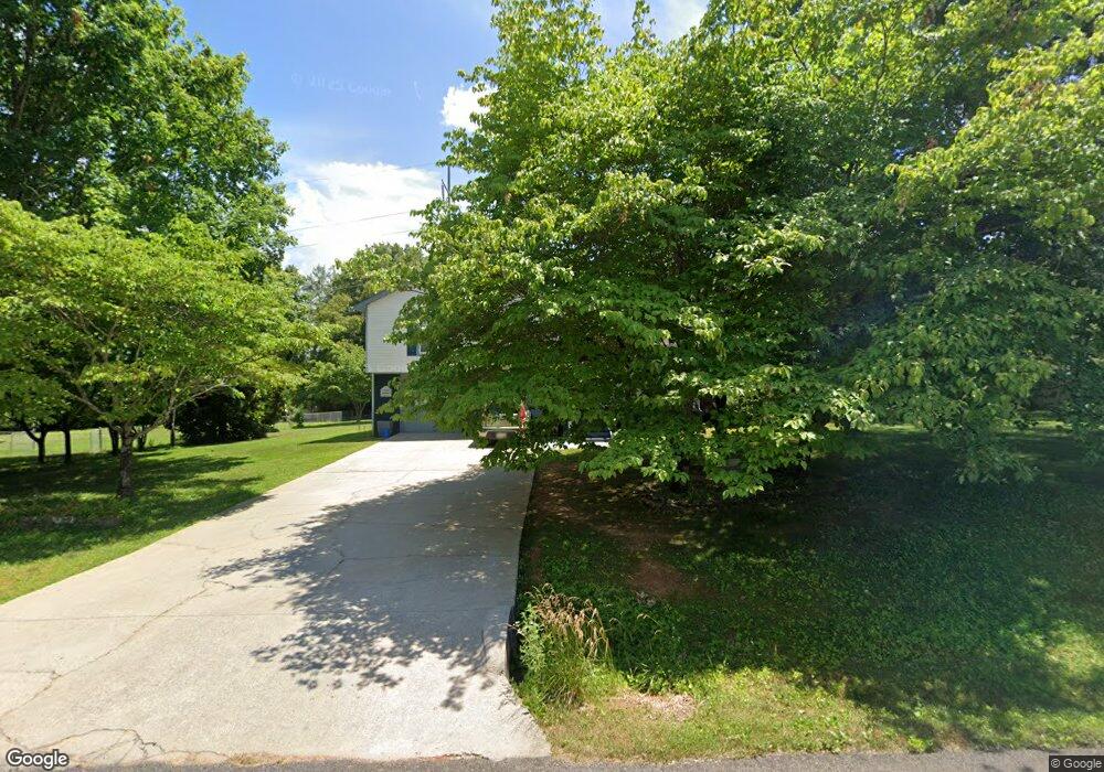
212 Frances Amelia Dr Huntsville, AL 35811
Moores Mill NeighborhoodEstimated Value: $172,980 - $262,000
--
Bed
--
Bath
1,306
Sq Ft
$166/Sq Ft
Est. Value
About This Home
This home is located at 212 Frances Amelia Dr, Huntsville, AL 35811 and is currently estimated at $216,495, approximately $165 per square foot. 212 Frances Amelia Dr is a home located in Madison County with nearby schools including Mt Carmel Elementary School, Riverton Intermediate School, and Buckhorn Middle School.
Ownership History
Date
Name
Owned For
Owner Type
Purchase Details
Closed on
Jan 6, 2009
Sold by
Uss Tomian F and Uss Stephanie Stimac
Bought by
Uss Stephanie Stimac and Uss Tomian F
Current Estimated Value
Home Financials for this Owner
Home Financials are based on the most recent Mortgage that was taken out on this home.
Original Mortgage
$84,000
Outstanding Balance
$53,800
Interest Rate
5.43%
Mortgage Type
New Conventional
Estimated Equity
$162,695
Purchase Details
Closed on
Jan 7, 2008
Sold by
Uss Tomian F and Uss Stephanie Stimac
Bought by
Uss Tomian F and Uss Stephanie Stimac
Create a Home Valuation Report for This Property
The Home Valuation Report is an in-depth analysis detailing your home's value as well as a comparison with similar homes in the area
Home Values in the Area
Average Home Value in this Area
Purchase History
| Date | Buyer | Sale Price | Title Company |
|---|---|---|---|
| Uss Stephanie Stimac | -- | -- | |
| Uss Tomian F | -- | -- |
Source: Public Records
Mortgage History
| Date | Status | Borrower | Loan Amount |
|---|---|---|---|
| Open | Uss Stephanie Stimac | $84,000 |
Source: Public Records
Tax History Compared to Growth
Tax History
| Year | Tax Paid | Tax Assessment Tax Assessment Total Assessment is a certain percentage of the fair market value that is determined by local assessors to be the total taxable value of land and additions on the property. | Land | Improvement |
|---|---|---|---|---|
| 2024 | -- | $15,460 | $1,020 | $14,440 |
| 2023 | $427 | $15,080 | $1,020 | $14,060 |
| 2022 | $364 | $12,980 | $1,020 | $11,960 |
| 2021 | $325 | $11,680 | $1,020 | $10,660 |
| 2020 | $289 | $10,480 | $1,020 | $9,460 |
| 2019 | $277 | $10,050 | $1,020 | $9,030 |
| 2018 | $259 | $9,460 | $0 | $0 |
| 2017 | $251 | $9,200 | $0 | $0 |
| 2016 | $251 | $9,200 | $0 | $0 |
| 2015 | $251 | $9,200 | $0 | $0 |
| 2014 | $249 | $9,120 | $0 | $0 |
Source: Public Records
Map
Nearby Homes
- 202 Frances Amelia Dr NE
- 707 Winchester Rd NE
- 235 Dormont Dr NE
- 57.4 +/- ACRES Winchester Rd NE
- Lot 2 Winchester Rd NE
- Lot 3 Winchester Rd NE
- 116 Santa Maria Dr NE
- 223 Dormont Dr NE
- 220 Valleyside Dr NE
- 152 Santa Maria Dr NE
- 159 Santa Maria Dr NE
- 127 Whitestone Dr NE
- Winston Pennington Ave
- The Winston Plan at Pennington
- The Bennington Plan at Pennington
- The Cambridge Plan at Pennington
- The Charleston Plan at Pennington
- The Manhattan Plan at Pennington
- The Raleigh Plan at Pennington
- The Savannah Plan at Pennington
- 210 Frances Amelia Dr
- 214 Frances Amelia Dr
- 117 Ann Bradley Dr
- 119 Ann Bradley Dr
- 101 Molly Bette Dr
- 121 Ann Bradley Dr
- 211 Frances Amelia Dr NE
- 216 Frances Amelia Dr
- 208 Frances Amelia Dr
- 123 Ann Bradley Dr
- 115 Ann Bradley Dr
- 100 Molly Bette Dr NE
- 125 Ann Bradley Dr
- 209 Frances Amelia Dr NE
- 113 Ann Bradley Dr
- 100 Molly Bette Dr
- 209 Frances Amelia Dr
- 118 Ann Bradley Dr
- 218 Frances Amelia Dr
- 116 Ann Bradley Dr