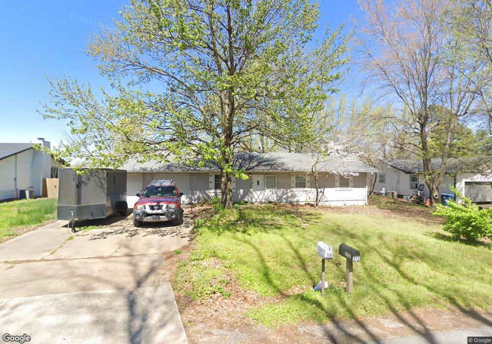
212 Frost St Pea Ridge, AR 72751
Estimated Value: $227,101 - $269,000
--
Bed
2
Baths
1,232
Sq Ft
$207/Sq Ft
Est. Value
About This Home
This home is located at 212 Frost St, Pea Ridge, AR 72751 and is currently estimated at $255,275, approximately $207 per square foot. 212 Frost St is a home located in Benton County with nearby schools including Pea Ridge Intermediate School, Pea Ridge Primary School, and Pea Ridge Middle School.
Ownership History
Date
Name
Owned For
Owner Type
Purchase Details
Closed on
Nov 30, 2011
Sold by
Tolbert Robert E and Tolbert Susan R
Bought by
Tolbert Robert E and Tolbert Susan R
Current Estimated Value
Purchase Details
Closed on
Sep 15, 2004
Bought by
Tolbert
Purchase Details
Closed on
Sep 13, 2004
Bought by
Tolbert
Purchase Details
Closed on
Sep 3, 2004
Bought by
Tolbert
Purchase Details
Closed on
May 12, 2004
Bought by
Knappenberger
Purchase Details
Closed on
Nov 7, 1996
Bought by
Tolbert
Purchase Details
Closed on
Jul 15, 1992
Bought by
Boyd
Create a Home Valuation Report for This Property
The Home Valuation Report is an in-depth analysis detailing your home's value as well as a comparison with similar homes in the area
Home Values in the Area
Average Home Value in this Area
Purchase History
| Date | Buyer | Sale Price | Title Company |
|---|---|---|---|
| Tolbert Robert E | -- | Waco | |
| Tolbert | $72,000 | -- | |
| Tolbert | $72,000 | -- | |
| Tolbert | -- | -- | |
| Knappenberger | $125,000 | -- | |
| Tolbert | $68,000 | -- | |
| Boyd | $55,000 | -- |
Source: Public Records
Tax History Compared to Growth
Tax History
| Year | Tax Paid | Tax Assessment Tax Assessment Total Assessment is a certain percentage of the fair market value that is determined by local assessors to be the total taxable value of land and additions on the property. | Land | Improvement |
|---|---|---|---|---|
| 2025 | $1,270 | $34,873 | $10,000 | $24,873 |
| 2024 | $1,194 | $34,873 | $10,000 | $24,873 |
| 2023 | $1,086 | $23,250 | $3,800 | $19,450 |
| 2022 | $1,046 | $23,250 | $3,800 | $19,450 |
| 2021 | $950 | $23,250 | $3,800 | $19,450 |
| 2020 | $892 | $14,670 | $2,800 | $11,870 |
| 2019 | $892 | $14,670 | $2,800 | $11,870 |
| 2018 | $892 | $14,670 | $2,800 | $11,870 |
| 2017 | $798 | $14,670 | $2,800 | $11,870 |
| 2016 | $798 | $14,670 | $2,800 | $11,870 |
| 2015 | $724 | $12,730 | $3,000 | $9,730 |
| 2014 | $724 | $12,730 | $3,000 | $9,730 |
Source: Public Records
Map
Nearby Homes