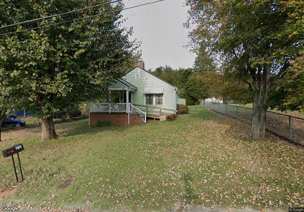
212 Hamil St Lexington, NC 27292
Estimated Value: $81,000 - $131,000
2
Beds
1
Bath
1,052
Sq Ft
$94/Sq Ft
Est. Value
About This Home
This home is located at 212 Hamil St, Lexington, NC 27292 and is currently estimated at $98,967, approximately $94 per square foot. 212 Hamil St is a home located in Davidson County with nearby schools including South Lexington School, Lexington Middle School, and Lexington Senior High School.
Ownership History
Date
Name
Owned For
Owner Type
Purchase Details
Closed on
Aug 10, 1958
Current Estimated Value
Create a Home Valuation Report for This Property
The Home Valuation Report is an in-depth analysis detailing your home's value as well as a comparison with similar homes in the area
Home Values in the Area
Average Home Value in this Area
Purchase History
| Date | Buyer | Sale Price | Title Company |
|---|---|---|---|
| -- | -- | -- |
Source: Public Records
Tax History Compared to Growth
Tax History
| Year | Tax Paid | Tax Assessment Tax Assessment Total Assessment is a certain percentage of the fair market value that is determined by local assessors to be the total taxable value of land and additions on the property. | Land | Improvement |
|---|---|---|---|---|
| 2025 | $166 | $37,790 | $0 | $0 |
| 2024 | $166 | $37,790 | $0 | $0 |
| 2023 | $166 | $37,790 | $0 | $0 |
| 2022 | $166 | $37,790 | $0 | $0 |
| 2021 | $166 | $37,790 | $0 | $0 |
| 2020 | $133 | $35,290 | $0 | $0 |
| 2019 | $135 | $35,290 | $0 | $0 |
| 2018 | $135 | $35,290 | $0 | $0 |
| 2017 | $135 | $35,290 | $0 | $0 |
| 2016 | $135 | $35,290 | $0 | $0 |
| 2015 | $130 | $35,290 | $0 | $0 |
| 2014 | $114 | $34,080 | $0 | $0 |
Source: Public Records
Map
Nearby Homes
- 402 Martin Luther King jr Blvd
- 56 E 4th St
- 322 Bristol St
- 433 N State St
- 214 W 5th St
- 521 E 1st St
- 116 Pond St
- 100 W Martin Luther King Junior Blvd
- 1130 Greensboro Street Extension
- 22 Covey Ct
- 32 Vance Cir
- 12 Vance Cir
- 319 E 3rd Avenue Extension
- 102 Theodore Ave
- 191 Young Dr
- 193 Young Dr
- 13290 N Carolina 8
- 5150 N Carolina 8
- 403 W Center St
- 501 W 2nd Ave
- 210 Hamil St
- 208 Hamil St
- 215 Hamil St
- 213 E Hemstead St
- 219 Hamil St
- 221 E Hemstead St
- 209 E Hemstead St
- 206 Hamil St
- 223 E Hemstead St
- 207 E Hemstead St
- 225 E Hemstead St
- 504 Tussey St
- 205 Hamil St
- 603 Poplar St
- 601 Poplar St
- 605 Poplar St
- 205 E Hemstead St
- 216 E Hemstead St
- 220 E Hemstead St Unit A
- 220 E Hemstead St