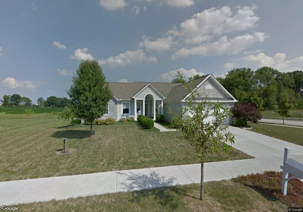
212 Harmony Dr Delaware, OH 43015
Delaware AreaEstimated Value: $417,000 - $473,000
About This Home
This home is located at 212 Harmony Dr, Delaware, OH 43015 and is currently estimated at $443,718, approximately $200 per square foot. 212 Harmony Dr is a home located in Delaware County with nearby schools including Robert F. Schultz Elementary School, John C. Dempsey Middle School, and Rutherford B. Hayes High School.
Ownership History
We collect this data history from publicly available records. To have your information removed, we recommend requesting removal directly through your county’s website.
Purchase Details
Purchase Details
Purchase Details
Purchase Details
Home Financials for this Owner
Home Financials are based on the most recent Mortgage that was taken out on this home.Purchase Details
Home Financials for this Owner
Home Financials are based on the most recent Mortgage that was taken out on this home.Purchase Details
Home Financials for this Owner
Home Financials are based on the most recent Mortgage that was taken out on this home.Purchase Details
Home Financials for this Owner
Home Financials are based on the most recent Mortgage that was taken out on this home.Purchase Details
Purchase Details
Purchase History
We collect this data history from publicly available records. To have your information removed, we recommend requesting removal directly through your county’s website.
| Date | Buyer | Sale Price | Title Company |
|---|---|---|---|
| -- | None Listed On Document | ||
| -- | None Available | ||
| -- | None Available | ||
| -- | None Available | ||
| -- | None Available | ||
| -- | None Available | ||
| -- | Attorney | ||
| $240,000 | Title First | ||
| -- | None Available | ||
| -- | None Available |
Mortgage History
We collect this data history from publicly available records. To have your information removed, we recommend requesting removal directly through your county’s website.
| Date | Status | Borrower | Loan Amount |
|---|---|---|---|
| Previous Owner | $45,000 | ||
| Previous Owner | $135,000 | ||
| Previous Owner | $160,150 | ||
| Previous Owner | $138,550 | ||
| Previous Owner | $141,800 | ||
| Previous Owner | $50,000 | ||
| Previous Owner | $140,000 |
Tax History
We collect this data history from publicly available records. To have your information removed, we recommend requesting removal directly through your county’s website.
| Year | Tax Paid | Tax Assessment Tax Assessment Total Assessment is a certain percentage of the fair market value that is determined by local assessors to be the total taxable value of land and additions on the property. | Land | Improvement |
|---|---|---|---|---|
| 2025 | $6,733 | $135,350 | $20,580 | $114,770 |
| 2024 | $6,390 | $135,350 | $20,580 | $114,770 |
| 2023 | $6,402 | $135,350 | $20,580 | $114,770 |
| 2022 | $5,368 | $98,490 | $16,730 | $81,760 |
| 2021 | $5,487 | $98,490 | $16,730 | $81,760 |
| 2020 | $5,549 | $98,490 | $16,730 | $81,760 |
| 2019 | $5,183 | $83,370 | $12,880 | $70,490 |
| 2018 | $5,255 | $83,370 | $12,880 | $70,490 |
| 2017 | $4,762 | $74,660 | $11,760 | $62,900 |
| 2016 | $4,294 | $74,660 | $11,760 | $62,900 |
| 2015 | $4,318 | $74,660 | $11,760 | $62,900 |
| 2014 | $4,512 | $74,660 | $11,760 | $62,900 |
| 2013 | $4,537 | $74,660 | $11,760 | $62,900 |
Map
- 114 Diverston Way
- 156 Diverston Way
- 0 S Houk Rd
- 206 Topaz Ct
- 13 Greenhedge Cir Unit 13
- 225 Lenell Loop
- 175 Lenell Loop
- 485 Steeplechase St
- 124 Steeplechase Ct
- 107 Bartlett St Unit 44
- 377 Cobblestone Dr
- 250 Hayfield Dr
- 131 Hewes St Unit 147
- 128 Granite Dr
- 381 Hearthstone Dr
- 185 Simon St Unit 93
- 132 Braddington Ct
- 1723 S Section Line Rd
- 289 Cobblestone Dr
- 521 Brickstone Dr Unit 521
- 218 Harmony Dr
- 224 Harmony Dr
- 1070 Boulder Dr
- 1142 Boulder Dr
- 211 Harmony Dr
- 1148 Boulder Dr
- 1100 Boulder Dr
- 1124 Boulder Dr
- 217 Harmony Dr
- 223 Harmony Dr
- 230 Harmony Dr
- 1136 Boulder Dr
- 235 Harmony Dr
- 236 Harmony Dr
- 1130 Boulder Dr
- 102 Diverston Way
- 449 Pagoda Loop
- 108 Diverston Way
- 1118 Boulder Dr
- 241 Harmony Dr
Ask me questions while you tour the home.