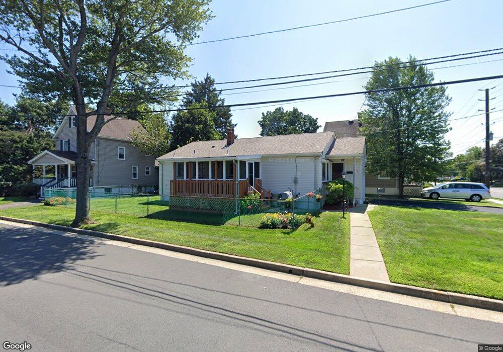
212 Lane Ave South Plainfield, NJ 07080
Estimated Value: $433,827 - $594,000
--
Bed
--
Bath
--
Sq Ft
5,009
Sq Ft Lot
About This Home
This home is located at 212 Lane Ave, South Plainfield, NJ 07080 and is currently estimated at $537,207. 212 Lane Ave is a home located in Middlesex County with nearby schools including South Plainfield High School, Holy Savior Academy, and Koinonia Academy.
Ownership History
Date
Name
Owned For
Owner Type
Purchase Details
Closed on
Aug 25, 1995
Sold by
Cichetti Anthony
Bought by
Margulski Helen
Current Estimated Value
Home Financials for this Owner
Home Financials are based on the most recent Mortgage that was taken out on this home.
Original Mortgage
$93,000
Interest Rate
7.32%
Create a Home Valuation Report for This Property
The Home Valuation Report is an in-depth analysis detailing your home's value as well as a comparison with similar homes in the area
Home Values in the Area
Average Home Value in this Area
Purchase History
| Date | Buyer | Sale Price | Title Company |
|---|---|---|---|
| Margulski Helen | $137,500 | -- |
Source: Public Records
Mortgage History
| Date | Status | Borrower | Loan Amount |
|---|---|---|---|
| Closed | Margulski Helen | $93,000 |
Source: Public Records
Tax History Compared to Growth
Tax History
| Year | Tax Paid | Tax Assessment Tax Assessment Total Assessment is a certain percentage of the fair market value that is determined by local assessors to be the total taxable value of land and additions on the property. | Land | Improvement |
|---|---|---|---|---|
| 2025 | $7,108 | $101,800 | $32,700 | $69,100 |
| 2024 | $6,798 | $101,800 | $32,700 | $69,100 |
| 2023 | $6,798 | $101,800 | $32,700 | $69,100 |
| 2022 | $6,714 | $101,800 | $32,700 | $69,100 |
| 2021 | $6,556 | $101,800 | $32,700 | $69,100 |
| 2020 | $6,460 | $101,800 | $32,700 | $69,100 |
| 2019 | $6,199 | $101,800 | $32,700 | $69,100 |
| 2018 | $6,039 | $101,800 | $32,700 | $69,100 |
| 2017 | $5,961 | $101,800 | $32,700 | $69,100 |
| 2016 | $5,901 | $101,800 | $32,700 | $69,100 |
| 2015 | $5,800 | $101,800 | $32,700 | $69,100 |
| 2014 | $5,633 | $101,800 | $32,700 | $69,100 |
Source: Public Records
Map
Nearby Homes
- 241 Van Fleet Ave
- 260 Merchants Ave
- 533 Edgar Ave
- 2 Melillo Ct
- 4 Melillo Ct
- 480 Sampton Ave
- 418 Bergen St
- 106 Devon Ln
- 222 Oak Tree Ave
- 218 Schillaci Ln
- 1726 Kenyon Ave
- 1712 Kenyon Ave
- 1214 New Market Ave
- 619 Hancock St
- 551 Melrose Ave
- 184 W Nassau Ave
- 1453 Tooz Place
- 128 Oak Tree Ave
- 102 Jerome Ave
- 1533 Clinton Ave
- 208 Lane Ave
- 308 Manning Ave
- 304 Lane Ave
- 200 Lane Ave Unit 204
- 315 Pearl Place
- 215 Lane Ave
- 215 Lane Ave Unit 2212
- 309 Manning Ave
- 205 Lane Ave
- 316 Manning Ave
- 211 Lane Ave
- 308 Lane Ave
- 305 Lane Ave
- 201 Lane Ave
- 250 Manning Ave
- 304 Fairlamb Ave
- 312 Lane Ave
- 308 Fairlamb Ave
- 267 Manning Ave
- 313 Lane Ave