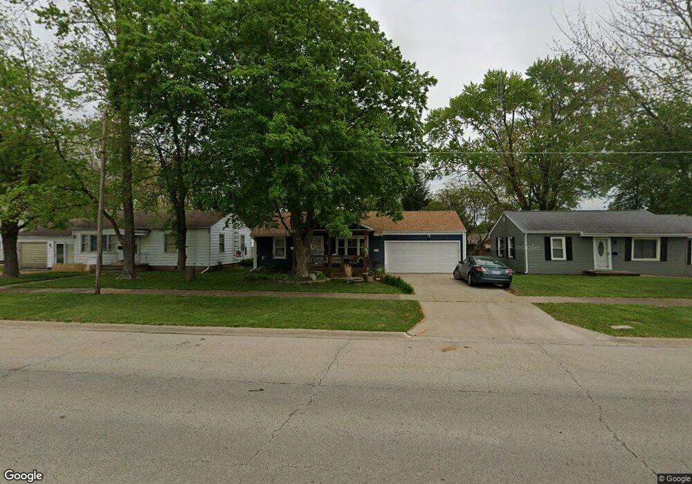
212 Limit St Lincoln, IL 62656
Estimated Value: $123,715 - $178,000
3
Beds
--
Bath
1,170
Sq Ft
$126/Sq Ft
Est. Value
About This Home
This home is located at 212 Limit St, Lincoln, IL 62656 and is currently estimated at $147,429, approximately $126 per square foot. 212 Limit St is a home located in Logan County with nearby schools including Chester-East Lincoln Elementary School, Lincoln Community High School, and Carroll Catholic School.
Ownership History
Date
Name
Owned For
Owner Type
Purchase Details
Closed on
Jun 7, 2020
Sold by
Long Robert
Bought by
Long Brandy
Current Estimated Value
Purchase Details
Closed on
Apr 29, 2005
Sold by
Long Robert A and Long Brandy J
Bought by
Long Robert A and Long Brandy L
Create a Home Valuation Report for This Property
The Home Valuation Report is an in-depth analysis detailing your home's value as well as a comparison with similar homes in the area
Home Values in the Area
Average Home Value in this Area
Purchase History
| Date | Buyer | Sale Price | Title Company |
|---|---|---|---|
| Long Brandy | -- | None Available | |
| Long Robert A | $87,500 | -- |
Source: Public Records
Tax History Compared to Growth
Tax History
| Year | Tax Paid | Tax Assessment Tax Assessment Total Assessment is a certain percentage of the fair market value that is determined by local assessors to be the total taxable value of land and additions on the property. | Land | Improvement |
|---|---|---|---|---|
| 2024 | $2,731 | $37,880 | $6,560 | $31,320 |
| 2023 | $2,538 | $35,070 | $6,070 | $29,000 |
| 2022 | $2,402 | $32,770 | $5,670 | $27,100 |
| 2021 | $2,302 | $31,460 | $5,440 | $26,020 |
| 2020 | $2,274 | $31,000 | $5,360 | $25,640 |
| 2019 | $2,219 | $30,390 | $5,250 | $25,140 |
| 2018 | $2,192 | $29,800 | $5,150 | $24,650 |
| 2017 | $2,196 | $29,800 | $5,150 | $24,650 |
| 2016 | $2,181 | $29,770 | $5,140 | $24,630 |
| 2015 | $2,013 | $28,780 | $4,970 | $23,810 |
| 2014 | $2,013 | $28,780 | $4,970 | $23,810 |
| 2013 | $2,013 | $27,320 | $4,720 | $22,600 |
| 2012 | $2,013 | $27,810 | $4,800 | $23,010 |
Source: Public Records
Map
Nearby Homes
- 1624 Delavan St
- 1311 Broadway St
- 1121 Broadway St
- 929 Decatur St
- 1227 Delavan St
- 1225 Delavan St
- 1025 Broadway St
- 928 Broadway St
- 617 Decatur St
- 521 Decatur St
- 502 Williamette Ave
- 418 Wyatt Ave
- 402 Wyatt Ave
- 419 Decatur St
- 802 Bryan Ave
- 113 N Kickapoo St
- 915 Peoria St
- 410 S Chicago St
- 1019 N Mclean St
- 716 S Kickapoo St
- 214 Limit St
- 210 Limit St
- 216 Limit St
- 208 Limit St
- 145 Portland Place
- 151 Portland Place
- 218 Limit St
- 157 Portland Place
- 206 Limit St
- 111 Welch Dr
- 131 Portland Place
- 159 Portland Place
- 125 Portland Place
- 204 Limit St
- 102 Welch Dr
- 119 Portland Place
- 146 Portland Place
- 140 Portland Place
- 152 Portland Place
- 184 Welch Dr