Estimated Value: $137,000 - $171,000
--
Bed
2
Baths
1,421
Sq Ft
$103/Sq Ft
Est. Value
About This Home
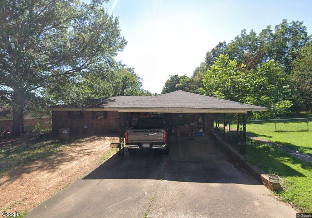
This home is located at 212 Maple Dr, Wynne, AR 72396 and is currently estimated at $146,806, approximately $103 per square foot. 212 Maple Dr is a home located in Cross County with nearby schools including Wynne Intermediate School, Wynne Primary School, and Wynne Junior High School.
Ownership History
Date
Name
Owned For
Owner Type
Purchase Details
Closed on
Sep 18, 2020
Sold by
Oguin Eddie and Oguin Susan
Bought by
Woodard Kenneth Wayne
Current Estimated Value
Home Financials for this Owner
Home Financials are based on the most recent Mortgage that was taken out on this home.
Original Mortgage
$68,400
Outstanding Balance
$60,588
Interest Rate
2.8%
Mortgage Type
New Conventional
Estimated Equity
$86,218
Purchase Details
Closed on
Feb 2, 2004
Bought by
Oguinn Susan and Oguinn Eddie
Purchase Details
Closed on
Jul 24, 2002
Bought by
State Certified
Purchase Details
Closed on
Jun 28, 1994
Bought by
Oguinn Susan and Oguinn Eddie
Purchase Details
Closed on
Feb 9, 1994
Bought by
Burroughs Herbert R
Purchase Details
Closed on
Jan 1, 1987
Bought by
Aycock Linda
Create a Home Valuation Report for This Property
The Home Valuation Report is an in-depth analysis detailing your home's value as well as a comparison with similar homes in the area
Home Values in the Area
Average Home Value in this Area
Purchase History
| Date | Buyer | Sale Price | Title Company |
|---|---|---|---|
| Woodard Kenneth Wayne | $72,000 | Cowling Title | |
| Oguinn Susan | -- | -- | |
| State Certified | -- | -- | |
| Oguinn Susan | -- | -- | |
| Burroughs Herbert R | $50,000 | -- | |
| Aycock Linda | -- | -- |
Source: Public Records
Mortgage History
| Date | Status | Borrower | Loan Amount |
|---|---|---|---|
| Open | Woodard Kenneth Wayne | $68,400 |
Source: Public Records
Tax History Compared to Growth
Tax History
| Year | Tax Paid | Tax Assessment Tax Assessment Total Assessment is a certain percentage of the fair market value that is determined by local assessors to be the total taxable value of land and additions on the property. | Land | Improvement |
|---|---|---|---|---|
| 2024 | $356 | $17,330 | $3,410 | $13,920 |
| 2023 | $433 | $17,330 | $3,410 | $13,920 |
| 2022 | $483 | $17,330 | $3,410 | $13,920 |
| 2021 | $483 | $17,330 | $3,410 | $13,920 |
| 2020 | $442 | $17,330 | $3,410 | $13,920 |
| 2019 | $403 | $15,710 | $3,090 | $12,620 |
| 2018 | $428 | $15,710 | $3,090 | $12,620 |
| 2017 | $428 | $15,710 | $3,090 | $12,620 |
| 2016 | $428 | $15,710 | $3,090 | $12,620 |
| 2015 | $428 | $15,710 | $3,090 | $12,620 |
| 2014 | $431 | $15,780 | $2,810 | $12,970 |
Source: Public Records
Map
Nearby Homes
- 206 Maple Dr
- 129 Lombardy Ln
- 102 Lombardy Ln
- 1484 Hamilton Ave E
- 6 A Londonderry Cir
- 116 Bailey St S
- 2 Donegal Cir
- 568 Killough Rd N
- 35 Morningside Dr
- 594 Malone St N
- 29 Sunset Dr
- 1321 Martin Dr E
- 4 Briarcliff Cir
- 105 Chickasaw
- 104 Shawnee
- 1011 Hilltop Dr
- 1910 Hess Ln
- 226 Nathan Dr E
- 1404 Airpark Rd
- 108 Nathan Dr E