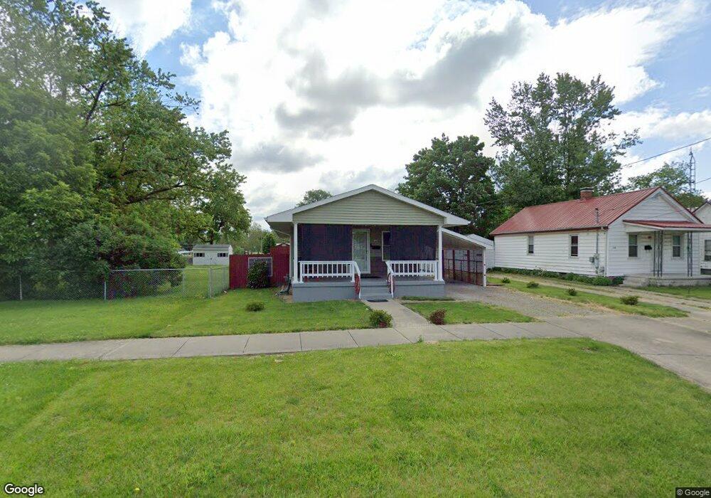
212 N 6th St Mattoon, IL 61938
Estimated Value: $79,677 - $132,000
2
Beds
1
Bath
1,008
Sq Ft
$103/Sq Ft
Est. Value
About This Home
This home is located at 212 N 6th St, Mattoon, IL 61938 and is currently estimated at $103,419, approximately $102 per square foot. 212 N 6th St is a home located in Coles County with nearby schools including Mattoon High School, St. John's Lutheran School, and St Mary School.
Ownership History
Date
Name
Owned For
Owner Type
Purchase Details
Closed on
Dec 31, 2013
Sold by
Cooley Sam
Bought by
Parse Ron
Current Estimated Value
Purchase Details
Closed on
Jun 20, 2008
Sold by
Huff James
Bought by
Cooley Sam
Home Financials for this Owner
Home Financials are based on the most recent Mortgage that was taken out on this home.
Original Mortgage
$25,000
Interest Rate
6.04%
Mortgage Type
Purchase Money Mortgage
Create a Home Valuation Report for This Property
The Home Valuation Report is an in-depth analysis detailing your home's value as well as a comparison with similar homes in the area
Home Values in the Area
Average Home Value in this Area
Purchase History
| Date | Buyer | Sale Price | Title Company |
|---|---|---|---|
| Parse Ron | $62,000 | -- | |
| Cooley Sam | $27,000 | None Available |
Source: Public Records
Mortgage History
| Date | Status | Borrower | Loan Amount |
|---|---|---|---|
| Previous Owner | Cooley Sam | $25,000 |
Source: Public Records
Tax History Compared to Growth
Tax History
| Year | Tax Paid | Tax Assessment Tax Assessment Total Assessment is a certain percentage of the fair market value that is determined by local assessors to be the total taxable value of land and additions on the property. | Land | Improvement |
|---|---|---|---|---|
| 2024 | $1,450 | $28,063 | $1,373 | $26,690 |
| 2023 | $1,243 | $25,056 | $1,226 | $23,830 |
| 2022 | $1,194 | $24,642 | $1,206 | $23,436 |
| 2021 | $1,158 | $22,635 | $1,108 | $21,527 |
| 2020 | $1,136 | $23,452 | $1,148 | $22,304 |
| 2019 | $1,082 | $22,635 | $3,811 | $18,824 |
| 2018 | $1,064 | $22,635 | $3,811 | $18,824 |
| 2017 | $1,000 | $21,964 | $3,811 | $18,153 |
| 2016 | $980 | $21,964 | $3,811 | $18,153 |
| 2015 | $1,250 | $21,964 | $3,811 | $18,153 |
| 2014 | $1,250 | $21,964 | $3,811 | $18,153 |
| 2013 | $1,250 | $14,164 | $3,811 | $10,353 |
Source: Public Records
Map
Nearby Homes
- 801 Richmond Ave
- 909 Broadway Ave
- 421 Dewitt Ave
- 609 Lafayette Ave
- 512 Dewitt Ave
- 720 Edgar Ave
- 1001 Wabash Ave
- 1120 Broadway Ave
- 1205 Champaign Ave
- 812 N 9th St Unit 73
- 916 Piatt Ave
- 613 S 7th St
- 1021 Piatt Ave
- 705 Marion Ave
- 1100 Marshall Ave
- 817 N 11th St
- 1412 Champaign Ave
- 1101 N 10th St
- 1305 Marshall Ave
- 1509 Lafayette Ave
- 208 N 6th St
- 206 N 6th St
- 204 N 6th St
- 220 N 6th St
- 200 N 6th St
- 213 N 6th St
- 600 Prairie Ave
- 605 Richmond Ave
- 604 Prairie Ave
- 600 Richmond Ave
- 609 Richmond Ave
- 512 Richmond Ave
- 608 Prairie Ave
- 520 Richmond Ave
- 508 Richmond Ave
- 615 Richmond Ave
- 610 Prairie Ave
- 500 Richmond Ave
- 617 Richmond Ave
- 612 Prairie Ave