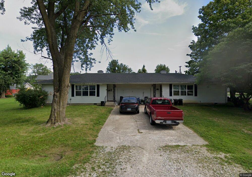
212 N 6th St Unit 212-214 Vandalia, MO 63382
Estimated Value: $123,000 - $187,000
--
Bed
--
Bath
1,680
Sq Ft
$89/Sq Ft
Est. Value
About This Home
This home is located at 212 N 6th St Unit 212-214, Vandalia, MO 63382 and is currently estimated at $149,666, approximately $89 per square foot. 212 N 6th St Unit 212-214 is a home located in Audrain County with nearby schools including Van-Far Elementary School and Van-Far Junior/Senior High School.
Ownership History
Date
Name
Owned For
Owner Type
Purchase Details
Closed on
Feb 3, 2023
Sold by
Selby Lonnie G
Bought by
Blueprint Real Estate Investme
Current Estimated Value
Purchase Details
Closed on
Jun 30, 2022
Sold by
Mudd Daniel L and Mudd Makenxie K
Bought by
Selby Lonnie G
Home Financials for this Owner
Home Financials are based on the most recent Mortgage that was taken out on this home.
Original Mortgage
$120,930
Interest Rate
5.52%
Mortgage Type
Construction
Purchase Details
Closed on
Mar 5, 2020
Sold by
Barnes M D L & A C Trust
Bought by
Mudd Daniel L
Home Financials for this Owner
Home Financials are based on the most recent Mortgage that was taken out on this home.
Original Mortgage
$60,000
Interest Rate
3.6%
Mortgage Type
Construction
Create a Home Valuation Report for This Property
The Home Valuation Report is an in-depth analysis detailing your home's value as well as a comparison with similar homes in the area
Home Values in the Area
Average Home Value in this Area
Purchase History
| Date | Buyer | Sale Price | Title Company |
|---|---|---|---|
| Blueprint Real Estate Investme | -- | Attorney Only | |
| Selby Lonnie G | $151,162 | Clear Title | |
| Mudd Daniel L | $75,000 | -- | |
| Barnes Danny L | -- | -- |
Source: Public Records
Mortgage History
| Date | Status | Borrower | Loan Amount |
|---|---|---|---|
| Previous Owner | Selby Lonnie G | $120,930 | |
| Previous Owner | Mudd Daniel L | $60,000 |
Source: Public Records
Tax History Compared to Growth
Tax History
| Year | Tax Paid | Tax Assessment Tax Assessment Total Assessment is a certain percentage of the fair market value that is determined by local assessors to be the total taxable value of land and additions on the property. | Land | Improvement |
|---|---|---|---|---|
| 2024 | $921 | $12,040 | $1,330 | $10,710 |
| 2023 | $909 | $12,040 | $1,330 | $10,710 |
| 2022 | $923 | $11,940 | $1,330 | $10,610 |
| 2021 | $901 | $11,940 | $1,330 | $10,610 |
| 2020 | $897 | $11,940 | $1,330 | $10,610 |
| 2019 | $895 | $11,940 | $1,330 | $10,610 |
| 2018 | $754 | $0 | $0 | $0 |
| 2017 | $827 | $0 | $0 | $0 |
| 2012 | $893 | $12,820 | $0 | $0 |
Source: Public Records
Map
Nearby Homes
- 0 U S 54
- 203 E Arlington Ave
- 314 N Clark St
- 1106 N Oak St
- 514 W Us Highway 54
- 401 E Washington St
- 102 N Clark St
- 114 W Union St
- 518 S Highland St
- 00 State Route V
- 405 W Bland St
- 102 Birchtree Dr
- 3511 Audrain Road 581
- 00 Highway V
- 20305 Highway M
- 234052 Highway M
- 14144 Highway E
- 36950 Highway K
- 81 Acre Audrain 695
- 43813 Audrain Road 620
- 212 N 6th St
- 609 N Lindell St
- 605 N Lindell St
- 211 W Saint Johns St
- 211 N 6th St
- 601 N Lindell St
- 613 N Jefferson St
- 705 N Lindell St
- 701 N Jefferson St
- 301 W Saint Johns St
- 714 N Jefferson St
- 707 N Jefferson St
- 610 N Lindell St
- 614 N Lindell St
- 614 N Walnut St
- 610 N Walnut St
- 510 N Jefferson St
- 700 N Walnut St
- 713 N Jefferson St
- 702 N Walnut St