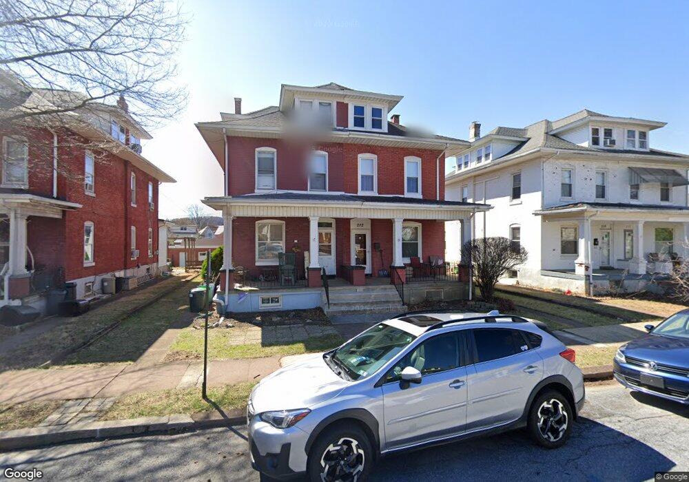
212 N Brobst St Reading, PA 19607
Estimated Value: $215,000 - $265,000
4
Beds
2
Baths
1,738
Sq Ft
$139/Sq Ft
Est. Value
About This Home
This home is located at 212 N Brobst St, Reading, PA 19607 and is currently estimated at $241,215, approximately $138 per square foot. 212 N Brobst St is a home located in Berks County with nearby schools including Cumru Elementary School, Governor Mifflin Intermediate School, and Governor Mifflin Middle School.
Ownership History
Date
Name
Owned For
Owner Type
Purchase Details
Closed on
May 12, 2025
Sold by
Sandra K Fisher Administrative Trust and Brower Megan K
Bought by
Brower Megan K
Current Estimated Value
Purchase Details
Closed on
Apr 11, 2025
Sold by
Sandra K Fisher Family Trust and Fisher Damien M
Bought by
Sandra K Fisher Family Trust and Megan K Brower Under The Sandra K Fisher Admi
Purchase Details
Closed on
Jun 5, 2017
Sold by
Fisher Sandra K
Bought by
Sandra K Fisher Family Trust
Purchase Details
Closed on
Jan 28, 2015
Sold by
Fisher Terry R and Fisher Sandra K
Bought by
Fisher Sandra K
Create a Home Valuation Report for This Property
The Home Valuation Report is an in-depth analysis detailing your home's value as well as a comparison with similar homes in the area
Home Values in the Area
Average Home Value in this Area
Purchase History
| Date | Buyer | Sale Price | Title Company |
|---|---|---|---|
| Brower Megan K | -- | None Listed On Document | |
| Sandra K Fisher Family Trust | -- | None Listed On Document | |
| Sandra K Fisher Family Trust | -- | None Available | |
| Fisher Sandra K | -- | None Available |
Source: Public Records
Tax History Compared to Growth
Tax History
| Year | Tax Paid | Tax Assessment Tax Assessment Total Assessment is a certain percentage of the fair market value that is determined by local assessors to be the total taxable value of land and additions on the property. | Land | Improvement |
|---|---|---|---|---|
| 2025 | $1,302 | $80,600 | $27,000 | $53,600 |
| 2024 | $3,674 | $80,600 | $27,000 | $53,600 |
| 2023 | $3,578 | $80,600 | $27,000 | $53,600 |
| 2022 | $3,538 | $80,600 | $27,000 | $53,600 |
| 2021 | $3,498 | $80,600 | $27,000 | $53,600 |
| 2020 | $3,498 | $80,600 | $27,000 | $53,600 |
| 2019 | $3,457 | $80,600 | $27,000 | $53,600 |
| 2018 | $3,417 | $80,600 | $27,000 | $53,600 |
| 2017 | $3,354 | $80,600 | $27,000 | $53,600 |
| 2016 | $1,146 | $80,600 | $27,000 | $53,600 |
| 2015 | $1,146 | $80,600 | $27,000 | $53,600 |
| 2014 | $1,048 | $80,600 | $27,000 | $53,600 |
Source: Public Records
Map
Nearby Homes
- 137 E Elm St
- 136 E Elm St
- 27 Pennsylvania Ave
- 33 Pennsylvania Ave
- 405 State St
- 305 W Elm St
- 24 Philadelphia Ave
- 31 S Sterley St Unit 401
- 31 S Sterley St Unit 101
- 31 S Wyomissing Ave
- 120 S Miller St
- 429 Devon Terrace
- 110 Chestnut St
- 322 New Holland Ave
- 511 Grill Ave
- 123 High Blvd
- 310 4th St
- 320 Hillside Dr
- 617 Meade Tc
- 15 Bare Ave