Estimated Value: $4,889,043
--
Bed
--
Bath
11,086
Sq Ft
$441/Sq Ft
Est. Value
About This Home
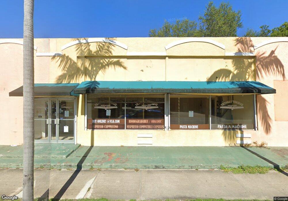
This home is located at 212 N Federal Hwy Unit 204, Dania, FL 33004 and is currently estimated at $4,889,043, approximately $441 per square foot. 212 N Federal Hwy Unit 204 is a home located in Broward County with nearby schools including Collins Elementary School, Olsen Middle School, and South Broward High School.
Ownership History
Date
Name
Owned For
Owner Type
Purchase Details
Closed on
Oct 1, 2021
Sold by
Tiram Real Estate Enterprises Llc
Bought by
Federal Highway-Dania Beach Llc
Current Estimated Value
Purchase Details
Closed on
Jun 17, 2021
Sold by
Apa Domenico and Apa Guiseppe
Bought by
Tiram Real Estate Enterprises Llc
Purchase Details
Closed on
Dec 2, 2015
Sold by
Apa Domenico
Bought by
Dania Land Trust #1 and Apa Giuseppe
Purchase Details
Closed on
Oct 9, 2014
Sold by
Mucci Mark S
Bought by
Apa Domenico
Purchase Details
Closed on
Nov 7, 2000
Sold by
Apa Domenico
Bought by
Mucci Mark S
Purchase Details
Closed on
Jun 26, 1999
Sold by
Apa Vincenzo
Bought by
Apa Domenico
Purchase Details
Closed on
Dec 7, 1996
Sold by
Apa Domenico and Apa Vincenzo
Bought by
Apa Domenico and Apa Vincenzo
Purchase Details
Closed on
Aug 7, 1995
Sold by
Apa Domenico and Apa Giuseppe
Bought by
Apa Domenico and Apa Vincenzo
Purchase Details
Closed on
Apr 1, 1985
Sold by
Available Not
Bought by
Available Not
Create a Home Valuation Report for This Property
The Home Valuation Report is an in-depth analysis detailing your home's value as well as a comparison with similar homes in the area
Home Values in the Area
Average Home Value in this Area
Purchase History
| Date | Buyer | Sale Price | Title Company |
|---|---|---|---|
| Federal Highway-Dania Beach Llc | -- | Tarr Andrew D | |
| Tiram Real Estate Enterprises Llc | $3,580,000 | Attorney | |
| Dania Land Trust #1 | -- | Attorney | |
| Apa Domenico | -- | All Property Title & Escrow | |
| Mucci Mark S | $274,800 | -- | |
| Apa Domenico | $84,600 | -- | |
| Apa Domenico | $100 | -- | |
| Apa Domenico | $15,000 | -- | |
| Available Not | $7,142 | -- |
Source: Public Records
Tax History Compared to Growth
Tax History
| Year | Tax Paid | Tax Assessment Tax Assessment Total Assessment is a certain percentage of the fair market value that is determined by local assessors to be the total taxable value of land and additions on the property. | Land | Improvement |
|---|---|---|---|---|
| 2025 | $70,923 | $3,539,420 | -- | -- |
| 2024 | $64,027 | $3,300,000 | $680,940 | $2,619,060 |
| 2023 | $64,027 | $2,925,150 | $0 | $0 |
| 2022 | $56,230 | $2,659,230 | $680,940 | $1,978,290 |
| 2021 | $32,299 | $1,386,300 | $680,940 | $705,360 |
| 2020 | $32,136 | $1,330,160 | $680,940 | $649,220 |
| 2019 | $32,107 | $1,330,160 | $680,940 | $649,220 |
| 2018 | $30,170 | $1,330,160 | $680,940 | $649,220 |
| 2017 | $28,538 | $1,100,000 | $0 | $0 |
| 2016 | $27,617 | $1,070,980 | $0 | $0 |
| 2015 | $25,737 | $973,620 | $0 | $0 |
| 2014 | $24,800 | $947,630 | $0 | $0 |
| 2013 | -- | $936,730 | $680,940 | $255,790 |
Source: Public Records
Map
Nearby Homes
- 146 NE 1st Ave
- 137 NE 1st Ct
- 17 NE 2nd Ave Unit 108
- 121 NE 1st Ct
- 129 NE 2nd Ave
- 118 N Federal Hwy
- 213 NE 2nd Ave
- 213 NE Stirling
- 29 NE 3rd St
- 35 NE 3rd St
- 212 NE 1st St
- 311 NE 2nd Ct
- 145 NW 2nd St
- 400 NW 1st St
- 226 NW 6th Ave
- 116 NW 6th Ave
- 135 NW 6th Ave
- 213 SE Park St
- 101 NW 7th Ave
- 205 NW 7th Ave
- 212 N Federal Hwy
- 222 N Federal Hwy Unit F
- 222 N Federal Hwy Unit A
- 222 N Federal Hwy
- 222 N Federal Hwy Unit 101
- 222 N Federal Hwy Unit D
- 222 N Federal Hwy Unit 105
- 222 N Federal Hwy Unit 104
- 222 N Federal Hwy Unit 104-10
- 222 N Federal Hwy Unit 108
- 222 N Federal Hwy Unit 203
- 222 N Federal Hwy Unit 201
- 222 N Federal Hwy Unit 103
- 222 N Federal Hwy Unit 106
- 222 N Federal Hwy Unit 104-105
- 222 N Federal Hwy Unit 102
- 222 N Federal Hwy Unit 107
- 106 NE 2nd Ave
- 209 NE 1st Ct