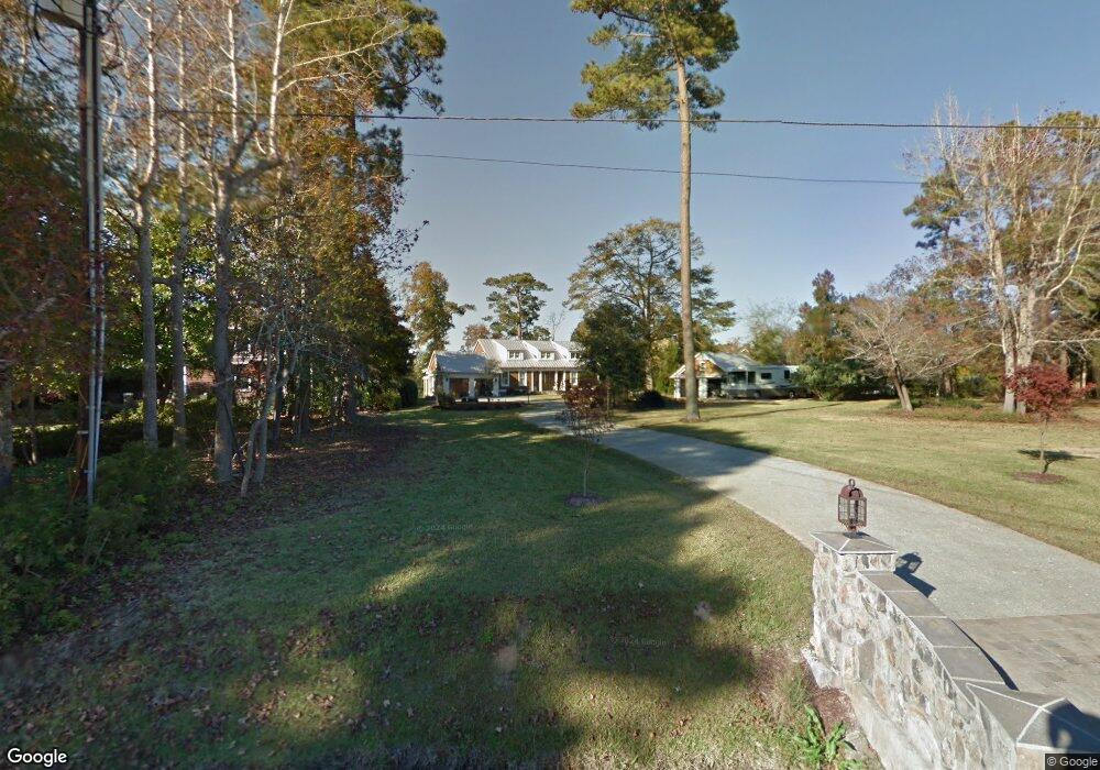
212 Olde Point Loop Hampstead, NC 28443
Estimated Value: $1,319,000 - $1,682,358
3
Beds
3
Baths
2,201
Sq Ft
$674/Sq Ft
Est. Value
About This Home
This home is located at 212 Olde Point Loop, Hampstead, NC 28443 and is currently estimated at $1,483,786, approximately $674 per square foot. 212 Olde Point Loop is a home located in Pender County with nearby schools including Topsail Elementary School, Topsail Middle School, and Topsail High School.
Ownership History
Date
Name
Owned For
Owner Type
Purchase Details
Closed on
Nov 30, 2021
Sold by
Tracy Daniel B
Bought by
Farmer Darin Andrew and Farmer Janet Elizabeth
Current Estimated Value
Home Financials for this Owner
Home Financials are based on the most recent Mortgage that was taken out on this home.
Original Mortgage
$1,196,800
Outstanding Balance
$1,090,689
Interest Rate
3.05%
Mortgage Type
New Conventional
Estimated Equity
$393,097
Purchase Details
Closed on
May 22, 2018
Sold by
Tracy Marjorie Ann
Bought by
Tracy Daniel Bruce
Purchase Details
Closed on
Mar 10, 2008
Sold by
Morgan Franklin M and Morgan Helen B
Bought by
Tracy Marjorie Ann and Tracy Daniel Bruce
Home Financials for this Owner
Home Financials are based on the most recent Mortgage that was taken out on this home.
Original Mortgage
$620,000
Interest Rate
5.87%
Mortgage Type
Adjustable Rate Mortgage/ARM
Create a Home Valuation Report for This Property
The Home Valuation Report is an in-depth analysis detailing your home's value as well as a comparison with similar homes in the area
Home Values in the Area
Average Home Value in this Area
Purchase History
| Date | Buyer | Sale Price | Title Company |
|---|---|---|---|
| Farmer Darin Andrew | $1,496,000 | None Available | |
| Tracy Daniel Bruce | -- | None Available | |
| Tracy Marjorie Ann | $775,000 | -- |
Source: Public Records
Mortgage History
| Date | Status | Borrower | Loan Amount |
|---|---|---|---|
| Open | Farmer Darin Andrew | $1,196,800 | |
| Previous Owner | Tracy Marjorie Ann | $620,000 |
Source: Public Records
Tax History
| Year | Tax Paid | Tax Assessment Tax Assessment Total Assessment is a certain percentage of the fair market value that is determined by local assessors to be the total taxable value of land and additions on the property. | Land | Improvement |
|---|---|---|---|---|
| 2025 | $4,994 | $1,015,274 | $248,448 | $766,826 |
| 2024 | $4,994 | $518,295 | $145,660 | $372,635 |
| 2023 | $4,994 | $518,295 | $145,660 | $372,635 |
| 2022 | $4,425 | $518,295 | $145,660 | $372,635 |
| 2021 | $4,425 | $518,295 | $145,660 | $372,635 |
| 2020 | $4,535 | $518,295 | $145,660 | $372,635 |
| 2019 | $4,535 | $518,295 | $145,660 | $372,635 |
| 2018 | $5,914 | $665,180 | $360,220 | $304,960 |
| 2017 | $5,914 | $665,180 | $360,220 | $304,960 |
| 2016 | $5,957 | $665,180 | $360,220 | $304,960 |
| 2015 | $5,922 | $665,180 | $360,220 | $304,960 |
| 2014 | $4,626 | $665,180 | $360,220 | $304,960 |
| 2013 | -- | $665,180 | $360,220 | $304,960 |
| 2012 | -- | $665,180 | $360,220 | $304,960 |
Source: Public Records
Map
Nearby Homes
- 105 White Heron Cove Rd
- 151 Olde Point Rd
- 1984 Kings Landing Rd
- 557 Button Bush Ln
- 130 Iris Way
- 480 Captain Beam Blvd
- 1020 Cordgrass Rd
- 1035 Grandview Dr
- 2001 Cordgrass Rd
- 167 Hydrangea Ln
- 703 Brown Pelican Ln
- 754 Country Club Dr
- 1406 Kings Landing Rd
- 109c Corcus Ferry Rd
- 237 Ravenswood Rd
- 171 Tanglewood Ct
- 161 Tanglewood Ct
- 203 Golf Terrace Ct
- 53 Arden Dr
- 513 Grandview Dr
- 212 Olde Point Loop
- 103 White Heron Cove Rd
- 214 Olde Point Loop
- 103 White Heron Cove
- 6 Crown Point
- 105 White Heron Cove
- 102 White Heron Cove Rd
- 218 Olde Point Loop
- 211 Olde Point Loop
- 104 White Heron Cove
- 107 White Heron Cove
- 209 Olde Point Loop
- 0 - LOT 38 Olde Pointe
- 220 Olde Point Loop
- 213 Olde Point Loop
- 108 White Heron Cove
- 109 White Heron Cove
- 108 White Heron Cove Rd
- 219 Olde Point Loop
- 206 Olde Point Loop