Estimated Value: $256,000 - $283,000
3
Beds
2
Baths
1,313
Sq Ft
$202/Sq Ft
Est. Value
About This Home
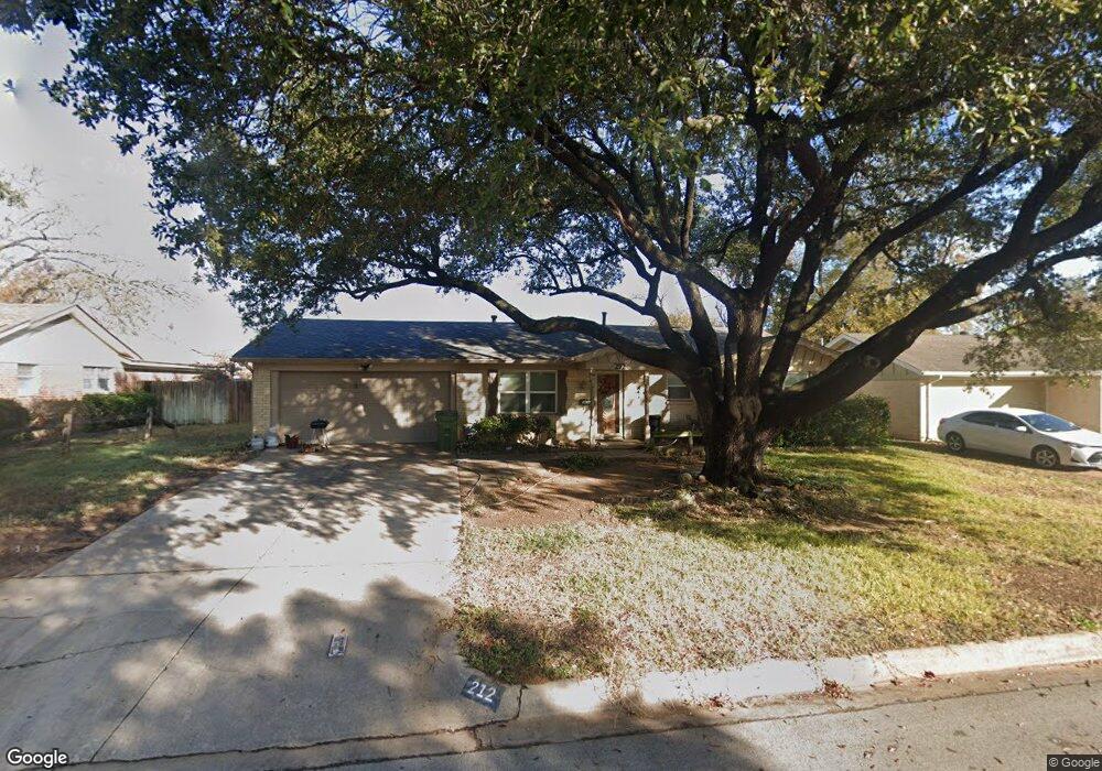
This home is located at 212 Olive St, Hurst, TX 76053 and is currently estimated at $264,683, approximately $201 per square foot. 212 Olive St is a home located in Tarrant County with nearby schools including Harrison Lane Elementary School, Hurst J High School, and L.D. Bell High School.
Ownership History
Date
Name
Owned For
Owner Type
Purchase Details
Closed on
May 25, 2007
Sold by
Simons Brian
Bought by
White Joe W and White Mary E
Current Estimated Value
Home Financials for this Owner
Home Financials are based on the most recent Mortgage that was taken out on this home.
Original Mortgage
$75,000
Outstanding Balance
$45,620
Interest Rate
6.17%
Mortgage Type
Purchase Money Mortgage
Estimated Equity
$219,063
Purchase Details
Closed on
May 24, 2005
Sold by
Sittler Timothy J and Sittler Irene D
Bought by
Martine Dolly
Create a Home Valuation Report for This Property
The Home Valuation Report is an in-depth analysis detailing your home's value as well as a comparison with similar homes in the area
Home Values in the Area
Average Home Value in this Area
Purchase History
| Date | Buyer | Sale Price | Title Company |
|---|---|---|---|
| White Joe W | -- | Alamo Title Company | |
| Martine Dolly | -- | Alamo Title Company |
Source: Public Records
Mortgage History
| Date | Status | Borrower | Loan Amount |
|---|---|---|---|
| Open | White Joe W | $75,000 |
Source: Public Records
Tax History
| Year | Tax Paid | Tax Assessment Tax Assessment Total Assessment is a certain percentage of the fair market value that is determined by local assessors to be the total taxable value of land and additions on the property. | Land | Improvement |
|---|---|---|---|---|
| 2025 | $4,560 | $189,749 | $55,000 | $134,749 |
| 2024 | $4,560 | $223,235 | $55,000 | $168,235 |
| 2023 | $4,825 | $240,851 | $40,000 | $200,851 |
| 2022 | $4,911 | $213,276 | $40,000 | $173,276 |
| 2021 | $3,776 | $156,583 | $40,000 | $116,583 |
| 2020 | $3,767 | $156,583 | $40,000 | $116,583 |
| 2019 | $3,832 | $156,583 | $40,000 | $116,583 |
| 2018 | $3,789 | $154,808 | $19,000 | $135,808 |
| 2017 | $3,729 | $147,350 | $19,000 | $128,350 |
| 2016 | $3,396 | $134,201 | $19,000 | $115,201 |
| 2015 | $2,318 | $88,400 | $15,000 | $73,400 |
| 2014 | $2,318 | $88,400 | $15,000 | $73,400 |
Source: Public Records
Map
Nearby Homes
- 1160 Harrison Ln
- 1148 Simpson Dr
- 1236 Harrison Ln
- 1113 Norwood Dr
- 1352 Simpson Dr
- 1348 Norwood Dr
- 1016 Keith Dr
- 1112 Karla Dr
- 905 Brown Trail
- 153 Sheri Ln
- 1213 Glenda Dr
- 1428 Pamela St
- 936 Barbara Ann Dr
- 344 Bedford Ct E
- 224 Plainview Dr
- 341 Hurst Dr
- 802 Brown Trail
- 209 W Cedar St
- 624 Forest Ln
- 701 Harrison Ln
Your Personal Tour Guide
Ask me questions while you tour the home.