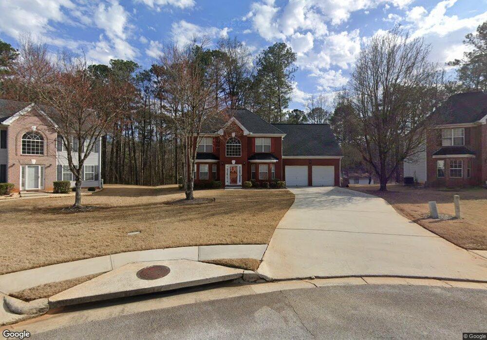
212 Palisade Point Dr Ellenwood, GA 30294
Estimated Value: $304,000 - $427,000
4
Beds
3
Baths
2,649
Sq Ft
$134/Sq Ft
Est. Value
About This Home
This home is located at 212 Palisade Point Dr, Ellenwood, GA 30294 and is currently estimated at $355,842, approximately $134 per square foot. 212 Palisade Point Dr is a home located in Henry County with nearby schools including Fairview Elementary School, Austin Road Middle School, and Stockbridge High School.
Ownership History
Date
Name
Owned For
Owner Type
Purchase Details
Closed on
Mar 25, 2021
Sold by
Mcdonald Edward E
Bought by
Mcdonald Bridgette M
Current Estimated Value
Home Financials for this Owner
Home Financials are based on the most recent Mortgage that was taken out on this home.
Original Mortgage
$151,995
Outstanding Balance
$136,710
Interest Rate
2.9%
Mortgage Type
New Conventional
Estimated Equity
$219,132
Purchase Details
Closed on
Aug 29, 2002
Sold by
Ridgeland Hms Inc
Bought by
Mcdonald Edward E and Mcdonald Bridgette M
Home Financials for this Owner
Home Financials are based on the most recent Mortgage that was taken out on this home.
Original Mortgage
$165,600
Interest Rate
6.21%
Mortgage Type
FHA
Purchase Details
Closed on
Nov 29, 2001
Sold by
I-20 East Inc
Bought by
Ridgland Homes Inc
Create a Home Valuation Report for This Property
The Home Valuation Report is an in-depth analysis detailing your home's value as well as a comparison with similar homes in the area
Home Values in the Area
Average Home Value in this Area
Purchase History
| Date | Buyer | Sale Price | Title Company |
|---|---|---|---|
| Mcdonald Bridgette M | -- | -- | |
| Mcdonald Edward E | $167,000 | -- | |
| Ridgland Homes Inc | $630,000 | -- |
Source: Public Records
Mortgage History
| Date | Status | Borrower | Loan Amount |
|---|---|---|---|
| Open | Mcdonald Bridgette M | $151,995 | |
| Previous Owner | Mcdonald Edward E | $165,600 |
Source: Public Records
Tax History Compared to Growth
Tax History
| Year | Tax Paid | Tax Assessment Tax Assessment Total Assessment is a certain percentage of the fair market value that is determined by local assessors to be the total taxable value of land and additions on the property. | Land | Improvement |
|---|---|---|---|---|
| 2025 | $2,994 | $143,720 | $16,000 | $127,720 |
| 2024 | $2,994 | $138,520 | $16,000 | $122,520 |
| 2023 | $2,220 | $131,160 | $16,000 | $115,160 |
| 2022 | $1,910 | $96,680 | $12,000 | $84,680 |
| 2021 | $1,386 | $74,480 | $12,000 | $62,480 |
| 2020 | $1,426 | $76,160 | $8,000 | $68,160 |
| 2019 | $2,431 | $72,120 | $8,000 | $64,120 |
| 2018 | $2,336 | $68,080 | $8,000 | $60,080 |
| 2016 | $1,993 | $57,160 | $8,000 | $49,160 |
| 2015 | $2,012 | $56,360 | $6,000 | $50,360 |
| 2014 | $1,689 | $47,800 | $6,000 | $41,800 |
Source: Public Records
Map
Nearby Homes
- 1202 Palisades Ln
- 1501 Pineview Terrace
- 1236 Country Pine Dr
- 4130 Windrock Dr
- 4395 Ward Bluff Ct
- 2669 Woodfen Dr
- 856 Haydens Ridge
- 4044 Ward Lake Trail
- 1012 Grace Marie Ln
- 4078 Bouldercrest Rd
- 4032 Ward Lake Trail
- 716 Habersham Ct
- 1548 Fairview Rd
- 4139 Tilson Rd
- 823 Haydens Ridge
- 4283 Northwind Dr
- 3902 Bouldercrest Rd
- 4390 Northridge Trail
- 2496 Montezuma Cir
- 216 Palisade Point Dr
- 208 Palisade Point Dr
- 1142 Palisades Dr
- 1142 Palisades Dr Unit 2
- 204 Palisade Point Dr
- 217 Palisade Point Dr
- 1144 Palisades Dr
- 200 Palisade Point Dr
- 213 Palisade Point Dr
- 209 Palisade Point Dr
- 205 Palisade Point Dr
- 1303 Palisades Way
- 1140 Palisades Dr
- 196 Palisade Point Dr
- 201 Palisade Point Dr
- 1263 Palisades Way
- 197 Palisade Point Dr
- 1224 Palisades Ln Unit 2
- 193 Palisade Point Dr
- 1226 Palisades Ln