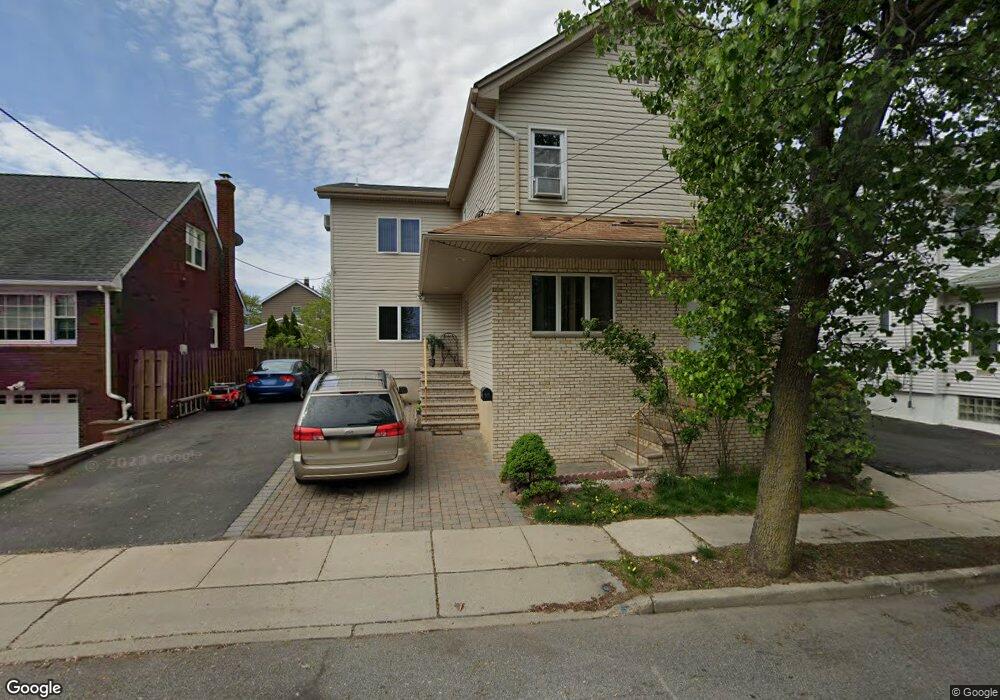
212 Paul St Lyndhurst, NJ 07071
Estimated Value: $933,391 - $1,034,000
--
Bed
--
Bath
3,000
Sq Ft
$321/Sq Ft
Est. Value
About This Home
This home is located at 212 Paul St, Lyndhurst, NJ 07071 and is currently estimated at $963,098, approximately $321 per square foot. 212 Paul St is a home located in Bergen County with nearby schools including Lyndhurst High School and Sacred Heart School.
Ownership History
Date
Name
Owned For
Owner Type
Purchase Details
Closed on
Sep 1, 2006
Sold by
Gabriele Giuseppina
Bought by
Canales Oscar and Checo Maria
Current Estimated Value
Home Financials for this Owner
Home Financials are based on the most recent Mortgage that was taken out on this home.
Original Mortgage
$544,500
Outstanding Balance
$324,671
Interest Rate
6.54%
Estimated Equity
$638,427
Create a Home Valuation Report for This Property
The Home Valuation Report is an in-depth analysis detailing your home's value as well as a comparison with similar homes in the area
Home Values in the Area
Average Home Value in this Area
Purchase History
| Date | Buyer | Sale Price | Title Company |
|---|---|---|---|
| Canales Oscar | $605,000 | -- |
Source: Public Records
Mortgage History
| Date | Status | Borrower | Loan Amount |
|---|---|---|---|
| Open | Canales Oscar | $544,500 |
Source: Public Records
Tax History Compared to Growth
Tax History
| Year | Tax Paid | Tax Assessment Tax Assessment Total Assessment is a certain percentage of the fair market value that is determined by local assessors to be the total taxable value of land and additions on the property. | Land | Improvement |
|---|---|---|---|---|
| 2025 | $14,694 | $712,100 | $245,000 | $467,100 |
| 2024 | $14,053 | $704,400 | $242,500 | $461,900 |
| 2023 | $13,354 | $691,600 | $235,000 | $456,600 |
| 2022 | $13,354 | $421,000 | $160,000 | $261,000 |
| 2021 | $12,177 | $421,000 | $160,000 | $261,000 |
| 2020 | $12,521 | $421,000 | $160,000 | $261,000 |
| 2019 | $12,428 | $421,000 | $160,000 | $261,000 |
| 2018 | $12,529 | $421,000 | $160,000 | $261,000 |
| 2017 | $12,213 | $421,000 | $160,000 | $261,000 |
| 2016 | $11,940 | $421,000 | $160,000 | $261,000 |
| 2015 | $11,565 | $421,000 | $160,000 | $261,000 |
| 2014 | $11,413 | $421,000 | $160,000 | $261,000 |
Source: Public Records
Map
Nearby Homes
- 258 Kingsland Ave
- 14 River Rd Unit F
- 14 River Rd Unit G
- 510 Anthony Ct
- 307 Jauncey Ave
- 474 Willow Ave
- 168 Forest Ave
- 614 10th St
- 25 River Rd Unit A-12
- 609 Chase Ave
- 416 Kingsland Ave
- 446 Alder St
- 824 Main St Unit j
- 824 Main St
- 459 Riverside Ave
- 471 Harding Ave
- 1 River Rd Unit L
- 1 River Rd
- 518 8th St
- 138 Fern Ave
- 212 Paul St Unit 2
- 208 Paul St
- 214 Paul St
- 204 Paul St
- 209 Thomas Ave
- 205 Thomas Ave
- 220 Paul St
- 201 Thomas Ave Unit 203
- 201 Thomas Ave Unit 1
- 758 Riverside Ave
- 715 Cedar St
- 211 Thomas Ave
- 211 Thomas Ave Unit 2nd floor
- 712 Cedar St
- 718 Wiedemann Place
- 707 Cedar St Unit 1
- 707 Cedar St Unit 2
- 708 Cedar St
- 756 Riverside Ave
- 756 Riverside Ave Unit 2