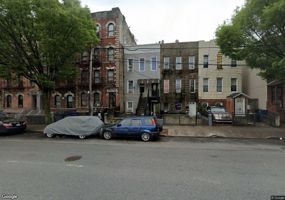
212 Pennsylvania Ave Brooklyn, NY 11207
Brownsville NeighborhoodEstimated Value: $858,000 - $996,454
--
Bed
--
Bath
1,920
Sq Ft
$480/Sq Ft
Est. Value
About This Home
This home is located at 212 Pennsylvania Ave, Brooklyn, NY 11207 and is currently estimated at $920,864, approximately $479 per square foot. 212 Pennsylvania Ave is a home located in Kings County with nearby schools including J.H.S 292 Margaret S. Douglas, Hyde Leadership Charter School-Brooklyn, and Trey Whitfield School.
Ownership History
Date
Name
Owned For
Owner Type
Purchase Details
Closed on
May 24, 2016
Sold by
Alexander Caserine and Mohammed Chris
Bought by
Foss Remo and Foss Toni Marie
Current Estimated Value
Home Financials for this Owner
Home Financials are based on the most recent Mortgage that was taken out on this home.
Original Mortgage
$485,775
Outstanding Balance
$384,775
Interest Rate
3.59%
Mortgage Type
New Conventional
Estimated Equity
$536,089
Purchase Details
Closed on
Jun 11, 2013
Sold by
Parad Llc
Bought by
Alexander Caserine and Mohammed Chris
Home Financials for this Owner
Home Financials are based on the most recent Mortgage that was taken out on this home.
Original Mortgage
$332,356
Interest Rate
3.83%
Mortgage Type
New Conventional
Purchase Details
Closed on
Apr 5, 2012
Sold by
Howe Referee Robert
Bought by
Parad Llc
Purchase Details
Closed on
Oct 5, 2006
Sold by
Lafortune Yvrose
Bought by
James John
Home Financials for this Owner
Home Financials are based on the most recent Mortgage that was taken out on this home.
Original Mortgage
$114,000
Interest Rate
6.49%
Purchase Details
Closed on
Nov 11, 2004
Sold by
Aquitato Joseph
Bought by
Lafortune Yvrose
Home Financials for this Owner
Home Financials are based on the most recent Mortgage that was taken out on this home.
Original Mortgage
$82,000
Interest Rate
5.75%
Purchase Details
Closed on
Jul 12, 2002
Sold by
Kinard Eric
Bought by
Coastal Properties
Home Financials for this Owner
Home Financials are based on the most recent Mortgage that was taken out on this home.
Original Mortgage
$288,000
Interest Rate
6.61%
Purchase Details
Closed on
Jul 11, 2002
Sold by
Coastal Properties Of Am
Bought by
Aquitato Joseph
Home Financials for this Owner
Home Financials are based on the most recent Mortgage that was taken out on this home.
Original Mortgage
$288,000
Interest Rate
6.61%
Create a Home Valuation Report for This Property
The Home Valuation Report is an in-depth analysis detailing your home's value as well as a comparison with similar homes in the area
Home Values in the Area
Average Home Value in this Area
Purchase History
| Date | Buyer | Sale Price | Title Company |
|---|---|---|---|
| Foss Remo | $647,700 | -- | |
| Alexander Caserine | $347,490 | -- | |
| Alexander Caserine | $347,490 | -- | |
| Parad Llc | $100,000 | -- | |
| Parad Llc | $100,000 | -- | |
| James John | $570,000 | -- | |
| James John | $570,000 | -- | |
| Lafortune Yvrose | $410,000 | -- | |
| Lafortune Yvrose | $410,000 | -- | |
| Coastal Properties | -- | -- | |
| Coastal Properties | -- | -- | |
| Aquitato Joseph | -- | -- | |
| Aquitato Joseph | -- | -- |
Source: Public Records
Mortgage History
| Date | Status | Borrower | Loan Amount |
|---|---|---|---|
| Open | Foss Remo | $485,775 | |
| Previous Owner | Alexander Caserine | $332,356 | |
| Previous Owner | James John | $114,000 | |
| Previous Owner | James John | $456,000 | |
| Previous Owner | Lafortune Yvrose | $82,000 | |
| Previous Owner | Lafortune Yvrose | $328,000 | |
| Previous Owner | Aquitato Joseph | $288,000 |
Source: Public Records
Tax History Compared to Growth
Tax History
| Year | Tax Paid | Tax Assessment Tax Assessment Total Assessment is a certain percentage of the fair market value that is determined by local assessors to be the total taxable value of land and additions on the property. | Land | Improvement |
|---|---|---|---|---|
| 2025 | $3,177 | $48,840 | $13,020 | $35,820 |
| 2024 | $3,177 | $45,960 | $13,020 | $32,940 |
| 2023 | $3,089 | $53,700 | $13,020 | $40,680 |
| 2022 | $2,922 | $49,680 | $13,020 | $36,660 |
| 2021 | $2,967 | $43,860 | $13,020 | $30,840 |
| 2020 | $1,462 | $39,300 | $13,020 | $26,280 |
| 2019 | $2,758 | $43,440 | $13,020 | $30,420 |
| 2018 | $2,584 | $12,674 | $4,264 | $8,410 |
| 2017 | $2,487 | $12,198 | $6,199 | $5,999 |
| 2016 | $2,349 | $11,749 | $6,143 | $5,606 |
| 2015 | $934 | $11,749 | $6,906 | $4,843 |
| 2014 | $934 | $7,663 | $5,144 | $2,519 |
Source: Public Records
Map
Nearby Homes
- 34&36 Marginal St
- 243 Wyona St
- 297 Pennsylvania Ave
- 159 Wyona St
- 317 Pennsylvania Ave
- 207 Bradford St
- 459 Belmont Ave
- 45 Hinsdale St
- 663 Sutter Ave
- 667 Sutter Ave
- 342 Wyona St
- 2210 Pitkin Ave
- 90 Wyona St
- 22 Hinsdale St
- 353 Pennsylvania Ave
- 279 van Siclen Ave
- 444 New Jersey Ave
- 174 van Siclen Ave
- 439 Vermont St
- 637 Blake Ave
- 210 Pennsylvania Ave
- 214 Pennsylvania Ave
- 208 Pennsylvania Ave
- 216 Pennsylvania Ave
- 206 Pennsylvania Ave
- 218 Pennsylvania Ave
- 222 Pennsylvania Ave
- 204 Pennsylvania Ave
- 202 Pennsylvania Ave
- 199 Sheffield Ave
- 224 Pennsylvania Ave
- 205 Sheffield Ave
- 195 Sheffield Ave
- 226 Pennsylvania Ave
- 200 Pennsylvania Ave
- 189 Sheffield Ave
- 228 Pennsylvania Ave
- 187 Sheffield Ave
- 197 Sheffield Ave
- 203 Sheffield Ave