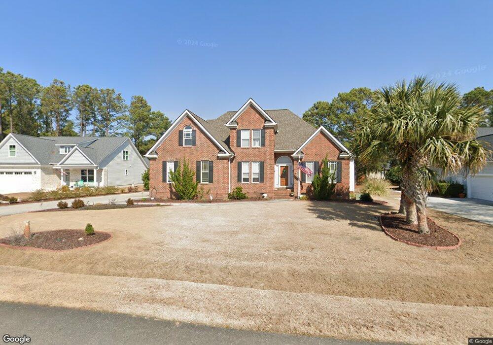
212 Port Side Dr Sneads Ferry, NC 28460
Estimated Value: $464,000 - $568,000
4
Beds
3
Baths
2,242
Sq Ft
$227/Sq Ft
Est. Value
About This Home
This home is located at 212 Port Side Dr, Sneads Ferry, NC 28460 and is currently estimated at $508,491, approximately $226 per square foot. 212 Port Side Dr is a home located in Onslow County with nearby schools including Dixon Elementary School, Coastal Elementary, and Dixon High School.
Ownership History
Date
Name
Owned For
Owner Type
Purchase Details
Closed on
Jun 21, 2011
Sold by
Castora Stephen L and Castora Taira
Bought by
Greider Theodore H and Greider Kathleen M
Current Estimated Value
Home Financials for this Owner
Home Financials are based on the most recent Mortgage that was taken out on this home.
Original Mortgage
$273,500
Interest Rate
4.65%
Mortgage Type
New Conventional
Purchase Details
Closed on
Apr 15, 2005
Sold by
Stancil Builders Inc
Bought by
Castora Stephen L and Castora Taira
Home Financials for this Owner
Home Financials are based on the most recent Mortgage that was taken out on this home.
Original Mortgage
$341,000
Interest Rate
5.98%
Mortgage Type
New Conventional
Create a Home Valuation Report for This Property
The Home Valuation Report is an in-depth analysis detailing your home's value as well as a comparison with similar homes in the area
Home Values in the Area
Average Home Value in this Area
Purchase History
| Date | Buyer | Sale Price | Title Company |
|---|---|---|---|
| Greider Theodore H | $363,500 | None Available | |
| Castora Stephen L | $360,000 | None Available |
Source: Public Records
Mortgage History
| Date | Status | Borrower | Loan Amount |
|---|---|---|---|
| Open | Greider Theodore H | $259,893 | |
| Closed | Greider Theodore H | $287,907 | |
| Closed | Greider Theodore H | $298,788 | |
| Closed | Greider Theodore H | $273,500 | |
| Previous Owner | Castora Stephen L | $48,000 | |
| Previous Owner | Castora Stephen L | $36,000 | |
| Previous Owner | Castora Stephen L | $341,000 |
Source: Public Records
Tax History Compared to Growth
Tax History
| Year | Tax Paid | Tax Assessment Tax Assessment Total Assessment is a certain percentage of the fair market value that is determined by local assessors to be the total taxable value of land and additions on the property. | Land | Improvement |
|---|---|---|---|---|
| 2025 | $2,354 | $359,439 | $42,500 | $316,939 |
| 2024 | $2,354 | $359,439 | $42,500 | $316,939 |
| 2023 | $2,354 | $359,439 | $42,500 | $316,939 |
| 2022 | $2,354 | $359,439 | $42,500 | $316,939 |
| 2021 | $1,793 | $254,350 | $38,000 | $216,350 |
| 2020 | $1,793 | $254,350 | $38,000 | $216,350 |
| 2019 | $1,793 | $254,350 | $38,000 | $216,350 |
| 2018 | $1,793 | $254,350 | $38,000 | $216,350 |
| 2017 | $1,802 | $266,940 | $55,000 | $211,940 |
| 2016 | $1,802 | $266,940 | $0 | $0 |
| 2015 | $1,999 | $296,140 | $0 | $0 |
| 2014 | $1,802 | $266,940 | $0 | $0 |
Source: Public Records
Map
Nearby Homes
- 107 Sea Turtle Cove
- L6 N Carolina 210
- Pt L6 N Carolina 210
- 1008 Mill Run Rd
- 104 Rollingwood Cir
- 108 Rollingwood Cir
- L7 State Highway 210
- 113 Windy Point
- 102 Pirates Cove
- 300 Sea Urchin Cove
- 315 Seascape Dr
- 281 Mimosa Dr
- 161 Marina Wynd Way
- 262 Cuddy Ct
- 110 Sea Level Ln
- 186 Snow Goose Ln
- 402 Canvasback Ln
- 917 Old Folkstone Rd
- 408 Canvasback Ln
- 901 Nubble Ct
- 210 Port Side Dr
- 214 Port Side Dr Unit Drive
- 214 Port Side Dr
- 511 N Shore Dr
- 513 Shore Dr
- 513 N Shore Dr
- 208 Port Side Dr
- 509 Shore Dr
- 213 Port Side Dr
- 509 N Shore Dr
- 216 Port Side Dr
- 515 N Shore Dr
- 218 Port Side Dr
- 215 Port Side Dr
- 211 Port Side Dr
- 206 Port Side Dr
- 507 N Shore Dr
- 217 Port Side Dr
- 209 Port Side Dr
- 517 N Shore Dr