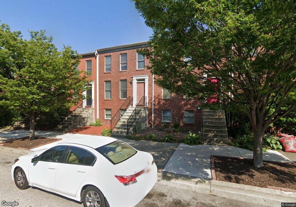
212 Presstman St Baltimore, MD 21217
Bolton Hill NeighborhoodEstimated Value: $272,366 - $320,000
--
Bed
3
Baths
1,240
Sq Ft
$239/Sq Ft
Est. Value
About This Home
This home is located at 212 Presstman St, Baltimore, MD 21217 and is currently estimated at $296,183, approximately $238 per square foot. 212 Presstman St is a home located in Baltimore City with nearby schools including Mount Royal Elementary/Middle School, Booker T. Washington Middle School, and Frederick Douglass High School.
Ownership History
Date
Name
Owned For
Owner Type
Purchase Details
Closed on
Apr 26, 2007
Sold by
Arvin Tracey
Bought by
Barbour Tracey
Current Estimated Value
Home Financials for this Owner
Home Financials are based on the most recent Mortgage that was taken out on this home.
Original Mortgage
$233,000
Outstanding Balance
$142,653
Interest Rate
6.29%
Mortgage Type
New Conventional
Estimated Equity
$153,530
Purchase Details
Closed on
Jun 16, 2005
Sold by
Secretary Of Housing & Urban
Bought by
Arvin Tracey
Purchase Details
Closed on
Nov 30, 2004
Sold by
Forney Robert
Bought by
Secretary Of Housing & Urban and Development
Purchase Details
Closed on
Apr 30, 2001
Sold by
Spicer'S Run Llc
Bought by
Forney Robert
Create a Home Valuation Report for This Property
The Home Valuation Report is an in-depth analysis detailing your home's value as well as a comparison with similar homes in the area
Home Values in the Area
Average Home Value in this Area
Purchase History
| Date | Buyer | Sale Price | Title Company |
|---|---|---|---|
| Barbour Tracey | -- | -- | |
| Arvin Tracey | $200,000 | -- | |
| Secretary Of Housing & Urban | $147,000 | -- | |
| Forney Robert | $128,862 | -- |
Source: Public Records
Mortgage History
| Date | Status | Borrower | Loan Amount |
|---|---|---|---|
| Open | Barbour Tracey | $233,000 |
Source: Public Records
Tax History Compared to Growth
Tax History
| Year | Tax Paid | Tax Assessment Tax Assessment Total Assessment is a certain percentage of the fair market value that is determined by local assessors to be the total taxable value of land and additions on the property. | Land | Improvement |
|---|---|---|---|---|
| 2025 | $4,958 | $254,200 | $50,000 | $204,200 |
| 2024 | $4,958 | $242,667 | $0 | $0 |
| 2023 | $4,728 | $231,133 | $0 | $0 |
| 2022 | $4,621 | $219,600 | $50,000 | $169,600 |
| 2021 | $4,962 | $210,267 | $0 | $0 |
| 2020 | $4,225 | $200,933 | $0 | $0 |
| 2019 | $4,100 | $191,600 | $50,000 | $141,600 |
| 2018 | $4,168 | $191,600 | $50,000 | $141,600 |
| 2017 | $4,213 | $191,600 | $0 | $0 |
| 2016 | $4,854 | $193,900 | $0 | $0 |
| 2015 | $4,854 | $193,900 | $0 | $0 |
| 2014 | $4,854 | $193,900 | $0 | $0 |
Source: Public Records
Map
Nearby Homes
- 339 Bloom St
- 835 Lennox St
- 819 Lennox St
- 817 Lennox St
- 2024 Bolton St
- 2028 Bolton St
- 2050 Linden Ave Unit B
- 2034 Bolton St
- 1906 Madison Ave
- 2023 Bolton St
- 1917 Mcculloh St
- 742 Watts St
- 740 Watts St
- 1726 Linden Ave
- 2103 Mcculloh St
- 2115 Mcculloh St
- 2203 Linden Ave
- 1908 Mcculloh St
- 739 Lennox St
- 716 Watts St
- 214 Presstman St
- 210 Presstman St
- 216 Presstman St
- 208 Presstman St
- 206 Presstman St
- 204 Presstman St
- 202 Presstman St
- 1941 Eutaw Place
- 1943 Eutaw Place
- 1939 Eutaw Place
- 1937 Eutaw Place
- 1945 Eutaw Place
- 200 Presstman St
- 1947 Eutaw Place
- 213 Presstman St
- 1920 Linden Ave
- 211 Presstman St
- 215 Presstman St
- 1949 Eutaw Place
- 1935 Eutaw Place