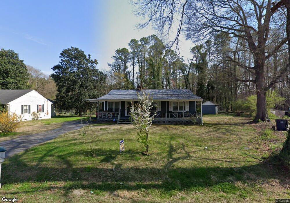
212 S Circle Dr La Fayette, GA 30728
Estimated Value: $143,603 - $206,000
--
Bed
1
Bath
1,092
Sq Ft
$167/Sq Ft
Est. Value
About This Home
This home is located at 212 S Circle Dr, La Fayette, GA 30728 and is currently estimated at $182,651, approximately $167 per square foot. 212 S Circle Dr is a home located in Walker County with nearby schools including North Lafayette Elementary School, Lafayette Middle School, and Lafayette High School.
Ownership History
Date
Name
Owned For
Owner Type
Purchase Details
Closed on
Feb 25, 1992
Sold by
Jackson Walter Lee
Bought by
Forrest Donna J
Current Estimated Value
Purchase Details
Closed on
Jul 26, 1991
Sold by
Scarbrough Thomas P and Scarbrough Kimbra
Bought by
Jackson Walter Lee
Purchase Details
Closed on
May 25, 1990
Sold by
Parish Bea
Bought by
Scarbrough Thomas P and Scarbrough Kimbra
Purchase Details
Closed on
Jan 30, 1989
Sold by
Conaway Larry S
Bought by
Parish Bea
Purchase Details
Closed on
Sep 29, 1988
Sold by
Jackson W L
Bought by
Conaway Larry S
Purchase Details
Closed on
Jan 1, 1972
Bought by
Jackson W L
Create a Home Valuation Report for This Property
The Home Valuation Report is an in-depth analysis detailing your home's value as well as a comparison with similar homes in the area
Home Values in the Area
Average Home Value in this Area
Purchase History
| Date | Buyer | Sale Price | Title Company |
|---|---|---|---|
| Forrest Donna J | $43,500 | -- | |
| Jackson Walter Lee | -- | -- | |
| Scarbrough Thomas P | -- | -- | |
| Parish Bea | $43,500 | -- | |
| Conaway Larry S | $43,500 | -- | |
| Jackson W L | -- | -- |
Source: Public Records
Tax History Compared to Growth
Tax History
| Year | Tax Paid | Tax Assessment Tax Assessment Total Assessment is a certain percentage of the fair market value that is determined by local assessors to be the total taxable value of land and additions on the property. | Land | Improvement |
|---|---|---|---|---|
| 2024 | $200 | $65,861 | $4,800 | $61,061 |
| 2023 | $171 | $62,803 | $4,800 | $58,003 |
| 2022 | $1 | $54,739 | $4,800 | $49,939 |
| 2021 | $1 | $29,948 | $4,800 | $25,148 |
| 2020 | $1 | $25,532 | $4,800 | $20,732 |
| 2019 | $1 | $25,532 | $4,800 | $20,732 |
| 2018 | $760 | $25,532 | $4,800 | $20,732 |
| 2017 | $90 | $25,532 | $4,800 | $20,732 |
| 2016 | $494 | $25,532 | $4,800 | $20,732 |
| 2015 | $633 | $29,521 | $4,800 | $24,721 |
| 2014 | $597 | $29,267 | $4,800 | $24,467 |
| 2013 | -- | $29,267 | $4,800 | $24,467 |
Source: Public Records
Map
Nearby Homes
- 214 East Ave
- 806 N Main St
- 114 Mallard Ln
- 111 Dove Dr
- 1001 N Main St
- 7552 Us Highway 27
- 107 Dogwood Cir
- 0 Center St Unit 15 11492953
- 0 Center St Unit 16 11493665
- 0 Center St Unit 1517720
- 307 Park St
- 302 Brookwood Ln
- 15.56 ACRES Round Pond Rd
- 0 Probasco St N Unit 1503555
- 1112 Probasco St N
- 105 Stanfield Rd
- 1129 Probasco St N
- 1403 N Main St
- 79 Hobart Ln
- 13 Steele St N
- 214 S Circle Dr
- 210 S Circle Dr
- S S Circle Dr
- 205 S Circle Dr
- 216 S Circle Dr
- 208 S Circle Dr
- 207 S Circle Dr
- 203 S Circle Dr
- 209 S Circle Dr
- 206 S Circle Dr
- 204 S Circle Dr
- 218 S Circle Dr
- 201 S Circle Dr
- 211 S Circle Dr
- 210 East Ave
- 00 E 136th Hwy
- 202 S Circle Dr
- 212 East Ave
- 704 N Duke St
- 706 N Duke St