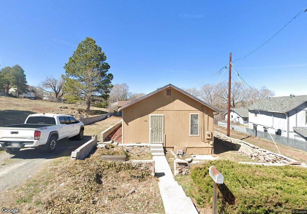
212 S Lewis St Williams, AZ 86046
Estimated Value: $293,000 - $370,000
--
Bed
--
Bath
900
Sq Ft
$354/Sq Ft
Est. Value
About This Home
This home is located at 212 S Lewis St, Williams, AZ 86046 and is currently estimated at $318,507, approximately $353 per square foot. 212 S Lewis St is a home located in Coconino County with nearby schools including Williams Elementary/Middle School, Williams High School, and Heritage Elementary - Williams.
Ownership History
Date
Name
Owned For
Owner Type
Purchase Details
Closed on
Dec 5, 2019
Sold by
Malone Estelene and Estelene Malone Living Trust
Bought by
Zabala Robin
Current Estimated Value
Purchase Details
Closed on
Dec 7, 2015
Sold by
Malone Estelene and Malone Shelley L
Bought by
Malone Estelene
Purchase Details
Closed on
Sep 18, 2008
Sold by
Malone Alvin E and Malone Estelene
Bought by
Malone Estelene and Malone Shelley L
Purchase Details
Closed on
Feb 16, 1994
Sold by
Seel James F and Seel Eloise M
Bought by
Malone Alvin E and Malone Estelene
Create a Home Valuation Report for This Property
The Home Valuation Report is an in-depth analysis detailing your home's value as well as a comparison with similar homes in the area
Home Values in the Area
Average Home Value in this Area
Purchase History
| Date | Buyer | Sale Price | Title Company |
|---|---|---|---|
| Zabala Robin | $75,000 | None Available | |
| Malone Estelene | -- | None Available | |
| Malone Estelene | -- | None Available | |
| Malone Alvin E | $30,000 | -- |
Source: Public Records
Tax History Compared to Growth
Tax History
| Year | Tax Paid | Tax Assessment Tax Assessment Total Assessment is a certain percentage of the fair market value that is determined by local assessors to be the total taxable value of land and additions on the property. | Land | Improvement |
|---|---|---|---|---|
| 2025 | $618 | $22,410 | -- | -- |
| 2024 | $618 | $21,521 | -- | -- |
| 2023 | $598 | $15,931 | $0 | $0 |
| 2022 | $563 | $13,793 | $0 | $0 |
| 2021 | $549 | $12,540 | $0 | $0 |
| 2020 | $536 | $11,196 | $0 | $0 |
| 2019 | $520 | $9,364 | $0 | $0 |
| 2018 | $499 | $7,713 | $0 | $0 |
| 2017 | $493 | $6,311 | $0 | $0 |
| 2016 | $486 | $6,287 | $0 | $0 |
| 2015 | $498 | $6,301 | $0 | $0 |
Source: Public Records
Map
Nearby Homes
- 201 S Slagel St
- 344 E Route 66
- 1012 Foothill Rd
- 500 Grand Canyon Ave
- 106 W Sherman Ave
- 412 S 1st St
- 410 N Locust St Unit 18
- 304 S 4th St
- 500 W Meade Ave
- 733 S 3rd St
- 00 W Fulton Ave
- 411 S 6th St
- 725 N Humbolt St
- 215 W Hancock Ave
- 530 W Mcpherson Ave
- 407 S 7th St
- 701 N Airport Rd
- 1028 W Rogers Ave
- 911 W Oak St
- 1011 W Sheridan Ave
- 226 E Sherman Ave
- 208 S Lewis St
- 211 S Slagel St
- 211 S Slagel St
- 202 S Lewis St
- 223 S Slagel St
- 209 S Slagel St
- 207 S Lewis St
- 221 S Lewis St
- 221 S Lewis St
- 225 S Lewis St
- 203 S Lewis St
- 135 S Slagel St
- 0 S Slagel St
- 310 E Sherman Ave
- 127 S Slagel St
- 201 S Lewis St
- 301 S Slagel St
- 305 S Lewis St
- 242 E Grant Ave