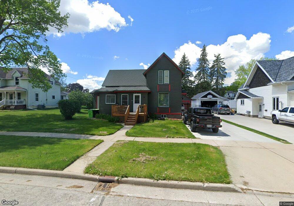
212 S State St Waupun, WI 53963
Estimated Value: $155,357 - $231,000
4
Beds
2
Baths
1,216
Sq Ft
$151/Sq Ft
Est. Value
About This Home
This home is located at 212 S State St, Waupun, WI 53963 and is currently estimated at $183,339, approximately $150 per square foot. 212 S State St is a home located in Dodge County with nearby schools including Meadow View Primary School, Rock River Intermediate School, and Waupun Area Junior High School.
Ownership History
Date
Name
Owned For
Owner Type
Purchase Details
Closed on
Jul 1, 2025
Sold by
Perrot Donald A and Perrot Dolores A
Bought by
Perrot Whisper A
Current Estimated Value
Purchase Details
Closed on
May 31, 2022
Sold by
Kimes Margaret G
Bought by
Perrot Donald A and Perrot Dolores A
Purchase Details
Closed on
Jan 30, 2015
Sold by
Kimes Margaret G
Bought by
Perrot Donald A and Perrot Dolores A
Purchase Details
Closed on
Nov 18, 2011
Sold by
Hunter Kenneth G and Hunter Cindy
Bought by
Kimes Margaret G
Create a Home Valuation Report for This Property
The Home Valuation Report is an in-depth analysis detailing your home's value as well as a comparison with similar homes in the area
Home Values in the Area
Average Home Value in this Area
Purchase History
| Date | Buyer | Sale Price | Title Company |
|---|---|---|---|
| Perrot Whisper A | -- | None Listed On Document | |
| Perrot Donald A | $51,000 | Qbs Law Sc | |
| Perrot Donald A | $39,000 | None Available | |
| Kimes Margaret G | $64,000 | None Available |
Source: Public Records
Tax History Compared to Growth
Tax History
| Year | Tax Paid | Tax Assessment Tax Assessment Total Assessment is a certain percentage of the fair market value that is determined by local assessors to be the total taxable value of land and additions on the property. | Land | Improvement |
|---|---|---|---|---|
| 2024 | $1,489 | $98,200 | $26,500 | $71,700 |
| 2023 | $1,376 | $98,200 | $26,500 | $71,700 |
| 2022 | $1,359 | $98,200 | $26,500 | $71,700 |
| 2021 | $1,335 | $74,600 | $22,000 | $52,600 |
| 2020 | $1,425 | $74,600 | $22,000 | $52,600 |
| 2019 | $1,347 | $74,600 | $22,000 | $52,600 |
| 2018 | $1,370 | $74,600 | $22,000 | $52,600 |
| 2017 | $1,211 | $62,100 | $19,400 | $42,700 |
| 2016 | $1,139 | $62,100 | $19,400 | $42,700 |
Source: Public Records
Map
Nearby Homes
- 231 Hillyer St
- 25 W Franklin St
- 10 S Forest St
- 517 W Jefferson St
- 504 Maxon St
- 315 E Main St
- 327 Carrington St
- 516 E Lincoln St
- 17.92 Ac Pattee Dr
- 811 W Jefferson St
- 134 N Watertown St
- 516 Doty St
- 806 Rock River Ave
- 231 Woodland Dr
- 736 Fern St
- 295 Harmsen Ave
- 18 Pluim Dr Unit 16
- 18 Pluim Dr Unit 13
- 380 Fond du Lac St
- W12681 County As
- 212 S State St
- 210 S State St
- 214 S State St
- 206 S State St
- 216 S State St
- 107 W Brown St
- 218 S State St
- 115 W Brown St
- 307 S Division St
- 101 W Brown St
- 303 S Division St
- 301 S Division St
- 211 S State St
- 213 S State St
- 207 S State St
- 205 S State St
- 222 S State St
- 217 S State St
- 123 W Brown St
- 23 W Brown St