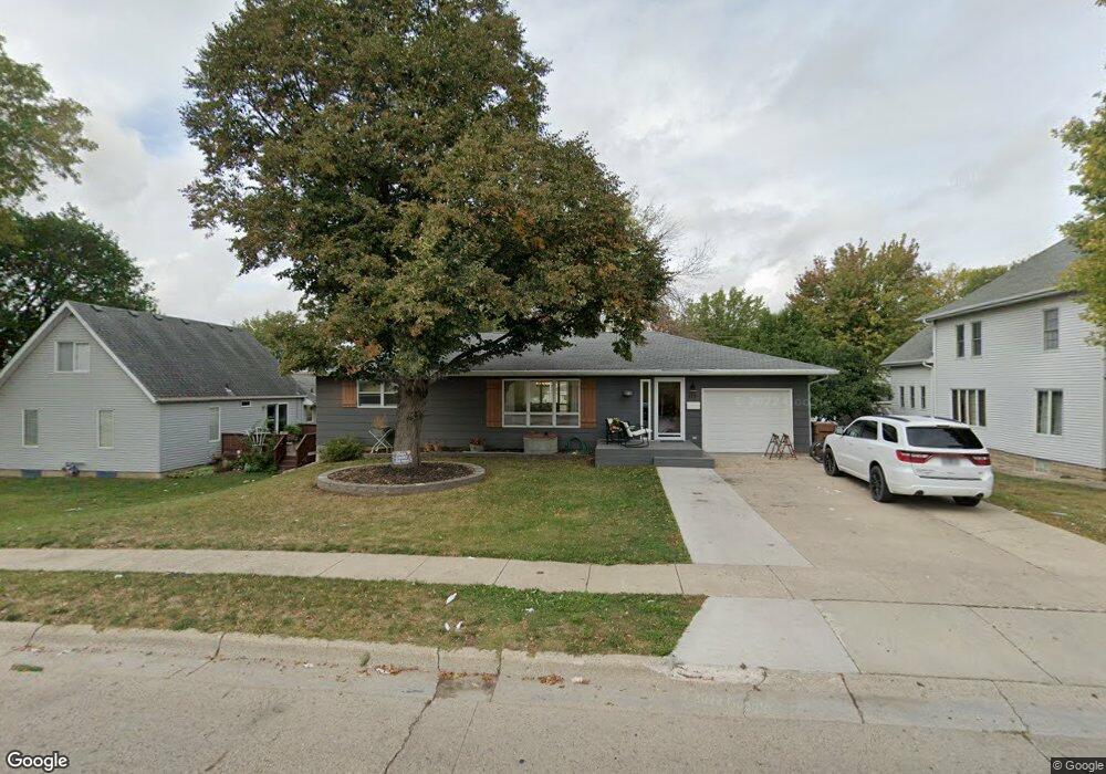
212 S Walnut St Carroll, IA 51401
Estimated Value: $198,493 - $227,000
2
Beds
2
Baths
1,290
Sq Ft
$167/Sq Ft
Est. Value
About This Home
This home is located at 212 S Walnut St, Carroll, IA 51401 and is currently estimated at $215,373, approximately $166 per square foot. 212 S Walnut St is a home with nearby schools including Fairview Elementary School, Adams Elementary School, and Carroll Middle School.
Ownership History
Date
Name
Owned For
Owner Type
Purchase Details
Closed on
Sep 26, 2024
Sold by
Ramaekers Mallory and Patterson Mallory
Bought by
Lml Trust and Lyons
Current Estimated Value
Purchase Details
Closed on
Aug 27, 2020
Sold by
Ramaekers Andrew J and Ramaekers Amy S
Bought by
Ramaekers Mallory
Purchase Details
Closed on
Aug 15, 2016
Sold by
Snyder Mary C
Bought by
Ramaekers Andrew J and Ramaekers Amy S
Home Financials for this Owner
Home Financials are based on the most recent Mortgage that was taken out on this home.
Original Mortgage
$250,000
Interest Rate
3.42%
Mortgage Type
Future Advance Clause Open End Mortgage
Create a Home Valuation Report for This Property
The Home Valuation Report is an in-depth analysis detailing your home's value as well as a comparison with similar homes in the area
Home Values in the Area
Average Home Value in this Area
Purchase History
| Date | Buyer | Sale Price | Title Company |
|---|---|---|---|
| Lml Trust | $232,000 | None Listed On Document | |
| Ramaekers Mallory | -- | Security Title | |
| Ramaekers Andrew J | $115,000 | None Available |
Source: Public Records
Mortgage History
| Date | Status | Borrower | Loan Amount |
|---|---|---|---|
| Previous Owner | Ramaekers Andrew J | $250,000 |
Source: Public Records
Tax History
| Year | Tax Paid | Tax Assessment Tax Assessment Total Assessment is a certain percentage of the fair market value that is determined by local assessors to be the total taxable value of land and additions on the property. | Land | Improvement |
|---|---|---|---|---|
| 2025 | $1,904 | $224,380 | $20,000 | $204,380 |
| 2024 | $19 | $145,260 | $20,000 | $125,260 |
| 2023 | $2,037 | $145,260 | $20,000 | $125,260 |
| 2022 | $1,930 | $133,170 | $20,000 | $113,170 |
| 2021 | $1,930 | $133,170 | $20,000 | $113,170 |
| 2020 | $1,973 | $133,170 | $20,000 | $113,170 |
| 2019 | $2,036 | $133,170 | $20,000 | $113,170 |
| 2018 | $1,918 | $133,170 | $20,000 | $113,170 |
| 2017 | $1,918 | $133,911 | $17,837 | $116,074 |
| 2016 | $1,666 | $125,150 | $0 | $0 |
| 2015 | $1,666 | $119,420 | $0 | $0 |
| 2014 | $1,566 | $119,420 | $0 | $0 |
Source: Public Records
Map
Nearby Homes
- 409 E Valley Dr
- 519-21 S Clark St
- 207 Ridgewood Dr
- 317 Arthur Neu Dr
- 222 W 2nd St
- Deer Creek Ln Lot 36
- 411 W 2nd St
- 326 N West St
- 479 Deer Creek Ln
- 804 N Clark St
- 19383 U S 30
- 827 N Clark St
- 332 N Crawford St
- 629 Meadow Ln
- 827 N Main St
- 110 E 10th St
- 451 Deer Creek Ln
- 0 Deer Creek Ln Unit 6302348
- 415 W Pleasant Ridge Rd
- 0 Monterey Dr Unit 6307161
- 527 E Anthony St
- 206 S Walnut St
- 520 Bluff St E
- 521 E Anthony St
- 205 S Walnut St
- 306 S Walnut St
- 511 E Anthony St
- 527 Bluff St E
- 519 Bluff St E
- 303 S Maple St
- 303 S Walnut St
- 310 S Walnut St
- 215 S Maple St
- 225 S Maple St
- 209 S Maple St
- 201 S Walnut St
- 510 Bluff St E
- 309 S Walnut St
- 309 S Maple St
- 203 S Maple St
Your Personal Tour Guide
Ask me questions while you tour the home.