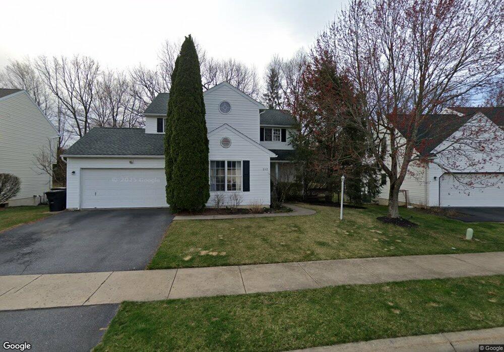
212 Thorndale Rd Port Matilda, PA 16870
Patton NeighborhoodEstimated Value: $394,000 - $525,000
3
Beds
3
Baths
2,213
Sq Ft
$199/Sq Ft
Est. Value
About This Home
This home is located at 212 Thorndale Rd, Port Matilda, PA 16870 and is currently estimated at $439,817, approximately $198 per square foot. 212 Thorndale Rd is a home located in Centre County with nearby schools including Gray's Woods Elementary School, Park Forest Middle School, and State College Area High School.
Ownership History
Date
Name
Owned For
Owner Type
Purchase Details
Closed on
Jan 18, 2011
Sold by
Scholton Todd Alan and Scholton Sondra Joan
Bought by
Ross Charles H and Ross Julia
Current Estimated Value
Home Financials for this Owner
Home Financials are based on the most recent Mortgage that was taken out on this home.
Original Mortgage
$264,130
Outstanding Balance
$174,296
Interest Rate
4.12%
Mortgage Type
FHA
Estimated Equity
$265,521
Purchase Details
Closed on
Mar 25, 1996
Bought by
Scholton Todd Alan and Sondra Joan
Create a Home Valuation Report for This Property
The Home Valuation Report is an in-depth analysis detailing your home's value as well as a comparison with similar homes in the area
Home Values in the Area
Average Home Value in this Area
Purchase History
| Date | Buyer | Sale Price | Title Company |
|---|---|---|---|
| Ross Charles H | $271,000 | None Available | |
| Scholton Todd Alan | $27,500 | -- |
Source: Public Records
Mortgage History
| Date | Status | Borrower | Loan Amount |
|---|---|---|---|
| Open | Ross Charles H | $264,130 |
Source: Public Records
Tax History Compared to Growth
Tax History
| Year | Tax Paid | Tax Assessment Tax Assessment Total Assessment is a certain percentage of the fair market value that is determined by local assessors to be the total taxable value of land and additions on the property. | Land | Improvement |
|---|---|---|---|---|
| 2025 | $4,789 | $68,740 | $12,460 | $56,280 |
| 2024 | $4,467 | $68,740 | $12,460 | $56,280 |
| 2023 | $4,467 | $68,740 | $12,460 | $56,280 |
| 2022 | $4,360 | $68,740 | $12,460 | $56,280 |
| 2021 | $4,360 | $68,740 | $12,460 | $56,280 |
| 2020 | $4,360 | $68,740 | $12,460 | $56,280 |
| 2019 | $3,059 | $68,740 | $12,460 | $56,280 |
| 2018 | $4,227 | $68,740 | $12,460 | $56,280 |
| 2017 | $4,180 | $68,740 | $12,460 | $56,280 |
| 2016 | -- | $68,740 | $12,460 | $56,280 |
| 2015 | -- | $68,740 | $12,460 | $56,280 |
| 2014 | -- | $68,740 | $12,460 | $56,280 |
Source: Public Records
Map
Nearby Homes
- 140 Pinewood Place
- 95 Greenmeadow Ln
- 2565 Carnegie Dr
- 107 Wildernest Ln
- 111 Wildernest Ln
- 144 Kenley Ct Unit 144
- 112 Montauk Cir
- 111 Harvard Rd
- 113 Manhasset Dr
- 112 Harvard Rd
- 190 Michael Rd
- Brandywine Plan at Grays Pointe - Single Family Homes
- Dartmouth Plan at Grays Pointe - Single Family Homes
- Crestmont Plan at Grays Pointe - Single Family Homes
- Charlotte Plan at Grays Pointe - Single Family Homes
- Elmcrest Plan at Grays Pointe - Single Family Homes
- Bayberry Plan at Grays Pointe - Single Family Homes
- Aspen Plan at Grays Pointe - Single Family Homes
- Fairmont Plan at Grays Pointe - Single Family Homes
- Monroe Plan at Grays Pointe - Single Family Homes
- 216 Thorndale Rd
- 208 Thorndale Rd
- 300 Thorndale Rd
- 204 Thorndale Rd
- 116 Whitepine Place
- 304 Thorndale Rd
- 200 Thorndale Rd
- 471 Scotia Rd
- 113 Whitepine Place
- 455 Scotia Rd
- 113 Cherrywood Rd
- 112 Whitepine Place
- 483 Scotia Rd
- 308 Thorndale Rd
- 116 Thorndale Rd
- 109 Whitepine Place
- 305 Thorndale Rd
- 108 Whitepine Place
- 109 Cherrywood Rd
- 312 Thorndale Rd