Estimated Value: $312,000 - $452,173
5
Beds
4
Baths
4,850
Sq Ft
$81/Sq Ft
Est. Value
About This Home
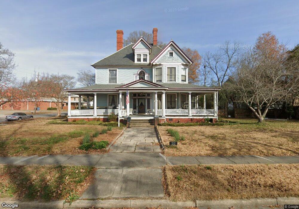
This home is located at 212 W Anderson St, Selma, NC 27576 and is currently estimated at $391,293, approximately $80 per square foot. 212 W Anderson St is a home located in Johnston County with nearby schools including Selma Elementary School, Selma Middle School, and Smithfield-Selma High School.
Ownership History
Date
Name
Owned For
Owner Type
Purchase Details
Closed on
Jul 26, 2005
Sold by
Larson Curtis and Larson Scarlett
Bought by
Petersen Mark A and Petersen Barbara Jane
Current Estimated Value
Home Financials for this Owner
Home Financials are based on the most recent Mortgage that was taken out on this home.
Original Mortgage
$217,100
Outstanding Balance
$113,752
Interest Rate
5.62%
Mortgage Type
Assumption
Estimated Equity
$277,541
Create a Home Valuation Report for This Property
The Home Valuation Report is an in-depth analysis detailing your home's value as well as a comparison with similar homes in the area
Home Values in the Area
Average Home Value in this Area
Purchase History
| Date | Buyer | Sale Price | Title Company |
|---|---|---|---|
| Petersen Mark A | $289,500 | None Available |
Source: Public Records
Mortgage History
| Date | Status | Borrower | Loan Amount |
|---|---|---|---|
| Open | Petersen Mark A | $217,100 |
Source: Public Records
Tax History Compared to Growth
Tax History
| Year | Tax Paid | Tax Assessment Tax Assessment Total Assessment is a certain percentage of the fair market value that is determined by local assessors to be the total taxable value of land and additions on the property. | Land | Improvement |
|---|---|---|---|---|
| 2025 | $3,993 | $356,520 | $87,500 | $269,020 |
| 2024 | $3,441 | $270,950 | $43,750 | $227,200 |
| 2023 | $3,495 | $270,950 | $43,750 | $227,200 |
| 2022 | $3,604 | $270,950 | $43,750 | $227,200 |
| 2021 | $3,549 | $270,950 | $43,750 | $227,200 |
| 2020 | $3,604 | $270,950 | $43,750 | $227,200 |
| 2019 | $3,522 | $270,950 | $43,750 | $227,200 |
| 2018 | $3,079 | $233,230 | $33,540 | $199,690 |
| 2017 | $3,009 | $233,230 | $33,540 | $199,690 |
| 2016 | $3,009 | $233,230 | $33,540 | $199,690 |
| 2015 | $3,009 | $233,230 | $33,540 | $199,690 |
| 2014 | $3,009 | $233,230 | $33,540 | $199,690 |
Source: Public Records
Map
Nearby Homes
- 5437 N Carolina 39 Hwy
- 63 W Victoria Ridge Dr
- 63 W Victoria Ridge Dr Unit 31
- 0 Atkinson Mill Rd Unit 10022797
- 201 Noramac Ct
- 183 Noramac Ct
- 405 N Massey St
- 104 N Green St
- 601 W Anderson St
- 305 W Waddell St
- 412 N Green St
- 112 N Sellers St
- 303 Godwin St
- 206 S Ethel St
- 901 W Anderson St
- 903 W Anderson St Unit 1/2
- 509 E Elizabeth St
- 23 W Victoria Ridge Dr Unit 33
- 1003 W Anderson St
- 62 W Victoria Ridge Dr W
- 112 N Massey St
- 112 N Massey St
- 112 S Massey St
- 207 W Waddell St
- 0 Atkinson Mill Rd Unit 2521342
- 0 Atkinson Mill Rd Unit 2481413
- 0 Atkinson Mill Rd Unit 2441897
- 0 Atkinson Mill Rd
- 103 S Massey St
- ooooo U S 301
- 1 N Carolina 39
- 102 S Massey St
- 0 U S 301 Unit 1809646
- 0 U S 301 Unit 1888005
- 0 U S 301 Unit 887848
- 0 N Carolina 39 Unit TR593684
- 0 U S 301 Unit 2427989
- 0 N Carolina 39 Unit 2424568
- 0 N Carolina 39 Unit 2363477
- 9959 N Carolina 96 Unit none