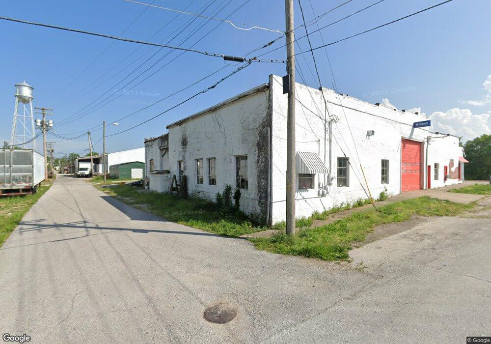
212 W Main St Ash Grove, MO 65604
--
Bed
2
Baths
6,642
Sq Ft
0.44
Acres
About This Home
This home is located at 212 W Main St, Ash Grove, MO 65604. 212 W Main St is a home located in Greene County with nearby schools including Bois D'Arc Elementary School and Ash Grove High School.
Ownership History
Date
Name
Owned For
Owner Type
Purchase Details
Closed on
Jan 15, 2022
Sold by
Dupre Greg
Bought by
Vert Brian and Vert Barbara
Home Financials for this Owner
Home Financials are based on the most recent Mortgage that was taken out on this home.
Original Mortgage
$16,000
Outstanding Balance
$14,746
Interest Rate
3.11%
Mortgage Type
Future Advance Clause Open End Mortgage
Purchase Details
Closed on
Jun 14, 2021
Sold by
Dupre Greg
Bought by
Vert Brian and Vert Barbara
Home Financials for this Owner
Home Financials are based on the most recent Mortgage that was taken out on this home.
Original Mortgage
$5,500
Interest Rate
2.96%
Mortgage Type
New Conventional
Purchase Details
Closed on
Jun 12, 2021
Sold by
Dupre Denise
Bought by
Vert Brian and Vert Barbara
Home Financials for this Owner
Home Financials are based on the most recent Mortgage that was taken out on this home.
Original Mortgage
$5,500
Interest Rate
2.96%
Mortgage Type
New Conventional
Create a Home Valuation Report for This Property
The Home Valuation Report is an in-depth analysis detailing your home's value as well as a comparison with similar homes in the area
Home Values in the Area
Average Home Value in this Area
Purchase History
| Date | Buyer | Sale Price | Title Company |
|---|---|---|---|
| Vert Brian | -- | Waco Title Co | |
| Vert Brian | -- | Waco Title Co | |
| Vert Brian | -- | Waco Title | |
| Vert Brian | -- | Waco Title Co | |
| Vert Brian | -- | Waco Title |
Source: Public Records
Mortgage History
| Date | Status | Borrower | Loan Amount |
|---|---|---|---|
| Open | Vert Brian | $16,000 | |
| Previous Owner | Vert Brian | $5,500 | |
| Previous Owner | Vert Brian | $70,000 | |
| Previous Owner | Vert Brian | $56,000 | |
| Previous Owner | Vert Brian | $5,500 |
Source: Public Records
Tax History Compared to Growth
Tax History
| Year | Tax Paid | Tax Assessment Tax Assessment Total Assessment is a certain percentage of the fair market value that is determined by local assessors to be the total taxable value of land and additions on the property. | Land | Improvement |
|---|---|---|---|---|
| 2025 | $2,130 | $32,480 | $7,140 | $25,340 |
| 2024 | $2,130 | $31,170 | $7,140 | $24,030 |
| 2023 | $2,000 | $31,170 | $7,140 | $24,030 |
| 2022 | $2,105 | $30,820 | $7,140 | $23,680 |
| 2021 | $1,982 | $30,820 | $7,140 | $23,680 |
| 2020 | $2,004 | $30,820 | $7,140 | $23,680 |
| 2019 | $1,998 | $30,820 | $7,140 | $23,680 |
| 2018 | $2,025 | $30,820 | $7,140 | $23,680 |
| 2017 | $2,009 | $30,630 | $7,140 | $23,490 |
| 2016 | $1,988 | $30,630 | $7,140 | $23,490 |
| 2015 | $1,983 | $30,630 | $7,140 | $23,490 |
| 2014 | $1,937 | $30,500 | $7,140 | $23,360 |
Source: Public Records
Map
Nearby Homes
- 203 E Prairie Ln
- 300 S High Ave
- 502 W Mill St
- 103 N Maple Ln
- 424 Coyote Pass
- 422 Coyote Pass
- 606 E Prairie Ln
- 711 W Woodbine Rd
- 407 N Crestview Ave
- 206 E Cawlfield St
- 000 State Highway V
- 134 Moonlight Valley Dr
- 415 S Piper Ave
- 806 E Grant St
- Tract Tbd W Farm Road 64
- 000 W Farm Road 64
- Tracts 2 & 3 Farm Rd 35 & 39
- Lot10 1193 Hunter Ln
- Lot11 1192 Hunter Ln
- 6896 N Farm Road 1
- 105 N Tower Ave
- 207 W Main St
- 343 W Main St
- 329 W Main St
- 106 N Exchange Ave
- 0 N Exchange Ave Unit 11313309
- Tbd N Exchange Ave
- 125 W Main St
- 201 N Tower St
- 125 W Main St
- 108 N Exchange Ave
- 118 W Main St
- 203 N Tower St
- 203 N Tower Ave
- 205 N Tower St
- 117 W Main St
- 111 W Main St
- 115 W Main St
- 207 N Tower Ave
- 202 N Tower St