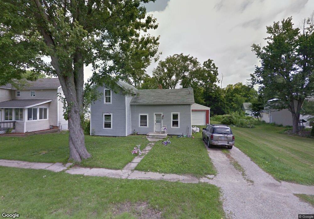
212 W Maple St Camden, MI 49232
Estimated Value: $91,314 - $168,000
--
Bed
1
Bath
1,132
Sq Ft
$126/Sq Ft
Est. Value
About This Home
This home is located at 212 W Maple St, Camden, MI 49232 and is currently estimated at $142,829, approximately $126 per square foot. 212 W Maple St is a home located in Hillsdale County with nearby schools including Camden-Frontier K-8 School, Camden-Frontier High School, and Ridgeview Camden School.
Ownership History
Date
Name
Owned For
Owner Type
Purchase Details
Closed on
Apr 2, 2014
Sold by
Lee Thomas H and Lee Heidi
Bought by
Wolff Kevin and Wolff Billie Jo
Current Estimated Value
Purchase Details
Closed on
Aug 5, 2011
Sold by
Lee Heidi
Bought by
Lee Thomas H and Lee Heidi
Purchase Details
Closed on
May 18, 2011
Sold by
Webster Benjamin and Webster Angela
Bought by
Lee Heidi and The Hedgecoke Family Trust
Purchase Details
Closed on
Aug 5, 1998
Sold by
Hedgecoke John N and Hedgecoke Helen D
Bought by
Hedgecoke Family Trust
Purchase Details
Closed on
Jul 19, 1996
Sold by
Webster Robert L and Webster Elizabeth F
Bought by
Hedgecoke John N and Hedgecoke Helen D
Create a Home Valuation Report for This Property
The Home Valuation Report is an in-depth analysis detailing your home's value as well as a comparison with similar homes in the area
Home Values in the Area
Average Home Value in this Area
Purchase History
| Date | Buyer | Sale Price | Title Company |
|---|---|---|---|
| Wolff Kevin | $9,000 | None Available | |
| Lee Thomas H | -- | None Available | |
| Lee Heidi | -- | None Available | |
| Hedgecoke Family Trust | $100 | -- | |
| Hedgecoke John N | $41,600 | -- |
Source: Public Records
Tax History Compared to Growth
Tax History
| Year | Tax Paid | Tax Assessment Tax Assessment Total Assessment is a certain percentage of the fair market value that is determined by local assessors to be the total taxable value of land and additions on the property. | Land | Improvement |
|---|---|---|---|---|
| 2025 | $660 | $37,200 | $0 | $0 |
| 2024 | $394 | $42,700 | $0 | $0 |
| 2023 | $378 | $39,000 | $0 | $0 |
| 2022 | $605 | $29,200 | $0 | $0 |
| 2021 | $586 | $27,000 | $0 | $0 |
| 2020 | $598 | $26,200 | $0 | $0 |
| 2019 | $581 | $25,200 | $0 | $0 |
| 2018 | $563 | $16,900 | $0 | $0 |
| 2017 | $697 | $18,230 | $0 | $0 |
| 2016 | $641 | $17,500 | $0 | $0 |
| 2015 | $192 | $17,500 | $0 | $0 |
| 2013 | $272 | $24,800 | $0 | $0 |
| 2012 | $269 | $24,540 | $0 | $0 |
Source: Public Records
Map
Nearby Homes
- 107 Mary St
- 9677 W Camden Rd
- 6524 W Montgomery Rd
- 115 N Michigan St
- 219 N Hayward St
- 0 W Territorial Rd Unit 25043960
- 0 W Territorial Rd Unit 11603977
- 0 Dimmers Rd
- 9949 Indian Trail
- 7944 Gilmore Rd
- 7841 Topinabee Dr
- 18405 County Road 2-50
- 5411 Lilac Rd
- 7950 E 400 N
- 5050 N 725 E
- V/L Delmar Rd
- 6430 E 784 N
- 0 W Silver St Unit 25044322
- 309 S Main St
- 108 Lynn St