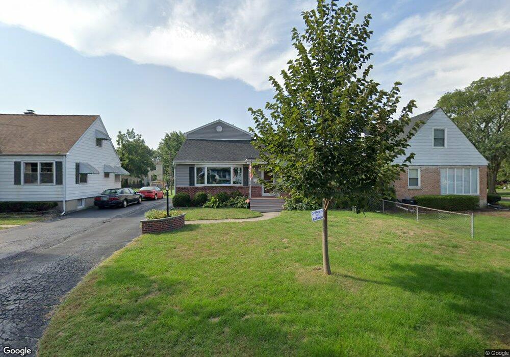
212 W Mckinley Ave Elmhurst, IL 60126
Estimated Value: $774,924 - $991,000
--
Bed
--
Bath
2,108
Sq Ft
$406/Sq Ft
Est. Value
About This Home
This home is located at 212 W Mckinley Ave, Elmhurst, IL 60126 and is currently estimated at $855,231, approximately $405 per square foot. 212 W Mckinley Ave is a home located in DuPage County with nearby schools including Pulaski Intl School of Chicago, Lincoln Elementary School, and Bryan Middle School.
Ownership History
Date
Name
Owned For
Owner Type
Purchase Details
Closed on
Nov 9, 2001
Sold by
Revocable Living Trust Of Glen E & Susan
Bought by
Peterson Karl A and Peterson Colleen N
Current Estimated Value
Home Financials for this Owner
Home Financials are based on the most recent Mortgage that was taken out on this home.
Original Mortgage
$267,000
Outstanding Balance
$104,049
Interest Rate
6.68%
Estimated Equity
$751,182
Create a Home Valuation Report for This Property
The Home Valuation Report is an in-depth analysis detailing your home's value as well as a comparison with similar homes in the area
Home Values in the Area
Average Home Value in this Area
Purchase History
| Date | Buyer | Sale Price | Title Company |
|---|---|---|---|
| Peterson Karl A | $335,000 | First American Title Ins |
Source: Public Records
Mortgage History
| Date | Status | Borrower | Loan Amount |
|---|---|---|---|
| Open | Peterson Karl A | $267,000 |
Source: Public Records
Tax History Compared to Growth
Tax History
| Year | Tax Paid | Tax Assessment Tax Assessment Total Assessment is a certain percentage of the fair market value that is determined by local assessors to be the total taxable value of land and additions on the property. | Land | Improvement |
|---|---|---|---|---|
| 2024 | $12,660 | $218,075 | $119,527 | $98,548 |
| 2023 | $11,757 | $201,660 | $110,530 | $91,130 |
| 2022 | $11,390 | $193,830 | $106,240 | $87,590 |
| 2021 | $11,109 | $189,010 | $103,600 | $85,410 |
| 2020 | $10,680 | $184,870 | $101,330 | $83,540 |
| 2019 | $10,457 | $175,770 | $96,340 | $79,430 |
| 2018 | $9,983 | $167,150 | $91,200 | $75,950 |
| 2017 | $9,766 | $159,280 | $86,910 | $72,370 |
| 2016 | $9,562 | $150,050 | $81,870 | $68,180 |
| 2015 | $9,469 | $139,790 | $76,270 | $63,520 |
| 2014 | $8,774 | $119,860 | $60,690 | $59,170 |
| 2013 | $8,679 | $121,540 | $61,540 | $60,000 |
Source: Public Records
Map
Nearby Homes
- 611 S Prospect Ave
- 680 S Bryan St
- 618 S Swain Ave
- 570 S Parkside Ave
- 634 S Spring Rd
- 762 S Saylor Ave
- 801 S Spring Rd
- 805 S Spring Rd
- 814 S Saylor Ave
- 694 S York St
- 28 Windsor Dr
- 663 S Hawthorne Ave
- 15 Manchester Ln
- 816 S Spring Rd
- 722 S Berkley Ave
- 740 S Berkley Ave
- 185 E Oneida Ave
- 500 S Kenilworth Ave
- 580 S Kearsage Ave
- 769 S Fairview Ave
- 208 W Mckinley Ave
- 677 S Mitchell Ave
- 660 S Prospect Ave
- 668 S Prospect Ave
- 219 W Mckinley Ave
- 689 S Mitchell Ave
- 676 S Mitchell Ave
- 672 S Mitchell Ave
- 668 S Mitchell Ave
- 678 S Mitchell Ave
- 680 S Mitchell Ave
- 676 S Prospect Ave
- 663 S Mitchell Ave
- 205 W Mckinley Ave
- 659 S Prospect Ave
- 663 S Prospect Ave
- 695 S Mitchell Ave
- 644 S Prospect Ave
- 643 S Prospect Ave
- 671 S Prospect Ave