Estimated Value: $87,000 - $188,000
--
Bed
--
Bath
2,770
Sq Ft
$53/Sq Ft
Est. Value
About This Home
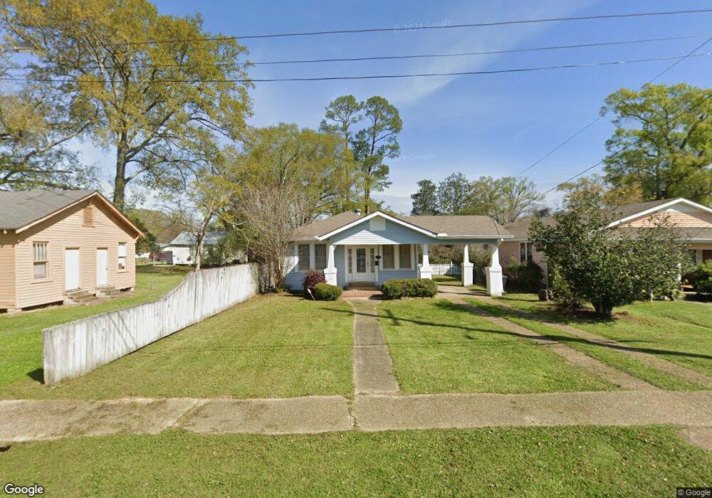
This home is located at 212 W Mulberry St, Amite, LA 70422 and is currently estimated at $146,667, approximately $52 per square foot. 212 W Mulberry St is a home located in Tangipahoa Parish with nearby schools including Amite Elementary Magnet School, Amite Westside Middle Magnet, and Amite High Magnet.
Ownership History
Date
Name
Owned For
Owner Type
Purchase Details
Closed on
Oct 9, 2018
Sold by
Covington Brent and Covington Dawn C
Bought by
Muse Antonio and Muse Robin
Current Estimated Value
Home Financials for this Owner
Home Financials are based on the most recent Mortgage that was taken out on this home.
Original Mortgage
$136,482
Outstanding Balance
$120,549
Interest Rate
5.12%
Mortgage Type
FHA
Estimated Equity
$26,118
Purchase Details
Closed on
Apr 22, 2010
Sold by
Campo Nancy Smith and Campo Mark
Bought by
Covington Brent
Home Financials for this Owner
Home Financials are based on the most recent Mortgage that was taken out on this home.
Original Mortgage
$98,188
Interest Rate
4.75%
Mortgage Type
FHA
Create a Home Valuation Report for This Property
The Home Valuation Report is an in-depth analysis detailing your home's value as well as a comparison with similar homes in the area
Home Values in the Area
Average Home Value in this Area
Purchase History
| Date | Buyer | Sale Price | Title Company |
|---|---|---|---|
| Muse Antonio | $13,900 | -- | |
| Covington Brent | $100,000 | None Available |
Source: Public Records
Mortgage History
| Date | Status | Borrower | Loan Amount |
|---|---|---|---|
| Open | Muse Antonio | $136,482 | |
| Previous Owner | Covington Brent | $98,188 |
Source: Public Records
Tax History Compared to Growth
Tax History
| Year | Tax Paid | Tax Assessment Tax Assessment Total Assessment is a certain percentage of the fair market value that is determined by local assessors to be the total taxable value of land and additions on the property. | Land | Improvement |
|---|---|---|---|---|
| 2024 | $795 | $9,396 | $1,080 | $8,316 |
| 2023 | $724 | $8,988 | $1,000 | $7,988 |
| 2022 | $724 | $8,988 | $1,000 | $7,988 |
| 2021 | $126 | $8,988 | $1,000 | $7,988 |
| 2020 | $768 | $8,988 | $1,000 | $7,988 |
| 2019 | $769 | $8,988 | $1,000 | $7,988 |
| 2018 | $771 | $8,988 | $1,000 | $7,988 |
| 2017 | $771 | $8,988 | $1,000 | $7,988 |
| 2016 | $771 | $8,988 | $1,000 | $7,988 |
| 2015 | $120 | $9,316 | $1,000 | $8,316 |
| 2014 | $119 | $9,316 | $1,000 | $8,316 |
Source: Public Records
Map
Nearby Homes
- 206 W Oak St
- 11128 Louisiana 16
- 0 Louisiana 16
- 0 Hwy 16 Unit LotWP001 24297163
- 0 Mixon Ln
- 404 W Oak (Hwy 16) St
- 106 E Chestnut St
- 308 N Laurel St
- 314 S Laurel St
- 203 S Bay St
- 0 U S Highway 51
- 02 Old Highway 51
- 01 Old Highway 51
- 704 N 1st St
- 405 Hickory St
- 0 W Oak St
- 716 S 1st St
- 212 Short St
- 210 W Factory St
- 105 W Factory St
- 210 W Mulberry St
- 208 W Mulberry St
- 201 N 2nd St
- 211 N 1st St Unit 101
- 211 N 1st St Unit 103
- 211 N 1st St Unit 102
- 109 1st Ave
- 203 N 2nd St
- 114 N 2nd St
- 215 1st Ave
- 215 N 1st St
- 213 N 2nd St
- 205 W Olive St
- 302 W Mulberry St
- 220 N 1st St
- 215 N 2nd St
- 114 W Mulberry St
- 107 N 1st St
- 300 W Oak St
- 301 N 2nd St