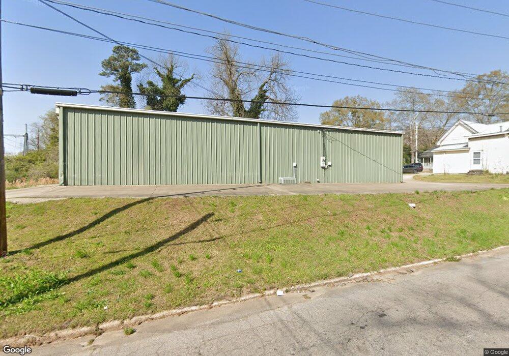
212 W Mulberry St Lagrange, GA 30240
Estimated Value: $165,886
--
Bed
1
Bath
3,200
Sq Ft
$52/Sq Ft
Est. Value
About This Home
This home is located at 212 W Mulberry St, Lagrange, GA 30240 and is currently estimated at $165,886, approximately $51 per square foot. 212 W Mulberry St is a home located in Troup County with nearby schools including Ethel W. Kight Elementary School, Hollis Hand Elementary School, and Franklin Forest Elementary School.
Ownership History
Date
Name
Owned For
Owner Type
Purchase Details
Closed on
May 30, 2024
Sold by
T Squared 2 Llc
Bought by
Carrera Celso Balbina
Current Estimated Value
Purchase Details
Closed on
Jun 1, 2021
Sold by
Stribling Ty
Bought by
T Squared 2 Llc
Purchase Details
Closed on
Oct 13, 2003
Sold by
Martin J Miller
Bought by
Stribling Ty
Purchase Details
Closed on
Mar 1, 2001
Sold by
Madeline Moore Tucker
Bought by
Martin J Miller
Purchase Details
Closed on
Mar 17, 1987
Sold by
Virginia Daniel Weir
Bought by
Madeline Moore Tucker
Purchase Details
Closed on
Feb 1, 1900
Sold by
Daniel - Will J B
Bought by
Virginia Daniel Weir
Create a Home Valuation Report for This Property
The Home Valuation Report is an in-depth analysis detailing your home's value as well as a comparison with similar homes in the area
Home Values in the Area
Average Home Value in this Area
Purchase History
| Date | Buyer | Sale Price | Title Company |
|---|---|---|---|
| Carrera Celso Balbina | $159,900 | -- | |
| T Squared 2 Llc | -- | -- | |
| Stribling Ty | $1,181,000 | -- | |
| Martin J Miller | $907,500 | -- | |
| Madeline Moore Tucker | $3,000 | -- | |
| Virginia Daniel Weir | -- | -- |
Source: Public Records
Tax History Compared to Growth
Tax History
| Year | Tax Paid | Tax Assessment Tax Assessment Total Assessment is a certain percentage of the fair market value that is determined by local assessors to be the total taxable value of land and additions on the property. | Land | Improvement |
|---|---|---|---|---|
| 2024 | $1,456 | $53,400 | $8,000 | $45,400 |
| 2023 | $1,435 | $52,600 | $8,000 | $44,600 |
| 2022 | $1,468 | $52,600 | $8,000 | $44,600 |
| 2021 | $974 | $32,280 | $2,080 | $30,200 |
| 2020 | $974 | $32,280 | $2,080 | $30,200 |
| 2019 | $1,018 | $33,760 | $1,680 | $32,080 |
| 2018 | $1,018 | $33,760 | $1,680 | $32,080 |
| 2017 | $1,018 | $33,760 | $1,680 | $32,080 |
| 2016 | $1,028 | $34,084 | $1,582 | $32,502 |
| 2015 | $1,030 | $34,084 | $1,582 | $32,502 |
| 2014 | $1,031 | $34,084 | $1,582 | $32,502 |
| 2013 | -- | $45,445 | $2,109 | $43,336 |
Source: Public Records
Map
Nearby Homes
- 303 E Mulberry St
- 501 Milam St
- 203 Fannin St
- 205 Fannin St
- W W Crovat St
- 206 Peachtree St
- 516 S Lewis St
- 509 S Lewis St
- 505 S Lewis St
- 109 Bell St
- 101 Cedar St
- 200 Mccall St
- 0 E Fendig St
- 113 E Fendig St
- 0 Bagley St
- 0 Boggs St Unit 10550243
- 0 Boggs St Unit 10550231
- 0 Boggs St Unit 10550239
- 0 Boggs St Unit 10550250
- 311 Colquitt St
- 310 Whitesville St
- 308 Whitesville St
- 406 Whitesville St
- 400 Whitesville St
- 306 Whitesville St
- 211 W Mulberry St
- 213 W Mulberry St
- 402 Whitesville St
- 315 Whitesville St
- 313 Whitesville St
- 311 Whitesville St
- 401 Whitesville St
- 404 Whitesville St
- 401 Milam St
- 403 Whitesville St
- 409 Milam St
- 301 E Mulberry St
- 305 Whitesville St
- 407 Whitesville St
- 410 Whitesville St