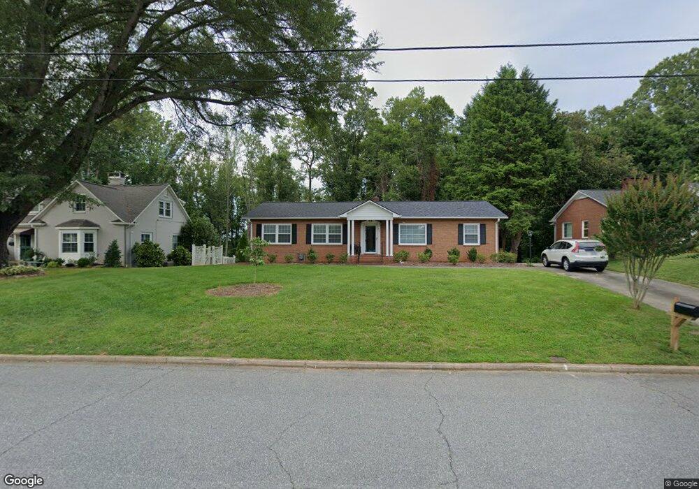
212 W Park Dr Morganton, NC 28655
Estimated Value: $270,000 - $379,000
3
Beds
2
Baths
1,653
Sq Ft
$197/Sq Ft
Est. Value
About This Home
This home is located at 212 W Park Dr, Morganton, NC 28655 and is currently estimated at $326,424, approximately $197 per square foot. 212 W Park Dr is a home located in Burke County with nearby schools including Forest Hill Elementary School, Walter R. Johnson Middle School, and Robert L. Patton High School.
Ownership History
Date
Name
Owned For
Owner Type
Purchase Details
Closed on
Dec 28, 2017
Sold by
Pitts Paige M
Bought by
Little Jean N
Current Estimated Value
Home Financials for this Owner
Home Financials are based on the most recent Mortgage that was taken out on this home.
Original Mortgage
$175,512
Outstanding Balance
$148,149
Interest Rate
3.95%
Mortgage Type
Credit Line Revolving
Estimated Equity
$178,275
Create a Home Valuation Report for This Property
The Home Valuation Report is an in-depth analysis detailing your home's value as well as a comparison with similar homes in the area
Home Values in the Area
Average Home Value in this Area
Purchase History
| Date | Buyer | Sale Price | Title Company |
|---|---|---|---|
| Little Jean N | $174,500 | None Available |
Source: Public Records
Mortgage History
| Date | Status | Borrower | Loan Amount |
|---|---|---|---|
| Open | Little Jean N | $175,512 |
Source: Public Records
Tax History Compared to Growth
Tax History
| Year | Tax Paid | Tax Assessment Tax Assessment Total Assessment is a certain percentage of the fair market value that is determined by local assessors to be the total taxable value of land and additions on the property. | Land | Improvement |
|---|---|---|---|---|
| 2025 | $1,331 | $222,326 | $57,728 | $164,598 |
| 2024 | $1,338 | $222,326 | $57,728 | $164,598 |
| 2023 | $1,333 | $222,326 | $57,728 | $164,598 |
| 2022 | $1,306 | $176,124 | $52,451 | $123,673 |
| 2021 | $1,300 | $176,124 | $52,451 | $123,673 |
| 2020 | $1,296 | $176,124 | $52,451 | $123,673 |
| 2019 | $1,296 | $176,124 | $52,451 | $123,673 |
| 2018 | $1,351 | $183,971 | $52,451 | $131,520 |
| 2017 | $1,345 | $183,438 | $52,451 | $130,987 |
| 2016 | $1,312 | $183,438 | $52,451 | $130,987 |
| 2015 | $1,309 | $183,438 | $52,451 | $130,987 |
| 2014 | $1,308 | $183,438 | $52,451 | $130,987 |
| 2013 | $1,308 | $183,438 | $52,451 | $130,987 |
Source: Public Records
Map
Nearby Homes
- 213 W Park Dr
- 220 W Park Dr
- 223 W Park Dr
- 507 Riverside Dr
- 115 Riverside Ct
- 404 Patton St
- 115 Kinwood St
- 300 Patton St
- 0 Poplar Ridge Ln
- 113 Falls St
- 231 Davis Dr
- 218 Davis Dr
- 101 Edgewood Ave
- 606 Collett St
- 244 N Anderson St
- 406 Burkemont Ave
- 0 N Green St
- 410 Burkemont Ave Unit A-D
- 00 S Anderson St
- 214 Howard St
- 210 W Park Dr
- 214 W Park Dr
- 208 W Park Dr
- 211 W Park Dr
- 215 W Park Dr
- 216 W Park Dr
- 209 W Park Dr
- 206 W Park Dr
- 217 W Park Dr
- 302 Walton Rd
- 207 W Park Dr
- 207 W Park Dr Unit 64
- 204 W Park Dr
- 109 Rockview Ln
- 107 Rockview Ln
- 219 W Park Dr
- 111 Rockview Ln
- 126 Silver Creek Rd
- 105 Rockview Ln
- 306 Walton Rd