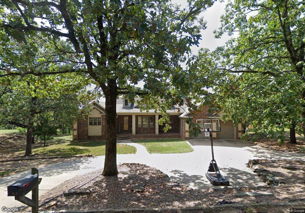
212 Water Tower Rd Muldrow, OK 74948
Estimated Value: $625,000 - $651,696
3
Beds
6
Baths
3,417
Sq Ft
$186/Sq Ft
Est. Value
About This Home
This home is located at 212 Water Tower Rd, Muldrow, OK 74948 and is currently estimated at $636,899, approximately $186 per square foot. 212 Water Tower Rd is a home located in Sequoyah County with nearby schools including Muldrow Elementary School, Muldrow Middle School, and Muldrow High School.
Ownership History
Date
Name
Owned For
Owner Type
Purchase Details
Closed on
Aug 17, 2022
Sold by
Whisenant and Kasey
Bought by
Grayt Life Llc
Current Estimated Value
Purchase Details
Closed on
Apr 7, 2010
Sold by
Mcdaniel Lamar and Mcdaniel Jean
Bought by
Robinson Theressa Jean and Robinson Robert
Purchase Details
Closed on
Nov 26, 2002
Sold by
Mcdaniel Lam
Bought by
Mcdaniel L
Purchase Details
Closed on
Nov 1, 2002
Sold by
Mcdaniel Lamar and Mcdaniel Jean
Bought by
Mcdaniel Theressa and Mcdaniel Ames
Purchase Details
Closed on
Feb 25, 1999
Sold by
Daniel Ben W and Daniel Pamela
Bought by
Mcdaniel Lamar and Mcdaniel Jean
Create a Home Valuation Report for This Property
The Home Valuation Report is an in-depth analysis detailing your home's value as well as a comparison with similar homes in the area
Home Values in the Area
Average Home Value in this Area
Purchase History
| Date | Buyer | Sale Price | Title Company |
|---|---|---|---|
| Grayt Life Llc | -- | Valley Land Title | |
| Whisenant Eric | $590,000 | Valley Land Title | |
| Robinson Theressa Jean | -- | None Available | |
| Robinson Theressa Jean | -- | None Available | |
| Mcdaniel L | -- | -- | |
| Mcdaniel Theressa | -- | -- | |
| Mcdaniel Lamar | $28,000 | -- |
Source: Public Records
Tax History Compared to Growth
Tax History
| Year | Tax Paid | Tax Assessment Tax Assessment Total Assessment is a certain percentage of the fair market value that is determined by local assessors to be the total taxable value of land and additions on the property. | Land | Improvement |
|---|---|---|---|---|
| 2024 | $4,828 | $68,145 | $978 | $67,167 |
| 2023 | $4,842 | $64,900 | $969 | $63,931 |
| 2022 | $2,352 | $34,098 | $990 | $33,108 |
| 2021 | $2,281 | $33,105 | $990 | $32,115 |
| 2020 | $2,281 | $33,105 | $990 | $32,115 |
| 2019 | $2,335 | $33,853 | $990 | $32,863 |
| 2018 | $2,386 | $34,584 | $990 | $33,594 |
| 2017 | $2,479 | $34,892 | $550 | $34,342 |
| 2016 | $3,181 | $44,765 | $550 | $44,215 |
| 2015 | $3,182 | $44,776 | $550 | $44,226 |
| 2014 | $3,182 | $44,781 | $550 | $44,231 |
Source: Public Records
Map
Nearby Homes
- Tbd Water Tower Rd
- 203 Pendergrass St
- 1 Oklahoma 64b
- 103 NE 1st St
- 103 Drake Dr
- 101 NE 2nd St
- 103756 Oklahoma 64b
- 109651 S 4720 Rd
- TBD S 4720 Rd
- 304 Oakdale Rd
- 300 S Fargo St
- TBD Hugo St
- 503 S Dogwood St
- 404 W Sequoyah St
- 107 7th St
- 505 Juniper Ln
- 701 S Ada St
- 806 S Ada St
- 201 9th St
- TBD Sequoyah St
- 216 Water Tower Rd
- 116 Water Tower Rd
- 205 Water Tower Rd
- 215 Water Tower Rd
- 205 Pendergrass St
- 0 Water Tower Rd Unit 110
- 201 Water Tower Rd
- 204 Pendergrass St
- tbd Pendergrass St
- 110 Water Tower Rd
- 473026 E 1097 Rd
- 904 Pendergrass St
- 200 Pendergrass St
- 206 Pendergrass St
- 206 Pendergrass St
- 109 Water Tower Rd
- 114 Pendergrass St
- 265 Gibbons Ln
- 225 NE Brassfield Rd
- 209 Brassfield St