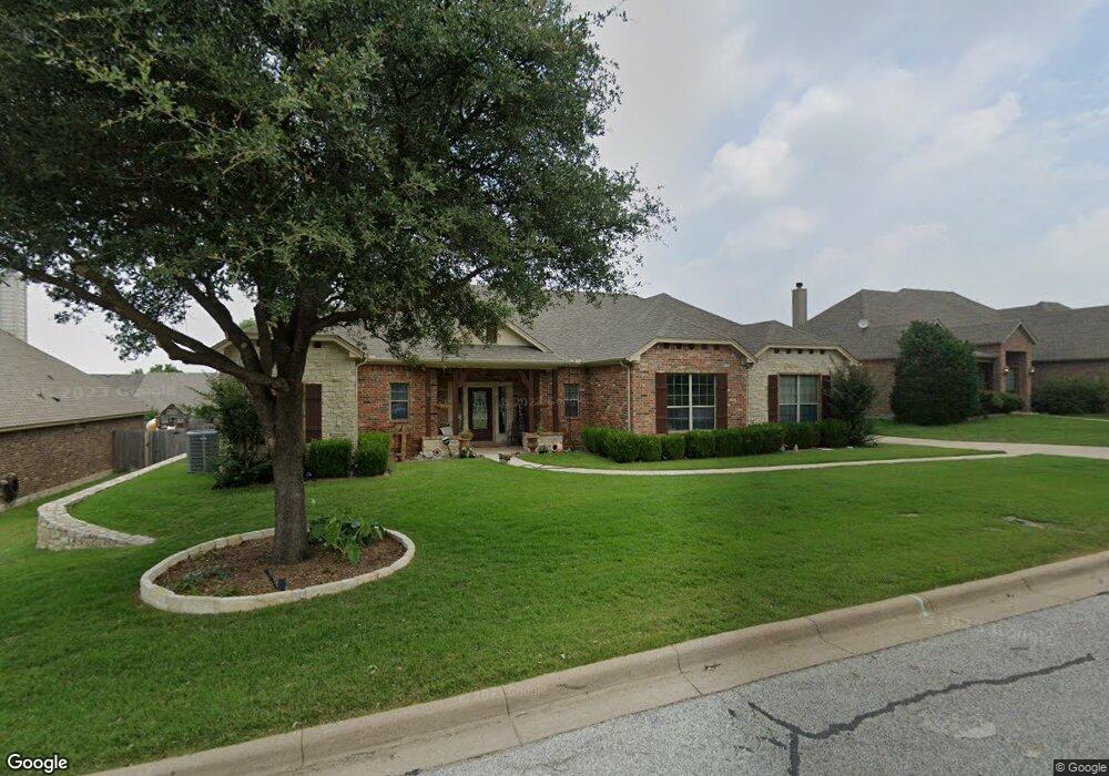
212 William Allen St Decatur, TX 76234
Estimated Value: $433,694 - $496,000
--
Bed
--
Bath
2,498
Sq Ft
$184/Sq Ft
Est. Value
About This Home
This home is located at 212 William Allen St, Decatur, TX 76234 and is currently estimated at $459,924, approximately $184 per square foot. 212 William Allen St is a home located in Wise County with nearby schools including Decatur High School and Victory Christian Academy.
Ownership History
Date
Name
Owned For
Owner Type
Purchase Details
Closed on
Jul 30, 2021
Sold by
Ellison Rory Scott and Hinshaw Ginger G
Bought by
Misenhimer Leslie
Current Estimated Value
Purchase Details
Closed on
Jun 12, 2019
Sold by
Hargrave David and Hargrave Edwina
Bought by
Ellison Rory Scott and Hinshaw Ginger G
Home Financials for this Owner
Home Financials are based on the most recent Mortgage that was taken out on this home.
Original Mortgage
$232,875
Interest Rate
4.1%
Mortgage Type
VA
Purchase Details
Closed on
Oct 8, 2003
Sold by
Wise Co Properties Lp
Bought by
Hargrave David
Purchase Details
Closed on
Jan 8, 2003
Sold by
Kings Terrace Llc
Bought by
Hargrave David
Create a Home Valuation Report for This Property
The Home Valuation Report is an in-depth analysis detailing your home's value as well as a comparison with similar homes in the area
Home Values in the Area
Average Home Value in this Area
Purchase History
| Date | Buyer | Sale Price | Title Company |
|---|---|---|---|
| Misenhimer Leslie | -- | Guardian Title Co | |
| Ellison Rory Scott | -- | None Available | |
| Hargrave David | -- | -- | |
| Hargrave David | -- | -- |
Source: Public Records
Mortgage History
| Date | Status | Borrower | Loan Amount |
|---|---|---|---|
| Previous Owner | Ellison Rory Scott | $232,875 |
Source: Public Records
Tax History Compared to Growth
Tax History
| Year | Tax Paid | Tax Assessment Tax Assessment Total Assessment is a certain percentage of the fair market value that is determined by local assessors to be the total taxable value of land and additions on the property. | Land | Improvement |
|---|---|---|---|---|
| 2025 | $7,509 | $478,100 | $78,345 | $399,755 |
| 2024 | $7,509 | $476,603 | $72,688 | $403,915 |
| 2023 | $8,029 | $442,614 | $0 | $0 |
| 2022 | $8,812 | $402,376 | $60,425 | $341,951 |
| 2021 | $8,007 | $350,860 | $50,350 | $300,510 |
| 2020 | $7,568 | $322,660 | $46,650 | $276,010 |
| 2019 | $7,788 | $314,210 | $46,650 | $267,560 |
| 2018 | $7,389 | $285,780 | $25,920 | $259,860 |
| 2017 | $6,945 | $280,980 | $22,220 | $258,760 |
| 2016 | $6,313 | $256,050 | $22,220 | $233,830 |
| 2015 | -- | $218,310 | $22,220 | $196,090 |
| 2014 | -- | $209,520 | $22,220 | $187,300 |
Source: Public Records
Map
Nearby Homes
- 304 Cyndilu Ln
- 101 E Mulberry St
- 114 Sondra Lin Blvd
- 903 N Miller St
- 802 N Church St
- 307 E Vernon St
- 700 N Church St
- 606 W Mulberry St
- 407 N Lane St
- 602 N Cates St
- 1 S Martin Extension
- TBD Farm To Market 51
- 4112 U S 380
- 50+/- acres U S 380
- 305 E Shoemaker St
- 0 N Hwy 287 Unit 25379920
- 401 S Holman St
- 1404 Shady Ln
- 506 E Main St
- 601 W Brady St
- 212 William Allen Ln
- 208 William Allen Ln
- 208 William Allen Ln
- 151 Emma Call Ct
- 137 Emma Call Ct
- 220 William Allen Ln
- 181 Emma Call Ct
- 123 Emma Call Ct
- 123 Emma Call Ct
- 220 William Allen Ln
- 187 Emma Call Ct
- 109 Emma Call Ct
- 197 Emma Call Ct
- 213 William Allen St
- 101 EmMacAll Ct
- 101 Emma Call Ct
- 209 William Allen Ln
- 201 Emma Call Ct
- 205 William Allen St
- 217 William Allen St