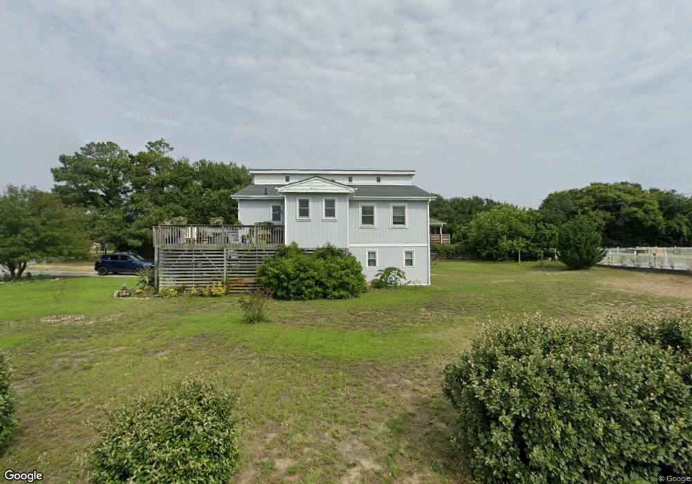
212 Woodard Rd Unit 6 Kitty Hawk, NC 27949
Estimated Value: $551,072 - $670,000
3
Beds
3
Baths
1,924
Sq Ft
$313/Sq Ft
Est. Value
About This Home
This home is located at 212 Woodard Rd Unit 6, Kitty Hawk, NC 27949 and is currently estimated at $602,018, approximately $312 per square foot. 212 Woodard Rd Unit 6 is a home located in Dare County with nearby schools including Kitty Hawk Elementary School, First Flight Middle School, and First Flight High School.
Ownership History
Date
Name
Owned For
Owner Type
Purchase Details
Closed on
Oct 23, 2017
Sold by
Basilone Mike and Basilone Erine
Bought by
Turner John L and Turner Emily E
Current Estimated Value
Purchase Details
Closed on
Feb 5, 2010
Sold by
U S Bank Na
Bought by
Basilone Mike and Balisone Erin
Home Financials for this Owner
Home Financials are based on the most recent Mortgage that was taken out on this home.
Original Mortgage
$149,572
Interest Rate
5.12%
Mortgage Type
FHA
Purchase Details
Closed on
Nov 17, 2009
Sold by
Collins William Shane and Collins Amanda N
Bought by
U S Bank Na and Citigroup Mortgage Loan Trust Inc
Purchase Details
Closed on
Sep 23, 2005
Sold by
Underwood Phillip Wayne
Bought by
Collins William S and Collins Amanda N
Home Financials for this Owner
Home Financials are based on the most recent Mortgage that was taken out on this home.
Original Mortgage
$250,000
Interest Rate
5.72%
Mortgage Type
Purchase Money Mortgage
Create a Home Valuation Report for This Property
The Home Valuation Report is an in-depth analysis detailing your home's value as well as a comparison with similar homes in the area
Home Values in the Area
Average Home Value in this Area
Purchase History
| Date | Buyer | Sale Price | Title Company |
|---|---|---|---|
| Turner John L | $290,000 | None Available | |
| Basilone Mike | $168,000 | None Available | |
| U S Bank Na | $171,000 | None Available | |
| Collins William S | $250,000 | None Available |
Source: Public Records
Mortgage History
| Date | Status | Borrower | Loan Amount |
|---|---|---|---|
| Previous Owner | Basilone Mike | $149,572 | |
| Previous Owner | Collins William S | $250,000 |
Source: Public Records
Tax History Compared to Growth
Tax History
| Year | Tax Paid | Tax Assessment Tax Assessment Total Assessment is a certain percentage of the fair market value that is determined by local assessors to be the total taxable value of land and additions on the property. | Land | Improvement |
|---|---|---|---|---|
| 2025 | $2,353 | $487,000 | $188,300 | $298,700 |
| 2024 | $2,324 | $331,700 | $108,100 | $223,600 |
| 2023 | $2,324 | $331,700 | $108,100 | $223,600 |
| 2022 | $2,324 | $331,700 | $108,100 | $223,600 |
| 2021 | $2,324 | $331,700 | $108,100 | $223,600 |
| 2020 | $2,324 | $331,700 | $108,100 | $223,600 |
| 2019 | $1,835 | $226,500 | $97,700 | $128,800 |
| 2018 | $1,835 | $226,500 | $97,700 | $128,800 |
| 2017 | $1,913 | $226,500 | $97,700 | $128,800 |
| 2016 | $1,821 | $226,500 | $97,700 | $128,800 |
| 2014 | $1,699 | $226,500 | $97,700 | $128,800 |
Source: Public Records
Map
Nearby Homes
- 302 Oak Run Unit Lot 14
- 305 Oak Run
- 210 W Kitty Hawk Rd Unit 210
- 212 W Kitty Hawk Rd Unit 212
- 204 First Flight Run Unit 8
- 408 1st Flight Run Unit Lot 19
- 3836 N Virginia Dare Trail Unit M1
- 3906 Virginia Dare Trail N Unit Lot 2
- 3104 Coral Reef Ct Unit 3104
- 122 Gables Way Unit 9A
- 800 W Kitty Hawk Rd
- 802 W Kitty Hawk Rd Unit Lot A1
- 102 Angler Way Unit 2
- 3636 Poseidon St Unit Lot 16
- 2902 Seahorse Ct Unit 2902
- 302 Angler Way Unit 302
- 307 Angler Way Unit 307
- 906 Swordfish Way Unit 906
- 3616 Virginia Dare Trail N Unit lot 5-5A
- 2406 Neptune Way Unit 2406