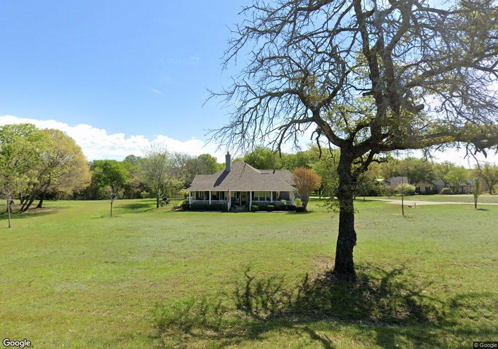
212 Woodcrest St Weatherford, TX 76087
Estimated Value: $537,137 - $619,000
3
Beds
2
Baths
2,528
Sq Ft
$224/Sq Ft
Est. Value
About This Home
This home is located at 212 Woodcrest St, Weatherford, TX 76087 and is currently estimated at $567,034, approximately $224 per square foot. 212 Woodcrest St is a home located in Parker County with nearby schools including Martin Elementary School, Tison Middle School, and Weatherford High School.
Ownership History
Date
Name
Owned For
Owner Type
Purchase Details
Closed on
Jun 20, 2016
Sold by
Swan Anna Lee Aston
Bought by
Phillips Scott A and Phillips Kay H
Current Estimated Value
Home Financials for this Owner
Home Financials are based on the most recent Mortgage that was taken out on this home.
Original Mortgage
$248,000
Outstanding Balance
$111,155
Interest Rate
3.61%
Mortgage Type
New Conventional
Estimated Equity
$455,879
Purchase Details
Closed on
Jan 1, 1901
Bought by
Phillips Scott A and Phillips Kay H
Create a Home Valuation Report for This Property
The Home Valuation Report is an in-depth analysis detailing your home's value as well as a comparison with similar homes in the area
Home Values in the Area
Average Home Value in this Area
Purchase History
| Date | Buyer | Sale Price | Title Company |
|---|---|---|---|
| Phillips Scott A | -- | Rtc | |
| Phillips Scott A | -- | -- |
Source: Public Records
Mortgage History
| Date | Status | Borrower | Loan Amount |
|---|---|---|---|
| Open | Phillips Scott A | $248,000 |
Source: Public Records
Tax History Compared to Growth
Tax History
| Year | Tax Paid | Tax Assessment Tax Assessment Total Assessment is a certain percentage of the fair market value that is determined by local assessors to be the total taxable value of land and additions on the property. | Land | Improvement |
|---|---|---|---|---|
| 2025 | $5,282 | $530,162 | -- | -- |
| 2024 | $5,282 | $481,965 | -- | -- |
| 2023 | $5,282 | $438,150 | $0 | $0 |
| 2022 | $8,835 | $398,320 | $152,640 | $245,680 |
| 2021 | $9,555 | $398,320 | $152,640 | $245,680 |
| 2020 | $8,739 | $361,690 | $116,010 | $245,680 |
| 2019 | $8,699 | $361,690 | $116,010 | $245,680 |
| 2018 | $7,944 | $309,690 | $80,970 | $228,720 |
| 2017 | $8,149 | $309,690 | $80,970 | $228,720 |
| 2016 | $7,100 | $269,840 | $69,010 | $200,830 |
| 2015 | $4,189 | $269,840 | $69,010 | $200,830 |
| 2014 | $4,301 | $245,760 | $64,840 | $180,920 |
Source: Public Records
Map
Nearby Homes
- 1553 Salado Trail
- 1520 Sidewinder Trail
- 1529 Sidewinder Trail
- 1525 Sand Dollar Trail
- 1636 Salado Trail
- 2321 Shamrock Ln
- 1629 Silverstone Dr
- 2317 Shamrock Ln
- 1541 Stanchion Way
- 1624 Sandle Wood Dr
- 2300 Shamrock Ln
- 536 Mitchell Blvd
- 532 Mitchell Blvd
- 541 Mitchell Blvd
- 1605 Stanchion Way
- 705 N Oakridge Dr
- 540 Waterford Park Blvd
- 540 Waterford Park
- 544 Waterford Park Blvd
- 520 Waterford Park Blvd
- 208 Woodcrest St
- 207 Woodcrest St
- 205 Woodcrest St
- 203 Woodcrest St
- 214 Woodcrest St
- 209 Woodcrest St
- 210 Woodcrest St
- 206 Woodcrest St
- 204 Woodcrest St
- 216 Woodcrest St
- 201 Woodcrest St
- 118 Woodcrest St
- 1504 Somerset Ln
- 1508 Somerset Ln
- 1512 Somerset Ln
- 1516 Somerset Ln
- 1600 Somerset Ln
- 1604 Somerset Ln
- 1604 Somerset Ln
- 1500 Somerset Ln