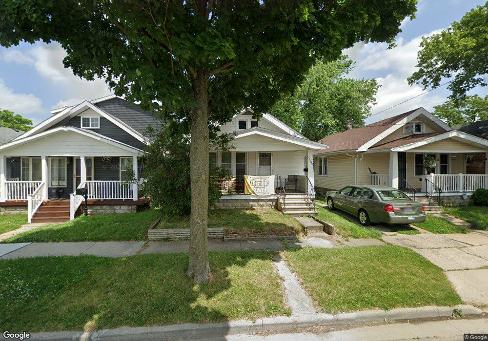
2120 Airline Ave Toledo, OH 43609
Southside NeighborhoodEstimated Value: $58,000 - $75,000
2
Beds
1
Bath
726
Sq Ft
$89/Sq Ft
Est. Value
About This Home
This home is located at 2120 Airline Ave, Toledo, OH 43609 and is currently estimated at $64,768, approximately $89 per square foot. 2120 Airline Ave is a home located in Lucas County with nearby schools including Burroughs Elementary School, Bowsher High School, and Explorers Academy of Science and Technology.
Ownership History
Date
Name
Owned For
Owner Type
Purchase Details
Closed on
Dec 8, 2006
Sold by
Findling John E and Findling Karen S
Bought by
Mikolajczyk David J and Mikolajczyk Marcia M
Current Estimated Value
Home Financials for this Owner
Home Financials are based on the most recent Mortgage that was taken out on this home.
Original Mortgage
$30,600
Outstanding Balance
$18,346
Interest Rate
6.36%
Mortgage Type
Purchase Money Mortgage
Estimated Equity
$46,422
Purchase Details
Closed on
Nov 21, 1994
Sold by
Jagodzinski Mary H
Bought by
Findling John E and Findling Karen S
Home Financials for this Owner
Home Financials are based on the most recent Mortgage that was taken out on this home.
Original Mortgage
$24,300
Interest Rate
9%
Mortgage Type
New Conventional
Create a Home Valuation Report for This Property
The Home Valuation Report is an in-depth analysis detailing your home's value as well as a comparison with similar homes in the area
Home Values in the Area
Average Home Value in this Area
Purchase History
| Date | Buyer | Sale Price | Title Company |
|---|---|---|---|
| Mikolajczyk David J | $38,300 | Chicago Title Insurance Co | |
| Findling John E | $27,000 | -- |
Source: Public Records
Mortgage History
| Date | Status | Borrower | Loan Amount |
|---|---|---|---|
| Open | Mikolajczyk David J | $30,600 | |
| Closed | Findling John E | $24,300 |
Source: Public Records
Tax History Compared to Growth
Tax History
| Year | Tax Paid | Tax Assessment Tax Assessment Total Assessment is a certain percentage of the fair market value that is determined by local assessors to be the total taxable value of land and additions on the property. | Land | Improvement |
|---|---|---|---|---|
| 2024 | $519 | $16,240 | $4,585 | $11,655 |
| 2023 | $739 | $10,675 | $3,745 | $6,930 |
| 2022 | $742 | $10,675 | $3,745 | $6,930 |
| 2021 | $757 | $10,675 | $3,745 | $6,930 |
| 2020 | $850 | $10,675 | $3,465 | $7,210 |
| 2019 | $825 | $10,675 | $3,465 | $7,210 |
| 2018 | $847 | $10,675 | $3,465 | $7,210 |
| 2017 | $866 | $10,675 | $2,905 | $7,770 |
| 2016 | $870 | $30,500 | $8,300 | $22,200 |
| 2015 | $863 | $30,500 | $8,300 | $22,200 |
| 2014 | $690 | $10,680 | $2,910 | $7,770 |
| 2013 | $690 | $10,680 | $2,910 | $7,770 |
Source: Public Records
Map
Nearby Homes
- 226 Somerset St
- 304 Mayberry St
- 221 Somerset St
- 321 Mayberry St
- 224 S Fearing Blvd
- 2126 Airport Hwy
- 440 Somerset St
- 142 S Detroit Ave
- 140 Whiting Ave
- 531 Shasta Dr
- 1754 Finch St
- 512 Woodsdale Ave
- 556 Apple Ave
- 1777 South Ave
- 649 Wright Ave
- 576 Bronx Dr
- 705 Wright Ave
- 323 Champion St
- 1587 Colton St
- 1574 Colton St
- 2124 Airline Ave
- 2118 Airline Ave
- 2116 Airline Ave
- 2130 Airline Ave
- 2112 Airline Ave
- 2140 Airline Ave
- 227 Mayberry St
- 2102 Airline Ave
- 224 Decatur St
- 233 Mayberry St
- 230 Decatur St
- 2142 Airline Ave
- 2062 Airline Ave
- 235 Mayberry St
- 234 Decatur St
- 2144 Airline Ave
- 239 Mayberry St
- 240 Decatur St
- 2150 Airline Ave
- 245 Mayberry St