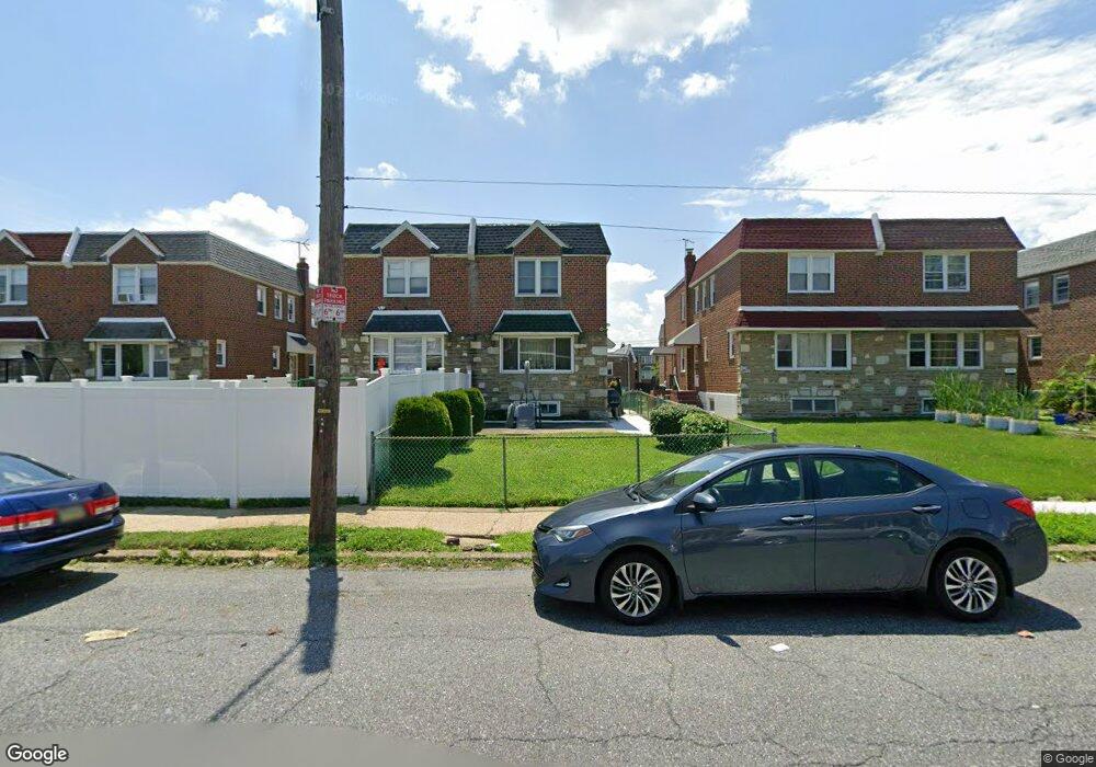
2120 Hoffnagle St Philadelphia, PA 19152
Rhawnhurst NeighborhoodEstimated Value: $324,000 - $375,000
4
Beds
1
Bath
1,558
Sq Ft
$222/Sq Ft
Est. Value
About This Home
This home is located at 2120 Hoffnagle St, Philadelphia, PA 19152 and is currently estimated at $345,445, approximately $221 per square foot. 2120 Hoffnagle St is a home with nearby schools including Farrell Louis H School, Northeast High School, and Tacony Academy Charter School.
Ownership History
Date
Name
Owned For
Owner Type
Purchase Details
Closed on
Jul 6, 2005
Sold by
Leiter Samuel D and Leiter Susan V
Bought by
Bites Yaron and Bitas Tair
Current Estimated Value
Home Financials for this Owner
Home Financials are based on the most recent Mortgage that was taken out on this home.
Original Mortgage
$148,000
Outstanding Balance
$76,908
Interest Rate
5.59%
Mortgage Type
Fannie Mae Freddie Mac
Estimated Equity
$268,537
Purchase Details
Closed on
Apr 6, 1995
Sold by
Lazar Philip and Lazar Joyce
Bought by
Leiter Samuel D and Leiter Susan V
Create a Home Valuation Report for This Property
The Home Valuation Report is an in-depth analysis detailing your home's value as well as a comparison with similar homes in the area
Home Values in the Area
Average Home Value in this Area
Purchase History
| Date | Buyer | Sale Price | Title Company |
|---|---|---|---|
| Bites Yaron | $188,000 | -- | |
| Leiter Samuel D | $95,000 | -- |
Source: Public Records
Mortgage History
| Date | Status | Borrower | Loan Amount |
|---|---|---|---|
| Open | Bites Yaron | $148,000 |
Source: Public Records
Tax History Compared to Growth
Tax History
| Year | Tax Paid | Tax Assessment Tax Assessment Total Assessment is a certain percentage of the fair market value that is determined by local assessors to be the total taxable value of land and additions on the property. | Land | Improvement |
|---|---|---|---|---|
| 2025 | $3,733 | $333,000 | $66,600 | $266,400 |
| 2024 | $3,733 | $333,000 | $66,600 | $266,400 |
| 2023 | $3,733 | $266,700 | $53,340 | $213,360 |
| 2022 | $2,336 | $221,700 | $53,340 | $168,360 |
| 2021 | $2,966 | $0 | $0 | $0 |
| 2020 | $2,966 | $0 | $0 | $0 |
| 2019 | $2,700 | $0 | $0 | $0 |
| 2018 | $2,133 | $0 | $0 | $0 |
| 2017 | $2,553 | $0 | $0 | $0 |
| 2016 | $2,133 | $0 | $0 | $0 |
| 2015 | $2,042 | $0 | $0 | $0 |
| 2014 | -- | $182,400 | $44,271 | $138,129 |
| 2012 | -- | $25,312 | $3,237 | $22,075 |
Source: Public Records
Map
Nearby Homes
- 2155 Benson St
- 2162 Strahle St
- 2223 Emerson St
- 2230 Emerson St
- 2201 Strahle St Unit C302
- 2232 Stanwood St
- 2321 Emerson St
- 1931 33 Rhawn St
- 2029 Loney St
- 2123 Loney St
- 2302 Rhawn St
- 2301 Ripley St
- 1705 Solly Ave
- 1702 Arthur St
- 1828 Megargee St
- 1917 Griffith St
- 1704 Stanwood St
- 2345 Ripley St
- 1716 Bergen St
- 1718 Rhawn St
- 2122 Hoffnagle St
- 2118 Hoffnagle St
- 2124 Hoffnagle St
- 2116 Hoffnagle St
- 2126 Hoffnagle St
- 2114 Hoffnagle St
- 2128 Hoffnagle St
- 2112 Hoffnagle St
- 2115 Emerson St
- 2113 Emerson St
- 2117 Emerson St
- 2130 Hoffnagle St
- 2111 Emerson St
- 2119 Emerson St
- 2109 Emerson St
- 2110 Hoffnagle St
- 2132 Hoffnagle St
- 2121 Emerson St
- 2108 Hoffnagle St
- 2107 Emerson St