Estimated Value: $264,000 - $310,000
4
Beds
2
Baths
1,496
Sq Ft
$193/Sq Ft
Est. Value
About This Home
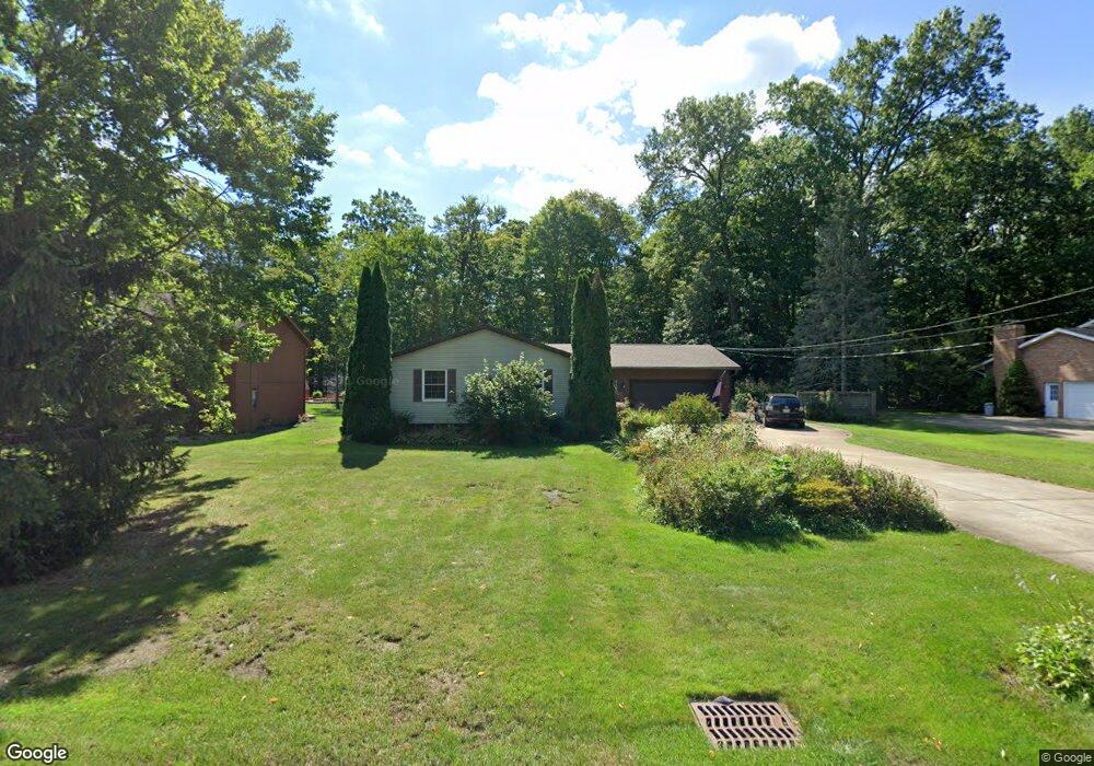
This home is located at 2120 Maple Rd, Stow, OH 44224 and is currently estimated at $288,953, approximately $193 per square foot. 2120 Maple Rd is a home located in Summit County with nearby schools including Stow-Munroe Falls High School, Holy Family Elementary School, and Walsh Jesuit High School.
Ownership History
Date
Name
Owned For
Owner Type
Purchase Details
Closed on
May 26, 2007
Sold by
Kerr Thomas C and Kerr Lorraine K
Bought by
Gazdik Larry P and Stevens Maureen E
Current Estimated Value
Home Financials for this Owner
Home Financials are based on the most recent Mortgage that was taken out on this home.
Original Mortgage
$133,600
Interest Rate
6.27%
Mortgage Type
Purchase Money Mortgage
Create a Home Valuation Report for This Property
The Home Valuation Report is an in-depth analysis detailing your home's value as well as a comparison with similar homes in the area
Home Values in the Area
Average Home Value in this Area
Purchase History
| Date | Buyer | Sale Price | Title Company |
|---|---|---|---|
| Gazdik Larry P | $167,000 | Chicago Title Insurance Co |
Source: Public Records
Mortgage History
| Date | Status | Borrower | Loan Amount |
|---|---|---|---|
| Previous Owner | Gazdik Larry P | $133,600 |
Source: Public Records
Tax History
| Year | Tax Paid | Tax Assessment Tax Assessment Total Assessment is a certain percentage of the fair market value that is determined by local assessors to be the total taxable value of land and additions on the property. | Land | Improvement |
|---|---|---|---|---|
| 2025 | $4,364 | $86,415 | $14,896 | $71,519 |
| 2024 | $4,364 | $86,415 | $14,896 | $71,519 |
| 2023 | $4,364 | $86,415 | $14,896 | $71,519 |
| 2022 | $3,336 | $60,701 | $10,416 | $50,285 |
| 2021 | $2,988 | $60,701 | $10,416 | $50,285 |
| 2020 | $2,937 | $60,710 | $10,420 | $50,290 |
| 2019 | $2,266 | $46,010 | $9,450 | $36,560 |
| 2018 | $2,230 | $46,010 | $9,450 | $36,560 |
| 2017 | $2,292 | $46,010 | $9,450 | $36,560 |
| 2016 | $2,358 | $46,010 | $9,450 | $36,560 |
| 2015 | $2,292 | $46,010 | $9,450 | $36,560 |
| 2014 | $2,294 | $46,010 | $9,450 | $36,560 |
| 2013 | $2,488 | $49,520 | $9,450 | $40,070 |
Source: Public Records
Map
Nearby Homes
- 3550 Sanford Ave
- 245 Bermont Ave
- 3564 Williamson Rd
- 3679 Sanford Ave
- 3355 Sycamore Dr
- 3905 Kent Rd
- 3820 Seneca St
- 3828 Osage St Unit 3832
- 3846 Charring Cross Dr
- 3070 Kent Rd
- 3068 Kent Rd Unit 105
- 3066 Kent Rd Unit 112
- 3064 Kent Rd Unit 403
- 3068 Kent Rd
- 0 Vira Rd
- 431 Trudy Ave
- 2419 Liberty Rd
- 4003 Kenneth Rd
- 4040 Burton Dr
- 3874 Lake Run Blvd
- 2130 Maple Rd
- 2110 Maple Rd
- 2125 Maple Rd
- 2140 Maple Rd
- 2100 Maple Rd
- 2146 Maple Rd
- 3368 Marcella Ave
- 3361 Marcella Ave
- 2139 Maple Rd
- 2097 Maple Rd Unit 2101
- 2090 Maple Rd
- 3371 Marcella Ave
- 3392 Hiwood Ave
- 3398 Hiwood Ave
- 3384 Hiwood Ave
- 2147 Maple Rd
- 2089 Maple Rd
- 3376 Hiwood Ave
- 3414 Hiwood Ave
- 2080 Maple Rd
Your Personal Tour Guide
Ask me questions while you tour the home.