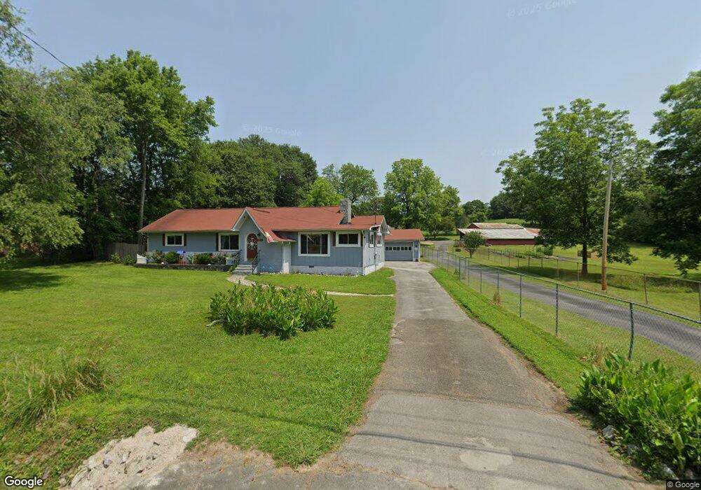
2120 Mcfarland Ave Rossville, GA 30741
Estimated Value: $213,000 - $260,000
--
Bed
2
Baths
1,436
Sq Ft
$163/Sq Ft
Est. Value
About This Home
This home is located at 2120 Mcfarland Ave, Rossville, GA 30741 and is currently estimated at $233,623, approximately $162 per square foot. 2120 Mcfarland Ave is a home located in Walker County with nearby schools including Stone Creek Elementary School, Rossville Middle School, and Ridgeland High School.
Ownership History
Date
Name
Owned For
Owner Type
Purchase Details
Closed on
Sep 10, 2019
Sold by
Richardson Ronald A
Bought by
Hughes Ronald Scott and Hughes Debra Jean
Current Estimated Value
Purchase Details
Closed on
Feb 24, 2017
Sold by
Richardson Ronald A
Bought by
Richardson Ronald A and Hughes Debra Jean
Purchase Details
Closed on
Jan 2, 1972
Bought by
Richardson Ronald A
Create a Home Valuation Report for This Property
The Home Valuation Report is an in-depth analysis detailing your home's value as well as a comparison with similar homes in the area
Home Values in the Area
Average Home Value in this Area
Purchase History
| Date | Buyer | Sale Price | Title Company |
|---|---|---|---|
| Hughes Ronald Scott | -- | -- | |
| Richardson Ronald A | -- | -- | |
| Richardson Ronald A | -- | -- |
Source: Public Records
Tax History Compared to Growth
Tax History
| Year | Tax Paid | Tax Assessment Tax Assessment Total Assessment is a certain percentage of the fair market value that is determined by local assessors to be the total taxable value of land and additions on the property. | Land | Improvement |
|---|---|---|---|---|
| 2024 | $2,107 | $93,830 | $9,204 | $84,626 |
| 2023 | $2,053 | $89,406 | $9,204 | $80,202 |
| 2022 | $1,943 | $77,430 | $9,204 | $68,226 |
| 2021 | $1,662 | $59,038 | $9,204 | $49,834 |
| 2020 | $1,478 | $49,984 | $9,204 | $40,780 |
| 2019 | $1,498 | $49,776 | $8,996 | $40,780 |
| 2018 | $1,317 | $49,776 | $8,996 | $40,780 |
| 2017 | $823 | $53,858 | $13,078 | $40,780 |
| 2016 | $521 | $53,858 | $13,078 | $40,780 |
| 2015 | $350 | $29,636 | $6,941 | $22,695 |
| 2014 | $263 | $29,636 | $6,941 | $22,695 |
| 2013 | -- | $34,634 | $11,940 | $22,694 |
Source: Public Records
Map
Nearby Homes
- 7 Broadway St
- 843 Schmitt Rd
- 9 Longstreet Rd
- 823 Schmitt Rd
- 705 Park City Rd
- 7 Catherine St
- 13 Circle Dr
- 323 N Jenkins Rd
- 51 Circle Dr
- 353 N Jenkins Rd
- 811 Park City Rd
- 57 Circle Dr
- 0 Gate St
- 0 Park City Rd Unit 1519998
- 01 7th St
- 109 7th St
- 170 7th St
- 0 7th St
- 0 Mission Ridge Rd Unit 1523146
- 0 Mission Ridge Rd Unit RTC3035902
- 2124 Mcfarland Ave
- 58 Ashley Ln
- 2118 Mcfarland Ave
- 2128 Mcfarland Ave
- 84 Ashley Ln
- 2132 Mcfarland Ave
- 2117 Mcfarland Ave
- 2125 Mcfarland Ave
- 2127 Mcfarland Ave
- 2121 Mcfarland Ave
- 2127 McFarland Gap Rd
- 2119 Mcfarland Ave
- 2134 Mcfarland Ave
- 2134 Mcfarland Ave
- 2111 Mcfarland Ave
- 2131 Mcfarland Ave
- 104 Hunt St
- 915 Schmitt Rd
- 138 Ashley Ln
- 1661 W Schmitt Rd