
Seller's Agent in 2025
Kelsey Snell
Garcia Properties
(314) 681-3048
3 in this area
193 Total Sales
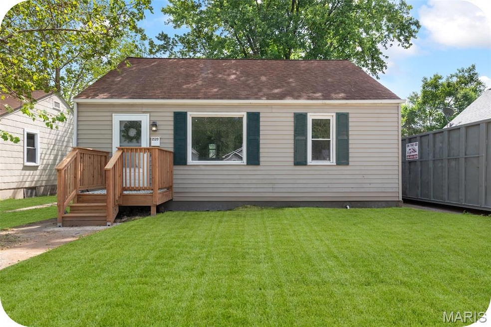
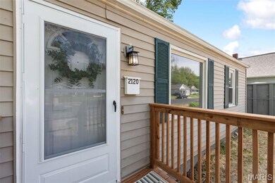
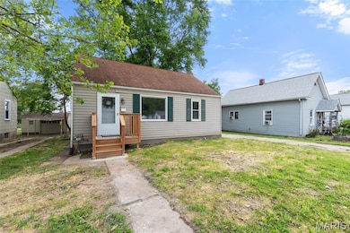
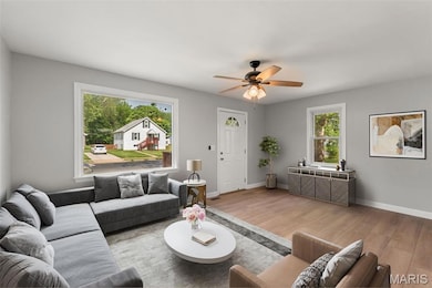
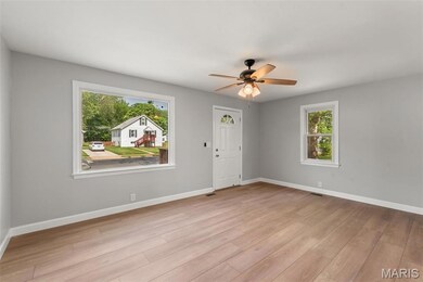
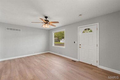
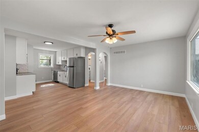
This move-in-ready 3-bedroom, 1-bath home has been completely remodeled from top to bottom for worry-free living. Walk into an open living/dining/kitchen area with shiny new floors and paint. The white kitchen is sparkling with quartz counters, gorgeous backsplash, and stainless steel appliances. Two bedrooms are located on the main floor along with a crisp full bath. Upstairs has an additional bedroom or bonus space featuring a brand-new mini-split system for efficient heating and cooling. The basement is a blank space ready for tinkering, exercise, or a tv. Outside, you'll find a 2-car garage (sold as-is) and plenty of space for a garden or outdoor entertaining. Major updates include all new plumbing, HVAC, electrical, hot water heater, and a new foundation with warranty. Conveniently located just minutes from the dining, shopping, and entertainment in downtown St. Charles. A great opportunity for low-maintenance homeownership in a prime location!
Last Agent to Sell the Property
Garcia Properties License #2018003810 Listed on: 05/18/2025
| Date | Type | Sale Price | Title Company |
|---|---|---|---|
| Warranty Deed | -- | Synergy Title | |
| Trustee Deed | $82,000 | None Listed On Document | |
| Trustee Deed | $72,366 | None Available | |
| Warranty Deed | -- | -- |
| Date | Status | Loan Amount | Loan Type |
|---|---|---|---|
| Open | $227,950 | New Conventional | |
| Previous Owner | $72,962 | FHA |
| Date | Event | Price | List to Sale | Price per Sq Ft |
|---|---|---|---|---|
| 07/11/2025 07/11/25 | Sold | -- | -- | -- |
| 06/09/2025 06/09/25 | Pending | -- | -- | -- |
| 06/03/2025 06/03/25 | For Sale | $235,000 | 0.0% | $220 / Sq Ft |
| 05/27/2025 05/27/25 | Pending | -- | -- | -- |
| 05/20/2025 05/20/25 | For Sale | $235,000 | -- | $220 / Sq Ft |
| Year | Tax Paid | Tax Assessment Tax Assessment Total Assessment is a certain percentage of the fair market value that is determined by local assessors to be the total taxable value of land and additions on the property. | Land | Improvement |
|---|---|---|---|---|
| 2025 | $1,787 | $27,161 | -- | -- |
| 2023 | $1,784 | $27,614 | -- | -- |
| 2022 | $1,484 | $21,348 | $0 | $0 |
| 2021 | $1,485 | $21,348 | $0 | $0 |
| 2020 | $1,450 | $20,023 | $0 | $0 |
| 2019 | $1,438 | $20,023 | $0 | $0 |
| 2018 | $1,387 | $18,359 | $0 | $0 |
| 2017 | $1,368 | $18,359 | $0 | $0 |
| 2016 | $1,356 | $17,523 | $0 | $0 |
| 2015 | $1,353 | $17,523 | $0 | $0 |
| 2014 | $1,316 | $16,810 | $0 | $0 |
Seller's Agent in 2025
Kelsey Snell
Garcia Properties
(314) 681-3048
3 in this area
193 Total Sales
Buyer's Agent in 2025
Angela carapella
Nettwork Global
(636) 579-3251
6 in this area
219 Total Sales
Source: MARIS MLS
MLS Number: MIS25033780
APN: 6-006D-4135-07-0013.0000000
Disclaimer: Certain information contained herein is derived from information provided by parties other than Homes.com. All information provided is deemed reliable, but is not guaranteed to be accurate and should be independently verified.
![]() Based on information submitted to the MLS GRID. All data is obtained from various sources and may not have been verified by broker or MLS GRID. Supplied Open House Information is subject to change without notice. All information should be independently reviewed and verified for accuracy. Properties may or may not be listed by the office/agent presenting the information. Some IDX listings have been excluded from this website.
Based on information submitted to the MLS GRID. All data is obtained from various sources and may not have been verified by broker or MLS GRID. Supplied Open House Information is subject to change without notice. All information should be independently reviewed and verified for accuracy. Properties may or may not be listed by the office/agent presenting the information. Some IDX listings have been excluded from this website.
Based on information submitted to the MLS GRID
Ask me questions while you tour the home.