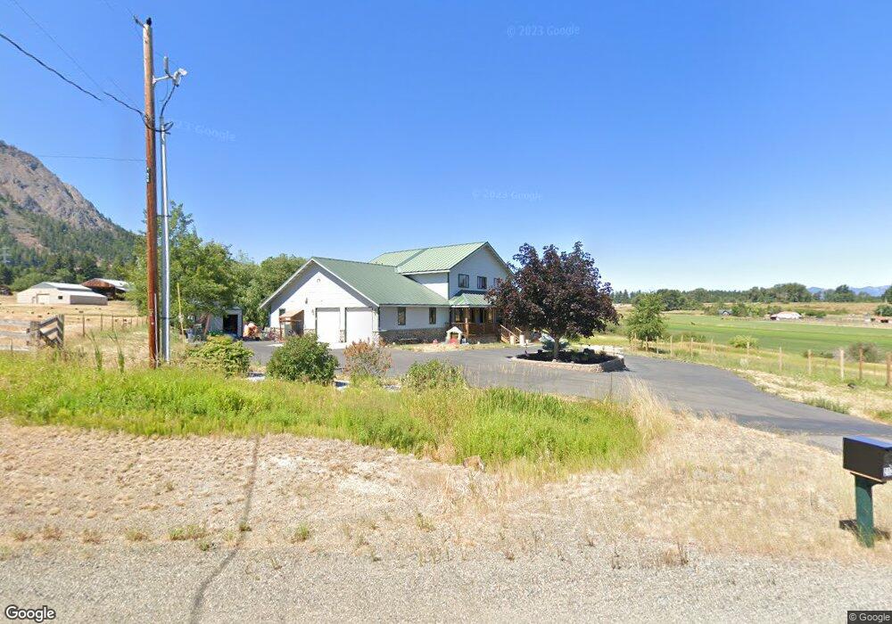
2120 Upper Peoh Point Rd Cle Elum, WA 98922
Estimated Value: $929,000 - $1,166,000
3
Beds
3
Baths
3,065
Sq Ft
$353/Sq Ft
Est. Value
About This Home
This home is located at 2120 Upper Peoh Point Rd, Cle Elum, WA 98922 and is currently estimated at $1,080,636, approximately $352 per square foot. 2120 Upper Peoh Point Rd is a home located in Kittitas County with nearby schools including Cle Elum Roslyn Elementary School, Walter Strom Middle School, and Cle Elum Roslyn High School.
Ownership History
Date
Name
Owned For
Owner Type
Purchase Details
Closed on
May 6, 2021
Sold by
Barker James E and Barker Brenda
Bought by
Farnam Kevin W and Farnam Sarah Grace
Current Estimated Value
Home Financials for this Owner
Home Financials are based on the most recent Mortgage that was taken out on this home.
Original Mortgage
$548,250
Outstanding Balance
$496,075
Interest Rate
3%
Mortgage Type
New Conventional
Estimated Equity
$584,561
Purchase Details
Closed on
Aug 14, 2013
Sold by
Barker James E
Bought by
Barker James E and Barker Brenda
Home Financials for this Owner
Home Financials are based on the most recent Mortgage that was taken out on this home.
Original Mortgage
$175,000
Interest Rate
4.25%
Mortgage Type
New Conventional
Create a Home Valuation Report for This Property
The Home Valuation Report is an in-depth analysis detailing your home's value as well as a comparison with similar homes in the area
Home Values in the Area
Average Home Value in this Area
Purchase History
| Date | Buyer | Sale Price | Title Company |
|---|---|---|---|
| Farnam Kevin W | $850,000 | Amerititle | |
| Barker James E | -- | First American Title Ins Co |
Source: Public Records
Mortgage History
| Date | Status | Borrower | Loan Amount |
|---|---|---|---|
| Open | Farnam Kevin W | $548,250 | |
| Previous Owner | Barker James E | $175,000 |
Source: Public Records
Tax History Compared to Growth
Tax History
| Year | Tax Paid | Tax Assessment Tax Assessment Total Assessment is a certain percentage of the fair market value that is determined by local assessors to be the total taxable value of land and additions on the property. | Land | Improvement |
|---|---|---|---|---|
| 2025 | $5,230 | $896,460 | $220,350 | $676,110 |
| 2023 | $5,230 | $788,490 | $176,350 | $612,140 |
| 2022 | $4,662 | $647,000 | $138,850 | $508,150 |
| 2021 | $4,819 | $637,410 | $138,850 | $498,560 |
| 2019 | $3,497 | $460,290 | $100,850 | $359,440 |
| 2018 | $3,108 | $388,400 | $100,850 | $287,550 |
| 2017 | $3,108 | $388,400 | $100,850 | $287,550 |
| 2016 | $3,116 | $388,400 | $100,850 | $287,550 |
| 2015 | $3,292 | $388,400 | $100,850 | $287,550 |
| 2013 | -- | $384,790 | $106,350 | $278,440 |
Source: Public Records
Map
Nearby Homes
- 31 Groeschell Rd
- 491 Pease Rd
- 66 x5 Upper Peoh Point Rd
- 66 x1 Upper Peoh Point Rd
- 66 x6 Upper Peoh Point Rd
- 66 x3 Upper Peoh Point Rd
- 66 x2 Upper Peoh Point Rd
- 66 x4 Upper Peoh Point Rd
- 0 XXX Westside Rd
- 601 Kretschman Dr
- 911 Westside Rd
- 501 Cleveland Ave
- 208 Sage Brook Ln
- 513 Cleveland Ave
- 423 Lincoln Ave
- 811 Lincoln Ave
- 302 River Trail Dr Unit C
- 41 Panorama Dr
- 508 E 1st St
- 0 NKA Anders Dr
- 2170 Upper Peoh Point Rd
- 0 Big House Rd Unit 29021469
- 0 Big House Rd Unit 29021485
- 0 Big House Rd Unit 1824197
- 2174 Upper Peoh Point Rd
- 2171 Upper Peoh Point Rd
- 21 XX Upper Peoh Point Rd
- 0 Upper Peoh Point Rd Unit 1282905
- 0 Upper Peoh Point Rd Unit 1274548
- 0 Upper Peoh Point Rd Unit 838206
- 0 Upper Peoh Point Rd Unit 617448
- 0 Upper Peoh Point Rd Unit 968802
- 0 Upper Peoh Point Rd Unit 968781
- 0 Upper Peoh Point Rd Unit 29069532
- 0 Upper Peoh Point Rd Unit 29065206
- 0 Upper Peoh Point Rd Unit 29065150
- 0 Upper Peoh Point Rd Unit 29064537
- 0 Upper Peoh Point Rd Unit 968789
- 0 Upper Peoh Point Rd Unit 968773
- 0 Upper Peoh Point Rd Unit 1115128