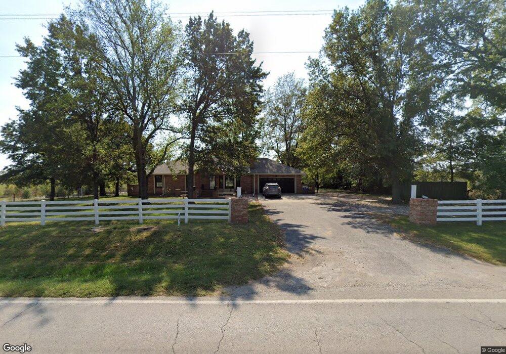
21201 E State Route 58 Pleasant Hill, MO 64080
Estimated Value: $514,801 - $849,000
3
Beds
2
Baths
1,400
Sq Ft
$449/Sq Ft
Est. Value
About This Home
This home is located at 21201 E State Route 58, Pleasant Hill, MO 64080 and is currently estimated at $628,267, approximately $448 per square foot. 21201 E State Route 58 is a home located in Cass County with nearby schools including Pleasant Hill Primary School, Pleasant Hill Elementary School, and Pleasant Hill Middle School.
Ownership History
Date
Name
Owned For
Owner Type
Purchase Details
Closed on
Nov 13, 2020
Sold by
Holt Thomas Andy and Holt Deborah
Bought by
Guffey Mark and Guffey Sherry
Current Estimated Value
Home Financials for this Owner
Home Financials are based on the most recent Mortgage that was taken out on this home.
Original Mortgage
$304,400
Outstanding Balance
$270,873
Interest Rate
2.8%
Mortgage Type
Commercial
Estimated Equity
$357,394
Create a Home Valuation Report for This Property
The Home Valuation Report is an in-depth analysis detailing your home's value as well as a comparison with similar homes in the area
Home Values in the Area
Average Home Value in this Area
Purchase History
| Date | Buyer | Sale Price | Title Company |
|---|---|---|---|
| Guffey Mark | -- | Continental Title Company |
Source: Public Records
Mortgage History
| Date | Status | Borrower | Loan Amount |
|---|---|---|---|
| Open | Guffey Mark | $304,400 |
Source: Public Records
Tax History Compared to Growth
Tax History
| Year | Tax Paid | Tax Assessment Tax Assessment Total Assessment is a certain percentage of the fair market value that is determined by local assessors to be the total taxable value of land and additions on the property. | Land | Improvement |
|---|---|---|---|---|
| 2024 | $1,870 | $30,940 | $4,340 | $26,600 |
| 2023 | $1,864 | $30,940 | $4,340 | $26,600 |
| 2022 | $1,650 | $27,020 | $4,340 | $22,680 |
| 2021 | $1,596 | $27,020 | $4,340 | $22,680 |
| 2020 | $1,505 | $26,240 | $4,340 | $21,900 |
| 2019 | $1,480 | $26,240 | $4,340 | $21,900 |
| 2018 | $1,422 | $23,900 | $3,700 | $20,200 |
| 2017 | $1,360 | $23,900 | $3,700 | $20,200 |
| 2016 | $1,360 | $22,830 | $3,700 | $19,130 |
| 2015 | $1,381 | $22,830 | $3,700 | $19,130 |
| 2014 | $1,385 | $22,770 | $3,640 | $19,130 |
| 2013 | -- | $22,770 | $3,640 | $19,130 |
Source: Public Records
Map
Nearby Homes
- 23005 E State Route 58
- Lot 8 175th St
- 17310 S Gray Dr
- Lot 6 175th St
- 18500 E 191st St
- 18200 E 191st St
- 23200 E 175th St
- 18001 E Hubach Hill Rd
- 20601 E State Route P
- 595 S Shore Dr
- 1 S Buffalo Ridge Ct
- 561 S Shore Dr
- 10 Tomahawk Cir
- 4 Black Hawk Dr
- 12 Omaha Cir
- 579 S Shore Dr
- 565 S Shore Dr
- 000TBD Deer Creek Ln
- 24908 E 199th St
- 3 Red Fox Cir
- 21200 E State Route 58 Unit 21800
- 21501 E State Route 58
- 18924 S Gray Dr
- 20508 E State Route 58
- 18721 S Gray Dr
- 20505 E State Route 58
- 18920 S Gray Dr
- 18701 S Gray Dr
- 18605 S Gray Dr
- 18509 S Gray Dr
- 20306 E State Route 58
- 22201 E State Route 58
- 18405 S Gray Dr
- 22103 E 189th St
- 0 Gray Dr Unit 1603872
- 19001 S Gray Dr
- 18615 S Gray Dr
- 22207 E 189th St
- 22215 E State Route 58
- 18208 S Gray Dr