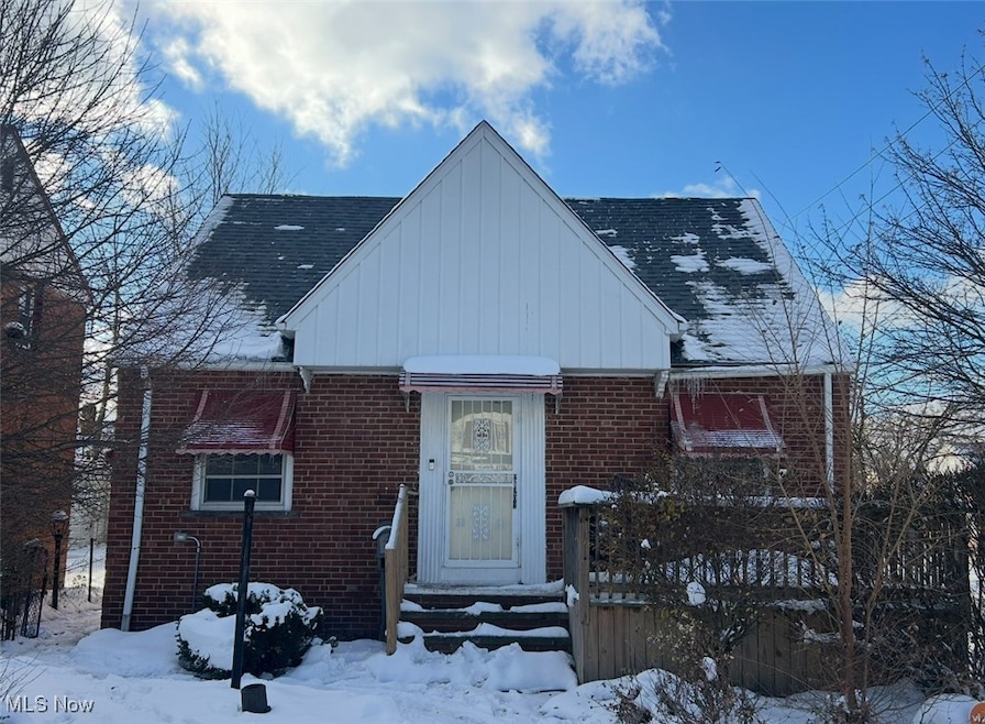
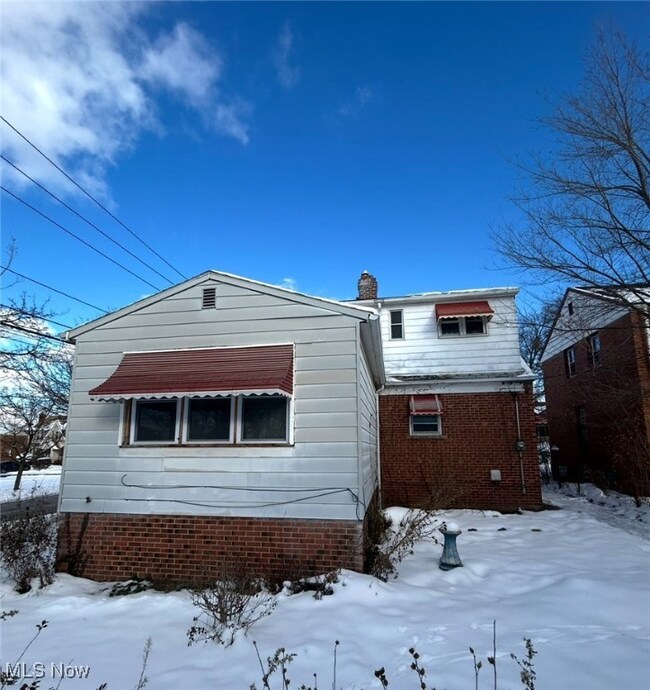
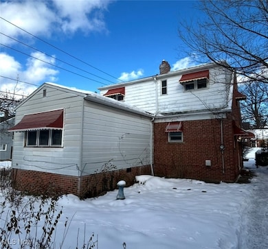
21202 Hillgrove Ave Maple Heights, OH 44137
Estimated payment $999/month
Highlights
- No HOA
- 1 Car Garage
- Gravity Heating System
- Bungalow
About This Home
Welcome home! Become an investor or move in. Tenant occupied, renting for $1,545/month. The home is an excellent location. Close to restaurants, grocery stores, freeways, schools, parks and more. The home is in moderate condition. Schedule a visit and take a tour. Great opportunity!
Listing Agent
BHR & Associates Brokerage Email: SilkTheRealtor@gmail.com, 216-324-9450 License #2019003236 Listed on: 12/05/2025
Home Details
Home Type
- Single Family
Est. Annual Taxes
- $2,559
Year Built
- Built in 1942
Lot Details
- 5,401 Sq Ft Lot
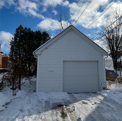
Parking
- 1 Car Garage
- Driveway
Home Design
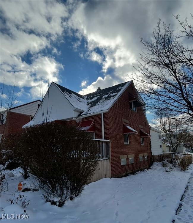
- Bungalow
- Asphalt Roof
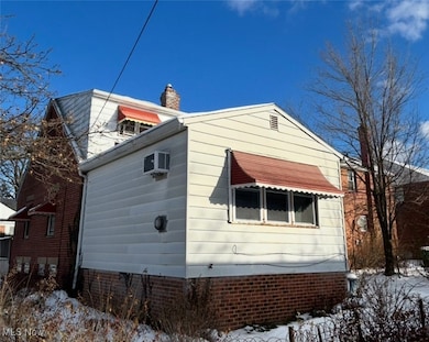
- Aluminum Siding
Interior Spaces
- 2-Story Property
- Unfinished Basement
- Basement Fills Entire Space Under The House
Bedrooms and Bathrooms
- 4 Bedrooms
- 2.5 Bathrooms
Utilities
- No Cooling
- Gravity Heating System
Community Details
- No Home Owners Association
- Center Hwy Allotment 03 Subdivision
Listing and Financial Details
- Assessor Parcel Number 782-16-150
Map
Home Values in the Area
Average Home Value in this Area
Tax History
| Year | Tax Paid | Tax Assessment Tax Assessment Total Assessment is a certain percentage of the fair market value that is determined by local assessors to be the total taxable value of land and additions on the property. | Land | Improvement |
|---|---|---|---|---|
| 2024 | $2,215 | $22,400 | $7,140 | $15,260 |
| 2023 | $1,573 | $12,960 | $4,310 | $8,650 |
| 2022 | $1,568 | $12,950 | $4,310 | $8,650 |
| 2021 | $1,662 | $12,950 | $4,310 | $8,650 |
| 2020 | $2,348 | $18,130 | $3,260 | $14,880 |
| 2019 | $2,343 | $51,800 | $9,300 | $42,500 |
| 2018 | $1,236 | $18,130 | $3,260 | $14,880 |
| 2017 | $1,079 | $16,490 | $3,010 | $13,480 |
| 2016 | $1,040 | $16,490 | $3,010 | $13,480 |
| 2015 | $3,724 | $16,490 | $3,010 | $13,480 |
| 2014 | $3,724 | $18,140 | $3,330 | $14,810 |
Property History
| Date | Event | Price | List to Sale | Price per Sq Ft |
|---|---|---|---|---|
| 12/05/2025 12/05/25 | For Sale | $149,900 | -- | -- |
Purchase History
| Date | Type | Sale Price | Title Company |
|---|---|---|---|
| Warranty Deed | $37,000 | Suntrust Title Agency | |
| Deed | -- | -- | |
| Deed | -- | -- | |
| Deed | -- | -- |
Source: MLS Now
MLS Number: 5175714
APN: 782-16-150
Disclaimer: Certain information contained herein is derived from information provided by parties other than Homes.com. All information provided is deemed reliable, but is not guaranteed to be accurate and should be independently verified.
![]() IDX information is provided exclusively for personal, non-commercial use, and may not be used for any purpose other than to identify prospective properties consumers may be interested in purchasing. Information is deemed reliable but not guaranteed.
IDX information is provided exclusively for personal, non-commercial use, and may not be used for any purpose other than to identify prospective properties consumers may be interested in purchasing. Information is deemed reliable but not guaranteed.
- 21207 Franklin Rd
- 21102 Raymond St
- 20814 Kenyon Dr
- 21416 Gardenview Dr
- 20814 Watson Rd
- 20612 Hillgrove Ave
- 20907 Watson Rd
- 20701 Kenyon Dr
- 21607 Libby Rd
- 20715 Watson Rd
- 21860 Louis Rd
- 5147 Warrensville Center Rd
- 20510 Mountville Dr
- 20107 Libby Rd
- 20120 Mccracken Rd
- 19807 Gardenview Dr
- 5285 Mardale Ave
- 19806 Mountville Dr
- 5301 Mardale Ave
- 20750 Bowling Green Rd
- 21304 Watson Rd
- 20801 Franklin Rd
- 21831 Libby Rd
- 5305 Northfield Rd
- 22155 Libby Rd
- 5327 Northfield Rd
- 20006 Mountville Dr
- 19600 Milan Dr
- 21955 Miles Rd
- 19409 Raymond St
- 22800 Rockside Rd
- 5339 Elmwood Ave
- 401 Mortimer Dr
- 4510-4548 Warrensville Center Rd
- 17515 Libby Rd
- 285 Marion Dr
- 21170 Ellacott Pkwy
- 5713 South Blvd
- 17100 Maple Heights Blvd
- 14 Elm St
