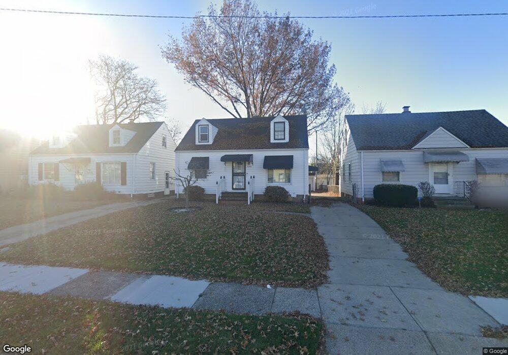
21208 Watson Rd Maple Heights, OH 44137
Estimated Value: $99,858 - $192,000
3
Beds
1
Bath
1,000
Sq Ft
$126/Sq Ft
Est. Value
About This Home
This home is located at 21208 Watson Rd, Maple Heights, OH 44137 and is currently estimated at $126,465, approximately $126 per square foot. 21208 Watson Rd is a home located in Cuyahoga County with nearby schools including Abraham Lincoln Elementary School, Rockside/ J.F. Kennedy School, and Italy High School.
Ownership History
Date
Name
Owned For
Owner Type
Purchase Details
Closed on
May 9, 2007
Sold by
Gillispie Shirley J
Bought by
Forest Deborah Ann
Current Estimated Value
Home Financials for this Owner
Home Financials are based on the most recent Mortgage that was taken out on this home.
Original Mortgage
$99,450
Outstanding Balance
$68,840
Interest Rate
8.87%
Mortgage Type
Purchase Money Mortgage
Estimated Equity
$57,625
Purchase Details
Closed on
Dec 13, 1999
Sold by
Papes Roberta J
Bought by
Gillispie George E and Gillispie Shirley J
Home Financials for this Owner
Home Financials are based on the most recent Mortgage that was taken out on this home.
Original Mortgage
$73,300
Interest Rate
7.87%
Purchase Details
Closed on
Jun 11, 1986
Sold by
Papes Wm J and Papes Roberta J
Bought by
Papes Roberta J
Purchase Details
Closed on
Jan 1, 1975
Bought by
Papes Wm J and Papes Roberta J
Create a Home Valuation Report for This Property
The Home Valuation Report is an in-depth analysis detailing your home's value as well as a comparison with similar homes in the area
Home Values in the Area
Average Home Value in this Area
Purchase History
| Date | Buyer | Sale Price | Title Company |
|---|---|---|---|
| Forest Deborah Ann | $117,000 | Mountaineer Title Agency | |
| Gillispie George E | $81,500 | -- | |
| Papes Roberta J | -- | -- | |
| Papes Wm J | -- | -- |
Source: Public Records
Mortgage History
| Date | Status | Borrower | Loan Amount |
|---|---|---|---|
| Open | Forest Deborah Ann | $99,450 | |
| Previous Owner | Gillispie George E | $73,300 |
Source: Public Records
Tax History Compared to Growth
Tax History
| Year | Tax Paid | Tax Assessment Tax Assessment Total Assessment is a certain percentage of the fair market value that is determined by local assessors to be the total taxable value of land and additions on the property. | Land | Improvement |
|---|---|---|---|---|
| 2024 | $2,796 | $30,380 | $6,965 | $23,415 |
| 2023 | $2,105 | $19,250 | $4,200 | $15,050 |
| 2022 | $2,097 | $19,250 | $4,200 | $15,050 |
| 2021 | $2,232 | $19,250 | $4,200 | $15,050 |
| 2020 | $1,916 | $14,600 | $3,190 | $11,410 |
| 2019 | $1,905 | $41,700 | $9,100 | $32,600 |
| 2018 | $947 | $14,600 | $3,190 | $11,410 |
| 2017 | $1,823 | $13,620 | $2,980 | $10,640 |
| 2016 | $1,764 | $13,620 | $2,980 | $10,640 |
| 2015 | $1,755 | $13,620 | $2,980 | $10,640 |
| 2014 | $1,755 | $14,950 | $3,260 | $11,690 |
Source: Public Records
Map
Nearby Homes
- 21102 Raymond St
- 21207 Franklin Rd
- 20907 Watson Rd
- 20814 Watson Rd
- 20715 Watson Rd
- 20814 Kenyon Dr
- 21416 Gardenview Dr
- 20701 Kenyon Dr
- 20120 Mccracken Rd
- 20510 Mountville Dr
- 20107 Libby Rd
- 19807 Gardenview Dr
- 5285 Mardale Ave
- 19806 Mountville Dr
- 5301 Mardale Ave
- 19812 Stockton Ave
- 19520 Maple Heights Blvd
- 19309 Nitra Ave
- 20750 Bowling Green Rd
- 5165 Camden Rd
- 21204 Watson Rd
- 21200 Watson Rd
- 21300 Watson Rd
- 21211 Raymond St
- 21215 Raymond St
- 21207 Raymond St
- 21219 Raymond St
- 21203 Raymond St
- 21116 Watson Rd
- 21209 Watson Rd
- 21205
- 21213 Watson Rd
- 21205 Watson Rd
- 21303 Raymond St
- 21217 Watson Rd
- 21201 Watson Rd
- 21308 Watson Rd
- 21112 Watson Rd
- 21307 Raymond St
- 21301 Watson Rd