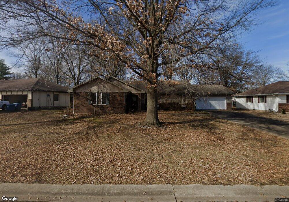
2121 Carrie St Carthage, MO 64836
Estimated Value: $261,949 - $321,000
--
Bed
1
Bath
2,062
Sq Ft
$138/Sq Ft
Est. Value
About This Home
This home is located at 2121 Carrie St, Carthage, MO 64836 and is currently estimated at $285,237, approximately $138 per square foot. 2121 Carrie St is a home located in Jasper County with nearby schools including Carthage High School and Victory Academy.
Create a Home Valuation Report for This Property
The Home Valuation Report is an in-depth analysis detailing your home's value as well as a comparison with similar homes in the area
Home Values in the Area
Average Home Value in this Area
Tax History Compared to Growth
Tax History
| Year | Tax Paid | Tax Assessment Tax Assessment Total Assessment is a certain percentage of the fair market value that is determined by local assessors to be the total taxable value of land and additions on the property. | Land | Improvement |
|---|---|---|---|---|
| 2025 | $1,449 | $31,290 | $4,000 | $27,290 |
| 2024 | $1,450 | $28,160 | $4,000 | $24,160 |
| 2023 | $1,450 | $28,160 | $4,000 | $24,160 |
| 2022 | $1,448 | $28,230 | $4,000 | $24,230 |
| 2021 | $1,433 | $28,230 | $4,000 | $24,230 |
| 2020 | $1,381 | $26,080 | $4,000 | $22,080 |
| 2019 | $1,383 | $26,080 | $4,000 | $22,080 |
| 2018 | $1,247 | $23,560 | $0 | $0 |
| 2017 | $1,250 | $23,560 | $0 | $0 |
| 2016 | $1,343 | $25,400 | $0 | $0 |
| 2015 | -- | $25,400 | $0 | $0 |
| 2014 | -- | $25,400 | $0 | $0 |
Source: Public Records
Map
Nearby Homes
- 2141 Carrie St
- 925 Gene Taylor Dr
- 1106 Southern Hills
- 1004 Gene Taylor Dr
- 909 Durward Hall Dr
- 1211 E Airport Dr
- 837 Modern Way
- 839 Modern Way
- 1341 E Airport Dr
- 1922 Southwood Ln
- 1431 Quail Place
- 1823 S River St
- NE COR Airport Dr & River
- 1320 Belle Air Place
- 1131 Belle Air Place
- 619 Belle Air Place
- 1647 Glenwood Place
- 1743 S River St
- 1012 Euclid Blvd
- 739 Sheridan St